
The Barents Sea is a marginal sea of the Arctic Ocean, located off the northern coasts of Norway and Russia and is divided between Norwegian and Russian territorial waters. Known among Russians in the Middle Ages as the Murman Sea, the sea takes its current name from the Dutch navigator Willem Barentsz.

Victoria Island is a large island in the Canadian Arctic Archipelago that straddles the boundary between Nunavut and the Northwest Territories of Canada. It is the eighth largest island in the world, and at 217,291 km2 (83,897 sq mi) in area, it is Canada's second largest island. It is nearly double the size of Newfoundland (111,390 km2 [43,008 sq mi]), and is slightly larger than the island of Great Britain (209,331 km2 [80,823 sq mi]) but smaller than Honshu (225,800 km2 [87,182 sq mi]). It contains the world's largest island within an island within an island. The western third of the island belongs to the Inuvik Region in the Northwest Territories; the remainder is part of Nunavut's Kitikmeot Region.

Danes Island is an island in Norway's Svalbard archipelago in the Arctic Ocean. It lies just off the northwest coast of Spitsbergen, the largest island in the archipelago, near to Magdalenefjorden. Just to the north lies Amsterdam Island. Like many of Svalbard's islands, Danes Island is uninhabited. The island has an area of 40.6 km2 (15.7 sq mi).

Rossøya, sometimes referred to as Ross Island in English, is an island located in the Arctic Ocean. It is a part of Sjuøyane, a group of islands in the Svalbard archipelago, some 20 km north of the coast of Nordaustlandet, Svalbard in Arctic Norway. Rossøya is located 100 m north-northwest of the somewhat larger island Vesle Tavleøya. The northern point of Rossøya, at 80° 49′ 44.41″ North, is the northernmost point in Svalbard, and thereby also in the Kingdom of Norway. The distance to the North Pole is 1024.3 kilometers, to Nordkapp on the Norwegian mainland 1084 km and to Pysen, off the southern tip of mainland Norway, 2580 km.
Freemansundet is the sound separating Barentsøya, to the north, from Edgeøya, in the Svalbard archipelago, Norway. It is named after Alderman Ralph Freeman, who was involved in the English whaling trade in the early 17th century. The polar bear, Ursus maritimus, is a seasonal visitor to the Freemansundet; this species has a genetically distinct deme within the Barents Sea region.
Moffen is a small, low island north of the mouth of Wijdefjorden, on the northern coast of Spitsbergen, the largest island of the Svalbard archipelago. The island lies just north of 80° so has become a popular target for vessels touring the archipelago but landing or entering the inner waters is strictly forbidden for fear of disturbing the wildlife as the island is an important haul-out area for Walrus and a nesting site for birds. The island was first labelled on a map by Hendrick Doncker, of Amsterdam, in 1655.
Waldenøya is a small, rocky island just north of Nordkapp, Nordaustlandet on Svalbard. It is located west of, but not part of the Sjuøyane in the Svaldbard archipelago.
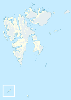
Nelsonøya is a small island, part of Sjuøyane, north of Nordaustlandet.
Vesle Tavleøya is the larger island of the two northernmost of Sjuøyane - the other being Rossøya, north of Nordaustlandet, Svalbard. Vesle Tavleøya is situated some 7 km northeast of Phippsøya, the largest island of the islands, separated by Sjuøyflaket sound.
Bölscheøya is an island southwest of Negerpynten, the southeastern point of Edgeøya. It is part of Thousand Islands. The island was named in 1868 by the German geographer August Petermann (1822–78) after the German journalist Carl Bölsche, father of the German writer and zoologist Wilhelm Bölsche (1843–93). The remains of a whaling station from the 17th century can be found on the island.

Gustav V Land is a land area comprising the peninsula on the northwestern part of Nordaustlandet, Svalbard in Arctic Norway. It constitutes roughly one quarter of the island's area, approximately 4000 km2, being some 80 km wide east–west and 85 km north–south, connected to the rest of the island by a 22-km-wide isthmus in the southeast. The peninsula is bordered to the south by Wahlenbergfjorden, to the west by Hinlopen Strait and Hinlopenrenna, to the north by Nordkappsundet, and to the east by Nordenskiöldbukta and Rijpfjorden. Gustav Adolf Land is to the south and Prins Oscars Land is to the east. The boundary of Gustav V Land passes through Rijpdalen and Flaumdalen to Winsnesbreen in the east, continues further southwest to Brånevatnet, and thence follows the river from Brånevatnet to the sea at Bodleybukta. The highest elevation is 630 metres (2,070 ft) on the glacier Vestfonna, which covers large parts of the land.
Barentsjøkulen is a glacier on Barentsøya, Svalbard. The glacier covers an area of about 571 km2 (220 sq mi). It is named after the Barents Island, which again is named after Dutch explorer Willem Barentsz. Barents Island is on the Barents Sea.

Orvin Land is the land area of the northeastern part of Nordaustlandet, Svalbard, east of Duvefjorden, including the lower part of Austfonna. The area is named after geologist Anders Kristian Orvin. Orvin Land is bordered by Prins Oscars Land to the east and Austfonna to the south.
Chermsideøya is a 14 km² island north of Nordaustlandet, Svalbard. It is separated from Nordaustlandet by the 1–2 km wide Beverlysundet. Two km to the east lies the two smaller Castrénøyane.
Hornodden is headland at the southeastern point of the island of Kvitøya in the Svalbard archipelago. It is named after geologist and Arctic explorer Gunnar Horn, leader of the Bratvaag Expedition to Kvitøya in 1930.
Storøysundet is a strait in the Svalbard archipelago. It separates the island of Storøya to the east from Nordaustlandet to the west.
Sabinebukta is a bay at the northern side of Nordaustlandet, Svalbard. The bay is split into Vestre Sabinevågen and Austre Sabinevågen. The Sabine Islands are located in the outer part of the bay. The bay is named after Arctic explorer Edward Sabine.
Scoresbyøya is an island in the Svalbard archipelago, north of Nordaustlandet. It has an area of about 6 km², and is located in Nordenskiöldbukta, outside the bay of Sabinebukta. The island is named after Arctic explorer William Scoresby. The southern part of the island is dominated by a large lagoon and narrow sand banks.
Orustdalen is a valley in Nordenskiöld Land at Spitsbergen, Svalbard. It is named after Swedish island of Orust in the province of Bohuslän. The valley has a length of about five kilometers and a width of two kilometers. It is located south of the mountains of Qvigstadfjellet, Christensenfjella and Systemafjellet.


