Caracas, officially Santiago de León de Caracas, is the capital and largest city of Venezuela, and centre of the Greater Caracas Area. Caracas is located along the Guaire River in the northern part of the country, following the contours of the narrow Caracas Valley on the Venezuelan coastal mountain range. Terrain suitable for building lies between 760 and 1,140 m above sea level, although there is some settlement above this range. The valley is close to the Caribbean Sea, separated from the coast by a steep 2,200-metre-high (7,200 ft) mountain range, Cerro El Ávila; to the south there are more hills and mountains. The Metropolitan Region of Caracas has an estimated population of 4,923,201.

The Orinoco River is one of the longest rivers in South America at 2,140 kilometres (1,330 mi). Its drainage basin, sometimes known as the Orinoquia, covers 880,000 square kilometres (340,000 sq mi), with 76.3 percent of it in Venezuela and the remainder in Colombia. It is the third largest river in the world by discharge volume of water. The Orinoco River and its tributaries are the major transportation system for eastern and interior Venezuela and the llanos of Colombia. The environment in the Orinoco's basin is extremely diverse; it hosts a wide variety of flora and fauna.

Oriskany is a village in Oneida County, New York, United States. The population was 1,400 at the 2010 census. The name is derived from the Iroquois word for "nettles."

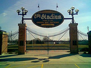
City Stadium is an American football stadium in Green Bay, Wisconsin, on the north side of the Green Bay East High School property. It was the home of the Green Bay Packers of the NFL from 1925 through 1956. Renovated and downsized, City Stadium remains the home of East High. Prior to 1925, the Packers played home games at nearby Hagemeister Park and Bellevue Park.
At the 1908 Summer Olympics, four fencing events were contested.

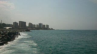
La Guaira is the capital city of the Venezuelan state of Vargas and the country's main port. It was founded in 1577 as an outlet for Caracas, 30 kilometres (19 mi) to the southeast. The town and the port were badly damaged during the December 1999 floods and mudslides that affected much of the region.

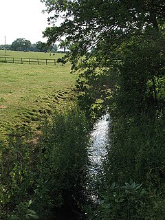
The River Croco is a small river in Cheshire in England. It starts as lowland field drainage west of Congleton, flows along the south edge of Holmes Chapel, and joins the River Dane at Middlewich. It is about 8 miles (13 km) long.
Axholme Charterhouse or Axholme Priory, also Melwood Priory or Low Melwood Priory, North Lincolnshire, is one of the ten medieval Carthusian houses (charterhouses) in England. It was established in 1397/1398 by Thomas Mowbray, Earl of Nottingham and later Duke of Norfolk. The house was centred on a pre-existing chapel on the present Low Melwood Farm, between Owston Ferry and Epworth in the Isle of Axholme, which according to a papal bull of 1398 "was called anciently the Priory of the Wood".
Awonou is a small town and arrondissement located in the commune of Adjohoun in the Borgou Department of Benin. Agriculture is the main industry. During the 2008 Benin floods, Awonou was the only area in Adjohoun commune not affected by the flooding of the Ouémé River.
Gangban is a small town in Benin, the seat of the Tohouè arrondissement located in the commune of Ouinhi in the Zou Department. Agriculture is the main industry lying in the fertile Ouémé River Valley of southern Benin.
Cuchivero River is a river of Venezuela. It is part of the Orinoco River basin.
Padamo River is a river of Venezuela. It is part of the Orinoco River basin.
Matacuni River is a river of Venezuela. It is part of the Orinoco River basin.
Ocamo River is a river of Venezuela. It is part of the Orinoco River basin.
Manaviche River is a river of Venezuela. It is part of the Orinoco River basin.

The Unare River is a river of Venezuela. It drains into the Caribbean Sea. In the 17th century the Dutch had a fort at the mouth of the river. It was constructed to protect their salt collection in the area. The other Dutch fort ever to stand on what is now Venezuelan soil stood on the little uninhabited islet La Tortuga, just west of Isla Margarita. It was built for the same reason as the one in Unare: to protect the salt harvesting activities of the Dutch. The Caribbean islands St. Maarten and Bonaire would subsequently satisfy the Dutch demand for salt.

Avochie Castle is a ruined tower house, dating from the 16th century, or early 17th century, around 4.5 miles (7.2 km) north of Huntly, east of the river Deveron, in Aberdeenshire, Scotland.
Cerro Jaua is a tepuy in Bolivar State, Venezuela. The mountain, which has a height of 2395 meters, is included in Jaua-Sarisariñama National Park.
Sherman Township is an inactive township in Cass County, in the U.S. state of Missouri.


