
The great Congo River, formerly known as the Zaire River under the Mobutu regime, is the second longest river in Africa, shorter only than the Nile, as well as the second largest river in the world by discharge volume, following only the Amazon. It is also the world's deepest recorded river, with measured depths in excess of 220 m (720 ft). The Congo-Lualaba-Chambeshi River system has an overall length of 4,700 km (2,920 mi), which makes it the world's ninth-longest river. The Chambeshi is a tributary of the Lualaba River, and Lualaba is the name of the Congo River upstream of Boyoma Falls, extending for 1,800 km (1,120 mi).

Uíge, one of the eighteen Provinces of Angola, is located in the northwestern part of the country. Its capital city is of the same name. Municipalities within the province include Alto Cauale, Ambuila, Bembe, Buengas, Bungo, Damba, Macocola, Milunga, Mucaba, Negage, Puri, Quimbele, Quitexe, Sanza Pombo, Songo, Uíge, and Zombo.

The Cuanza River, also known as the Coanza, the Quanza, and the Kwanza, is a river in Angola. It empties into the Atlantic Ocean just south of the national capital Luanda.
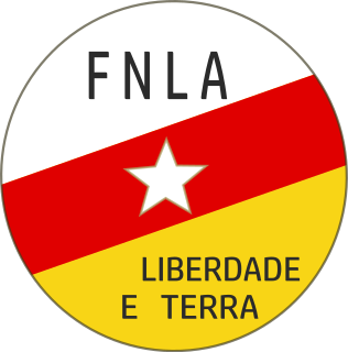
The National Front for the Liberation of Angola is a political party and former militant organisation that fought for Angolan independence from Portugal in the war of independence, under the leadership of Holden Roberto.

Kolwezi or Kolwesi is the capital city of Lualaba Province in the south of the Democratic Republic of the Congo, west of Likasi. It is home to an airport and a railway to Lubumbashi. The population is approximately 453,000.

Ambriz is a village and municipality in Bengo Province, Angola. It is located 127 km from the town of Caxito. It borders the municipality of N'zeto, Zaire Province, to the North and the municipality of Dande, to the South.

Strophanthus is a genus of flowering plants in the family Apocynaceae, first described as a genus in 1802. It is native primarily to tropical Africa, extending to South Africa, with a few species in Asia from southern India to New Guinea and southern China. The name derives from the long, twisted, threadlike segments of the corolla, which attain a length of 30–35 cm in S. preussii.

N'zeto is a town located in the province of Zaire in Angola. During the Portuguese domain the town was called Ambrizete. It has an estimated population of 45,000. It is served by N'zeto Airport.

Soyo is a city located in the province of Zaire in Angola, at the mouth of the Congo river. Soyo recently became the largest oil-producing region in the country, with an estimate of 1,200,000 barrels per day (190,000 m3/d).

Shaba I was a conflict in Zaire's Shaba (Katanga) Province lasting from March 8, 1977, to May 26, 1977. The conflict began when the Front for the National Liberation of the Congo (FNLC), a group of about 2,000 Katangan Congolese soldiers crossed the border into Shaba from Angola. The FNLC made quick progress through the region, due to sympathizing locals and to the disorganization of the Zairian military. Traveling east from Zaire's border with Angola, the rebels reached Mutshatsha, a small town near to the key mining town of Kolwezi.

In November 1975, on the eve of Angola's independence, Cuba launched a large-scale military intervention in support of the leftist People's Movement for the Liberation of Angola (MPLA) against United States-backed interventions by South Africa and Zaire in support of two right-wing independence movements competing for power in the country, the National Liberation Front of Angola (FNLA) and the National Union for the Total Independence of Angola (UNITA). By the end of 1975 the Cuban military in Angola numbered more than 25,000 troops. Following the withdrawal of Zaire and South Africa, Cuban forces remained in Angola to support the MPLA government against UNITA in the continuing Angolan Civil War.

Angola is located on the western Atlantic Coast of southern Africa between Namibia and the Republic of the Congo. It also is bordered by the Democratic Republic of the Congo and Zambia to the east. The country consists of a sparsely watered and somewhat sterile coastal plain extending inland for a distance varying from 50 to 160 km. Slightly inland and parallel to the coast is a belt of hills and mountains and behind those a large plateau.
Noqui is a town and municipality in Zaire Province in Angola. It is on the Congo River, just across the border from the city of Matadi in the Democratic Republic of the Congo.

M'banza-Kongo, is the capital of Angola's northwestern Zaire Province. M'banza Kongo was founded some time before the arrival of the Portuguese in 1483 and was the capital of the Kilukeni dynasty ruling at that time. The site was temporarily abandoned during civil wars in the 17th century. It lies close to Angola's border with the Democratic Republic of the Congo. It is located at around 6°16′0″S14°15′0″E and sits on top of an impressive flat-topped mountain, sometimes called Mongo a Kaila because recent legends recall that the king created the clans of the kingdom and sent them out from there. In the valley to the south runs the Luezi River. In 2017, Mbanza Kongo was declared as a UNESCO World Heritage Site.
N'zeto Airport is an airport serving N'zeto, a town in Zaire Province, Angola. The runway is 2.5 kilometres (1.6 mi) south of the town, along the Atlantic coast.
The Cuvo is a river in central Angola. The river mouth is at the Atlantic Ocean at Benguela Bay, in Cuanza Sul Province. Cuvo is its name in its upper reaches; its lower course is called the Keve or Queve. The river is navigable upstream to Binga Falls near Gabela.


