Related Research Articles

Duluth is a city in Gwinnett County, Georgia, United States. Located north of Interstate 85, it is approximately 22 miles (35 km) northeast of Atlanta.

Suwanee is a city in Gwinnett County and a part of the Atlanta metropolitan area in the U.S. state of Georgia. As of the 2010 census, the population was 15,355; this had grown to an estimated 20,907 as of 2019.

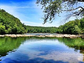
The Chattahoochee River is a river in the Southern United States. It forms the southern half of the Alabama and Georgia border, as well as a portion of the Florida and Georgia border. It is a tributary of the Apalachicola River, a relatively short river formed by the confluence of the Chattahoochee and Flint rivers and emptying from Florida into Apalachicola Bay in the Gulf of Mexico. The Chattahoochee River is about 430 miles (690 km) long. The Chattahoochee, Flint, and Apalachicola rivers together make up the Apalachicola–Chattahoochee–Flint River Basin. The Chattahoochee makes up the largest part of the ACF's drainage basin.
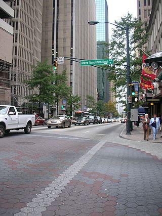
Peachtree Street is one of several major streets running through the city of Atlanta, Georgia, United States. Beginning at Five Points in downtown Atlanta, it runs North through Midtown; a few blocks after entering into Buckhead, the name changes to Peachtree Road at Palisades Road. Much of the city's historic and noteworthy architecture is located along the street, and it is often used for annual parades,, as well as one-time parades celebrating events such as the 100th anniversary of Coca-Cola in 1986 and the Atlanta Braves' 1995 and 2021 World Series victories.

State Route 141 (SR 141) is a 34.1-mile-long (54.9 km) state highway that runs southwest-to-northeast in the northwest part of the U.S. state of Georgia. It connects the Buckhead area of Atlanta with Cumming. Its routing exists within portions of Fulton, DeKalb, Gwinnett, Forsyth counties.

The Chattooga River is the main tributary of the Tugaloo River.
There were several historic mills around the metro Atlanta area, for which many of its current-day roads are still named. Most of the mills date back to the 1820s and 1830s, and were built along the area's many streams. The locations of many of these mills are shown on a map of 1875 showing U. S. military operations around Atlanta in 1864. This map is now located in the U. S. Library of Congress but can be seen on the webpage linked here.
Historic ferries operated on rivers around Atlanta, Georgia area, and became namesakes for numerous current-day roads in north Georgia. Most of the ferries date to the early years of European-American settlement in the 1820s and 1830s, when parts of the region were still occupied by cherokee and other Native American communities.

Lake Lanier is a reservoir in the northern portion of the U.S. state of Georgia. It was created by the completion of Buford Dam on the Chattahoochee River in 1956, and is also fed by the waters of the Chestatee River. The lake encompasses 38,000 acres (15,000 ha) or 59 sq mi (150 km2) of water, and 692 mi (1,114 km) of shoreline at normal level, a "full pool" of 1,071 ft (326 m) above mean sea level and the exact shoreline varies by resolution according to the coastline paradox. Named for Confederate poet Sidney Lanier, it was built and is operated by the U.S. Army Corps of Engineers for flood control and water supplies. Its construction destroyed more than 50,000 acres (20,000 ha) of farmland and displaced more than 250 families, 15 businesses, and relocated 20 cemeteries along with their remains in the process.

Peachtree Creek is a major stream in Atlanta. It flows for 7.5 miles (12.1 km) almost due west into the Chattahoochee River just south of Vinings.

Brookhaven is a city in the northeastern suburbs of Atlanta that is located in western DeKalb County, Georgia, United States, directly northeast of Atlanta. On July 31, 2012, Brookhaven was approved in a referendum to become DeKalb County's 11th city. Incorporation officially took place on December 17, 2012, on which date municipal operations commenced. With a population of around 55,366 as of 2021, it is the largest city in DeKalb County. The new city stretches over 12 square miles (31 km2).
Chattahoochee River National Recreation Area (CRNRA) preserves a series of sites between Atlanta and Lake Sidney Lanier along the Chattahoochee River in Georgia, U.S. The 48-mile (77 km) stretch of the river affords public recreation opportunities and access to historic sites. The national recreation area, a National Park Service unit, was established on August 15, 1978, by President Jimmy Carter.

Doraville is a train station in Doraville, Georgia, and the northern terminus on the Gold Line of the Metropolitan Atlanta Rapid Transit Authority (MARTA) rail system. Doraville serves as the ground for the Doraville rail yard for the Gold line, with a capacity of 30 rail cars.

Peachtree Corners is a city in Gwinnett County, Georgia, United States. It is part of the Atlanta metropolitan area, and is the largest city in Gwinnett County with a population of 42,243 as of the 2020 US Census.

The Outer Perimeter is a freeway originally planned to encircle Atlanta, in the U.S. state of Georgia about 20 to 25 miles outside of Interstate 285, which is colloquially referred to as the Perimeter and is a point of reference for local travel outside Atlanta's city core.
There were several historic bridges around the metro Atlanta, Georgia area, for which many of its current-day roads are named. Many of them originated as ferries, dating back to the 1820s and 1830s, and carrying travelers across the Chattahoochee River and several other smaller rivers. Several were also covered bridges, very few of which remain as historic sites.

Metro Atlanta, designated by the United States Office of Management and Budget as the Atlanta–Sandy Springs–Roswell metropolitan statistical area, is the most populous metropolitan statistical area in the U.S. state of Georgia and the sixth-largest in the United States, based on the July 1, 2023 metropolitan area population estimates from the U.S. Census Bureau. Its economic, cultural, and demographic center is Atlanta, and its total population was 6,307,261 in the 2023 estimate from the U.S. Census Bureau.
The tri-state water dispute is a 21st-century water-use conflict among the U.S. states of Georgia, Alabama, and Florida over flows in the Apalachicola-Chattahoochee-Flint River Basin and the Alabama-Coosa-Tallapoosa River Basin. The U.S. Army Corps of Engineers has regulated water flow for the entire Chattahoochee River, from Lake Lanier in Forsyth County, Georgia, to Alabama and Florida.
The Peachtree Creek Greenway trail is a multi-use trail under construction along the North Fork Peachtree Creek in and near Atlanta, Georgia, United States, which will traverse the cities of Atlanta, Brookhaven, Chamblee, Doraville and parts of Unincorporated Dekalb County. Once complete, it will connect 12 miles from the Atlanta Beltline trails and Path 400 northward up to I-285. Some landmarks along the route will include Silverback stadium, Mercer University, CHOA & Emory and multiple schools and libraries.

West Point Lake is a man-made reservoir located mostly in west-central Georgia on the Chattahoochee River and maintained by the U.S. Army Corps of Engineers (USACE). The Chattahoochee river flows in from the north, before flowing through the West Point Dam, which impounds the lake, and continuing to Columbus, Georgia. Of the four major USACE lakes in the ACF River Basin, West Point Lake is the smallest by area containing 25,864 acres (10,467 ha) of water, and has the second shortest shoreline at 604 mi (972 km). The purposes of the reservoir are to provide flood control, hydroelectric power, and water storage to aid the navigation of the lower Chattahoochee.