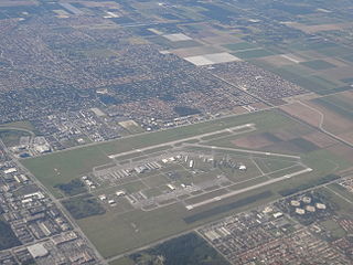
Miami airport, Miami aeroport, Miami aerodrome, Miami airfield or variation, may refer to:

Opa-locka is a city in Miami-Dade County, Florida, United States. Spanning roughly 4.1 square miles (11 km2), it is part of the Miami metropolitan area of South Florida. As of the 2020 Census, the population was 16,463, up from 15,219 in 2010.

An IATA airport code, also known as an IATA location identifier, IATA station code, or simply a location identifier, is a three-letter geocode designating many airports and metropolitan areas around the world, defined by the International Air Transport Association (IATA). The characters prominently displayed on baggage tags attached at airport check-in desks are an example of a way these codes are used.

The ICAOairport code or location indicator is a four-letter code designating aerodromes around the world. These codes, as defined by the International Civil Aviation Organization and published quarterly in ICAO Document 7910: Location Indicators, are used by air traffic control and airline operations such as flight planning. ICAO codes are also used to identify other aviation facilities such as weather stations, international flight service stations or area control centers, whether or not they are located at airports. Flight information regions are also identified by a unique ICAO-code.

Miami Executive Airport, formerly known until 2014 as Kendall-Tamiami Executive Airport, is a public airport in unincorporated Miami-Dade County, Florida, 13 miles (21 km) southwest of Downtown Miami. It is operated by the Miami-Dade Aviation Department.
KMIA may refer to:

Miami-Opa Locka Executive Airport is a joint civil-military airport located in Miami-Dade County, Florida 11 mi (18 km) north of downtown Miami. Part of the airport is in the city limits of Opa-locka. The National Plan of Integrated Airport Systems for 2011–2015 called it a general aviation reliever airport.
Trent Lott International Airport is a county-owned public-use airport located in Moss Point, approximately six miles (9.7 km) north of the central business district of Pascagoula, a city in Jackson County, Mississippi, United States. The airport is named for Trent Lott, a former United States Senator from Mississippi.
A location identifier is a symbolic representation for the name and the location of an airport, navigation aid, or weather station, and is used for staffed air traffic control facilities in air traffic control, telecommunications, computer programming, weather reports, and related services.

Amelia Earhart Park is a 515-acre (208.41 ha) urban park in unincorporated Miami-Dade County, just north of Hialeah, Florida. It offers a number of recreational attractions like bike trails, skateboarding, and fishing.
North Perry Airport is a public airport in the City of Pembroke Pines, 5 miles (8 km) west of the central business district of Hollywood, in Broward County, Florida, United States. It is also known as Hollywood North Perry Airport, hence the HWO codes. The airport is owned by the Broward County Aviation Department. It is a general aviation airport devoted to private and business light aircraft activity.
OPF may refer to:

Opa-locka West Airport was a county-owned public airport located 12 miles (19 km) northwest of the central business district of Miami, a city in Miami-Dade County, Florida, United States. It covered an area of 420 acres (170 ha) which contained two asphalt paved runways: 9/27 measuring 3,000 x 60 ft and 18/36 measuring 3,000 x 60 ft.

Miami Municipal Airport is two miles northwest of Miami, in Ottawa County, Oklahoma. The National Plan of Integrated Airport Systems for 2011–2015 called it a general aviation facility.

Miami-Dade County is a county located in the southeastern part of the U.S. state of Florida. The county had a population of 2,701,767 as of the 2020 census, making it the most populous county in Florida and the seventh-most populous county in the United States. It is Florida's third largest county in terms of land area with 1,946 square miles (5,040 km2). The county seat is Miami, the core of the nation's ninth-largest and world's 65th-largest metropolitan area with a 2020 population of 6.138 million people, exceeding the population of 31 of the nation's 50 states as of 2022.

Coast Guard Air Station Miami is an Air Station of the United States Coast Guard located at Opa-locka Executive Airport in Opa-locka, Florida. The station operates the HC-144 Ocean Sentry maritime patrol aircraft and the MH-65 Dolphin helicopter.