
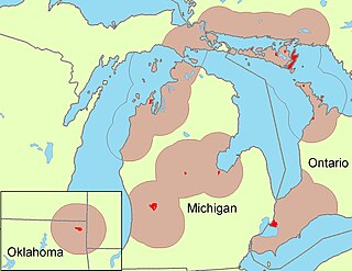
The Miami are a Native American nation originally speaking one of the Algonquian languages. Among the peoples known as the Great Lakes tribes, they occupied territory that is now identified as North-central Indiana, southwest Michigan, and western Ohio. By 1846, most of the Miami had been forcefully displaced to Indian Territory. The Miami Tribe of Oklahoma are the federally recognized tribe of Miami Indians in the United States. The Miami Nation of Indiana, a nonprofit organization of descendants of Miamis who were exempted from removal, have unsuccessfully sought separate recognition.

Maumee is a city in Lucas County, Ohio, United States. Located along the Maumee River, it is about 10 miles southwest of Toledo. The population was 14,286 at the 2010 census. Maumee was declared an All-America City by the National Civic League in June 2006.
The St. Marys River, St. Mary's River, or St. Mary River may refer to:

The Maumee River is a river running in the United States Midwest from northeastern Indiana into northwestern Ohio and Lake Erie. It is formed at the confluence of the St. Joseph and St. Marys rivers, where Fort Wayne, Indiana, has developed, and meanders northeastwardly for 137 miles (220 km) through an agricultural region of glacial moraines before flowing into the Maumee Bay of Lake Erie. The city of Toledo is located at the mouth of the Maumee. The Maumee was designated an Ohio State Scenic River on July 18, 1974. The Maumee watershed is Ohio’s breadbasket; it is two-thirds farmland, mostly corn and soybeans. It is the largest watershed of any of the rivers feeding the Great Lakes, and supplies five percent of Lake Erie’s water.

The Wabash River is a 503-mile-long (810 km) river that drains most of the state of Indiana in the United States. It flows from the headwaters in Ohio, near the Indiana border, then southwest across northern Indiana turning south near the Illinois border where the southern portion forms the Indiana-Illinois border before flowing into the Ohio River. It is the largest northern tributary of the Ohio River and third largest overall, right behind the Cumberland and Tennessee Rivers. From the dam near Huntington, Indiana, to its terminus at the Ohio River, the Wabash flows freely for 411 miles (661 km). Its watershed drains most of Indiana. The Tippecanoe River, White River, Embarras River and Little Wabash River are major tributaries. The river's name comes from a Miami Indian word meaning "water over white stones".
The Odawa, said to mean "traders", are an Indigenous American ethnic group who primarily inhabit land in the Eastern Woodlands region, commonly known as the northeastern United States and southeastern Canada. They have long had territory that crosses the current border between the two countries, and they are federally recognized as Native American tribes in the United States and have numerous recognized First Nations bands in Canada. They are one of the Anishinaabeg, related to but distinct from the Ojibwe and Potawatomi peoples.
St. Joseph River may refer to:
Little River may refer to several places:

The Auglaize River is a 113-mile-long (182 km) tributary of the Maumee River in northwestern Ohio in the United States. It drains a primarily rural farming area in the watershed of Lake Erie. The name of the river was derived from the French term for it. The French called it "rivière à la Grande Glaize", referring to the soil in the area.

The St. Marys River is a 99-mile-long (159 km) tributary of the Maumee River in northwestern Ohio and northeastern Indiana in the United States. Prior to development, it was part of the Great Black Swamp. Today, it drains a primarily rural farming region in the watershed of Lake Erie.

The Ottawa River, also known as Ottawa Creek, is a short river, approximately 20 miles (32 km) long, in northwest Ohio and southeast Michigan in the United States. It drains an area on the Ohio-Michigan border along the eastern and northern fringes of the city of Toledo, goes through Ottawa Hills, and empties directly into Lake Erie. It is one of two rivers in northwestern Ohio that share the same name, along with the Ottawa River that is a tributary of the Auglaize River. The upper 4 miles (6 km) of the river in Michigan north of Sylvania, Ohio is called North Tenmile Creek on federal maps, while another branch rising in Fulton County, Ohio, is called Tenmile Creek.
Sugar Creek or Sugarcreek may refer to:
Miami is the autonym for the Miami Indians once of Ohio, Indiana, and Michigan.
Clear Creek may refer to:

The Treaty of Detroit was a treaty between the United States and the Ottawa, Chippewa, Wyandot and Potawatomi Native American nations. The treaty was signed at Detroit, Michigan on November 17, 1807, with William Hull, governor of the Michigan Territory and superintendent of Indian affairs, the sole representative of the U.S.

The Sandusky River is a tributary to Lake Erie in north-central Ohio in the United States. It is about 133 miles (214 km) long and flows into Lake Erie at the southwest side of Sandusky Bay.
Mary Jane Thurston State Park is a 105-acre (42 ha) public recreation area one mile west of Grand Rapids in Wood and Henry counties, Ohio, United States. The state park lies along the south bank of the Maumee River near remains of the historic Miami and Erie Canal. It is named for Mary Jane Thurston, a schoolteacher from Grand Rapids who bequeathed land for the establishment of a park. The park's year-round recreation includes hunting, fishing, boating, picnicking, and camping.
Blanchard's Fork Reserve was an Ottawa Indian Reserve located in northwestern Ohio along the Blanchard River, also known as the Blanchard's Fork of the Auglaize River, a tributary of the Maumee River which ran to Lake Erie. The Reserve was established under the 1817 Treaty at the Foot of the Rapids of the Miami of Lake Erie. This group became known officially as the Ottawa of Blanchard's Fork.