Espionage, spying, or intelligence gathering is the act of obtaining secret or confidential information (intelligence). A person who commits espionage is called an espionage agent or spy. Any individual or spy ring, in the service of a government, company, criminal organization, or independent operation, can commit espionage. The practice is clandestine, as it is by definition unwelcome. In some circumstances, it may be a legal tool of law enforcement and in others, it may be illegal and punishable by law.
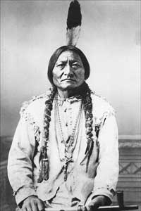
The Sioux or Oceti Sakowin are groups of Native American tribes and First Nations people from the Great Plains of North America. The Sioux have two major linguistic divisions: the Dakota and Lakota peoples. Collectively, they are the Očhéthi Šakówiŋ, or "Seven Council Fires". The term "Sioux", an exonym from a French transcription of the Ojibwe term Nadowessi, can refer to any ethnic group within the Great Sioux Nation or to any of the nation's many language dialects.

A conscientious objector is an "individual who has claimed the right to refuse to perform military service" on the grounds of freedom of conscience or religion. The term has also been extended to objecting to working for the military–industrial complex due to a crisis of conscience. In some countries, conscientious objectors are assigned to an alternative civilian service as a substitute for conscription or military service.

Arlington National Cemetery is the largest cemetery in the United States National Cemetery System, one of two maintained by the United States Army. Over 400,000 people are buried in its 639 acres in Arlington County, Virginia.

The Tower Building of the Little Rock Arsenal, also known as the Main Building of the U.S. Arsenal at Little Rock, or Headquarters Building of the Little Rock Barracks, is the home of the MacArthur Museum of Arkansas Military History. It is also a part of the MacArthur Park Historic District, in Little Rock, Arkansas.

Fort Hawkins was a fort built between 1806 and 1810 in the historic Creek Nation by the United States government under President Thomas Jefferson and used until 1824. Built in what is now Georgia at the Fall Line on the east side of the Ocmulgee River, the fort overlooked the sacred ancient earthwork mounds of the Ocmulgee Old Fields, now known as the Ocmulgee Mounds National Historical Park. The Lower Creek Trading Path passed by just outside the fort's northwestern blockhouse, and continued in a westerly direction until it reached a natural ford on the Ocmulgee River. A trading settlement and later the city of Macon, Georgia, developed in the area prior to the construction of the fort, with British traders being in the area as early as the 1680s. Later, the fort would become important to the Creek Nation, the United States, and the state of Georgia for economic, military, and political reasons.
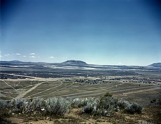
The Tule Lake National Monument in Modoc and Siskiyou counties in California, consists primarily of the site of the Tule Lake War Relocation Center, one of ten concentration camps constructed in 1942 by the United States government to incarcerate Japanese Americans forcibly removed from their homes on the West Coast. They totaled nearly 120,000 people, more than two-thirds of whom were United States citizens. Among the inmates, the notation "鶴嶺湖" was sometimes applied.

Moccasin Bend Archeological District is an archeological site in Chattanooga, Tennessee, that is part of the Chickamauga and Chattanooga National Military Park unit. The National Park Service refers to it as one of the "most unique units found in the entire National Park Service." The area contains remnants of 12,000 years of continuous human habitation and serves as an area with unique cultural significance. For many years, there was little recognition of the historical significance of the area, and years of industrial development occurred on and around sites of archeological importance. After decades of campaigning by concerned citizens, private organizations, local officials, the Friends of Moccasin Bend National Park, and finally a state representative, the area was officially recognized as a National Archeological District in 2003. Moccasin Bend is currently undergoing a process of renovation and restoration that will allow the area to fulfill the National Park Service's mission of preserving "natural and cultural resources" for the "enjoyment, education, and inspiration of this and future generations."

Devil's Den is a boulder-strewn hill on the south end of Houck's Ridge at Gettysburg Battlefield, used by artillery and sharpshooters on the second day of the 1863 Battle of Gettysburg during the American Civil War. A tourist attraction since the memorial association era, several boulders are worn from foot traffic and the site includes numerous cannons, memorials, and walkways, including a bridge spanning two boulders.

The Raven Rock Mountain Complex (RRMC), also known as Site R, is a U.S. military installation with an underground nuclear bunker near Blue Ridge Summit, Pennsylvania, at Raven Rock Mountain that has been called an "underground Pentagon". The bunker has emergency operations centers for the United States Army, Navy, Air Force, and Marine Corps. Along with Mount Weather Emergency Operations Center in Virginia and the Cheyenne Mountain Complex in Colorado, it formed the core bunker complexes for the US continuity of government plan during the Cold War to survive a nuclear attack.

During the American Civil War, Arkansas was a Confederate state, though it had initially voted to remain in the Union. Following the capture of Fort Sumter in April 1861, Abraham Lincoln called for troops from every Union state to put down the rebellion, and Arkansas along several other southern states seceded. For the rest of the civil war, Arkansas played a major role in controlling the Mississippi River, a major waterway.

The 6th Arkansas Infantry Regiment, commonly known as the "Sixth Arkansas", was a line infantry formation of the Confederate States Army in the Western Theater of the American Civil War.

The units of the Arkansas Militia in the Civil War to which the current Arkansas National Guard has a connection include the Arkansas State Militia, Home Guard, and State Troop regiments raised by the State of Arkansas. Like most of the United States, Arkansas had an organized militia system before the American Civil War. State law required military service of most male inhabitants of a certain age. Following the War with Mexico, the Arkansas militia experienced a decline, but as sectional frictions between the north and south began to build in the late 1850s the militia experienced a revival. By 1860 the state's militia consisted of 62 regiments divided into eight brigades, which comprised an eastern division and a western division. New regiments were added as the militia organization developed. Additionally, many counties and cities raised uniformed volunteer companies, which drilled more often and were better equipped than the un-uniformed militia. These volunteer companies were instrumental in the seizure of federal installations at Little Rock and Fort Smith, beginning in February 1861.

The 3rd Arkansas Field Battery (1860–1865) was a Confederate Army artillery battery from Pulaski County, Arkansas, during the American Civil War. The battery is also known as the Totten Light Artillery, Pulaski Light Artillery, the Weaver Light Artillery, Woodruff's Battery, and Marshall's Battery. The battery originated as a pre-war Militia company, initially enrolled in state service. After the Battle of Wilson's Creek, the battery was released from state service and eventually reorganized for Confederate Service. The battery provided the initial training for the leaders of numerous other Arkansas artillery batteries during the Civil War. The battery spent its entire service in the Department of the Trans-Mississippi.

The Arkansas Highway System is made up of all the highways designated as Interstates, U.S. Highways and State Highways in the US state of Arkansas. The system is maintained by the Arkansas Department of Transportation (ArDOT), known as the Arkansas State Highway Department (AHD) until 1977 and the Arkansas State Highway and Transportation Department (AHTD) from 1977 to 2017. The system contains 16,442.90 miles (26,462.28 km) of Interstates, U.S. Routes, state highways, and special routes. The shortest members are unsigned state highways Arkansas Highway 806 and Arkansas Highway 885, both 0.09 miles (0.14 km) in length. The longest route is U.S. Route 67, which runs 296.95 miles (477.89 km) from Texarkana to Missouri.
The 7th Arkansas Field Battery, originally known as the Blocher's Battery (1862–1865), was a Confederate artillery battery that served during the American Civil War. The unit was also known as Blocher's Battery or Zimmerman's Battery. The battery spent its entire existence in the Department of the Trans-Mississippi.
On 22 December 2011, a series of coordinated attacks occurred in Baghdad, Iraq, killing 69 people. This was the first major attack following U.S. withdrawal from Iraq.

Princess Caroline's Battery is an artillery battery in the British Overseas Territory of Gibraltar. It is located at the northern end of the Upper Rock Nature Reserve, at the junction of Willis's Road and Queen's Road. The nearby Princess Anne's Battery is often mistakenly referred to as Princess Caroline's Battery. The latter was built in 1732 and named after Princess Caroline, the daughter of King George II. Princess Caroline's Battery was updated in 1905, and a 6 inch Mark VII gun was mounted above the magazine. Later, the battery was decommissioned and the gun removed. The underground magazine is now home to the Military Heritage Centre, which includes the Memorial Chamber.

Rock Gun Battery is an artillery battery in the British Overseas Territory of Gibraltar. It is located on the North Face of the Rock of Gibraltar at the northern end of the Upper Rock Nature Reserve, above Green's Lodge Battery. The emplacement on Middle Hill is at the northern summit of the Rock. It was constructed during the Great Siege of Gibraltar, due to its advantageous position and the success of the gun at Green's Lodge Battery. It was used effectively during the Great Siege and was rebuilt during the Second World War. During the mid-twentieth century, the Ministry of Defence began to use the site as an aerial farm, which was then refurbished in 1958. The Rock Gun Battery and the Middle Hill Battery were closed to the public for decades. In 2005, the radio farm was closed and the Ministry of Defence withdrew from most of the area, transferring it to the Government of Gibraltar. However, the summit, the site of the Rock Gun Battery, continues to be under MOD authority.

