Ohio is a state in the East North Central region of the Midwestern United States. Of the fifty states, it is the 34th largest by area, the seventh most populous, and the tenth most densely populated. The state's capital and largest city is Columbus. Ohio is bordered by Lake Erie to the north, Pennsylvania to the east, West Virginia to the southeast, Kentucky to the southwest, Indiana to the west, and Michigan to the northwest.

Fairfield County is a county located in the U.S. state of Ohio. As of the 2010 census, the population was 146,156. Its county seat is Lancaster. Its name is a reference to the Fairfield area of the original Lancaster.

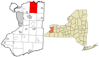
Amherst is a town in Erie County, New York, United States. Amherst is the most populated town in upstate New York, and an inner ring suburb of Buffalo. As of the 2010 census, the town had a total population of 122,366. This represents an increase of 5.0% from the 2000 census.

Clarence is a town located in the northeastern part of Erie County, New York, United States, northeast of Buffalo. The population was 30,673 according to the 2010 census. This represents an increase of 17.42% from the 2000 census figure. The Clarence census-designated place occupies the southeast part of the town and roughly corresponds to a postal district with ZIP code 14031 and 14221 in the western side which it shares with nearby Williamsville. The town is named in honor of Prince William, Duke of Clarence and St Andrews (1765–1837), the third son of King George III and later king himself, as William IV.

Fairfield Beach is an unincorporated community and census-designated place (CDP) in Fairfield County, Ohio, United States. The population was 1,292 at the 2010 census.

Millersport is a village in Fairfield County, Ohio, United States. The population was 1,044 at the 2010 census. Millersport is most notable as the home of the Sweet Corn Festival, which is held in Millersport annually during the first week of September.
Interstate 990 (I-990) is an auxiliary Interstate Highway located entirely within the town of Amherst in Erie County, New York, in the United States. It runs in a roughly north–south direction for 6.43 miles (10.35 km) through the southwestern and central parts of Amherst from an interchange with I-290 north of Buffalo to an intersection with New York State Route 263 south of Lockport. The highway serves as a connection between Buffalo, the University at Buffalo, and Lockport. Like I-590 in nearby Rochester, I-990 does not physically meet I-90, its parent Interstate Highway; instead, the highway makes the connection by way of a "sibling" highway (I-290). I-990 is the highest numbered Interstate Highway in the United States.
The Great Hopewell Road is thought to connect the Hopewell culture monumental earthwork centers located at Newark and Chillicothe, a distance of 60 miles (97 km) through the heart of Ohio, United States. The Newark complex was built 2,000 to 1800 years ago.

New York State Route 263 (NY 263) is a state highway located entirely within the town of Amherst in Erie County, New York, in the United States. It extends from just north of the northeast corner of the city of Buffalo in a roughly northeast direction almost straight to just south of the north county line. The road is named Millersport Highway north of Eggert Road in Amherst for the community at its northern terminus. The section between its southern terminus at U.S. Route 62 (US 62) and the Eggert Road intersection is named Grover Cleveland Highway.

New York State Route 270 (NY 270) is a north–south state highway in western New York in the United States. It runs through rural and wooded areas of the town of Amherst in Erie County and the town of Pendleton in Niagara County. The southern terminus of the route is at an intersection with NY 263 south of the hamlet of Getzville. Its northern terminus is at a junction with NY 31 and NY 93 west of the city of Lockport. The entirety of NY 270 is known as Campbell Boulevard.
Millersport, New York is a hamlet in the town of Amherst in Erie County, New York, United States. It is the namesake of the Millersport Highway, known legally as New York State Route 263.
Millersport Jr./Sr. High School is a public high school in Millersport, Ohio, United States. It is the only high school in the Walnut Township Local School District. The school's nickname is the Lakers.

Walnut Township is one of the thirteen townships of Fairfield County, Ohio, United States. As of the 2010 census the population was 6,841, of whom 4,789 lived in the unincorporated portions of the township.

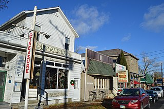
Getzville is a hamlet in the town of Amherst in Erie County, New York, United States. Getzville's ZIP code is 14068, and its post office is located on Millersport Highway.

Madison Township is one of twelve townships in Dubois County, Indiana. As of the 2010 census, its population was 2,696 and it contained 935 housing units.

New York State Route 268 (NY 268) was a state highway in northeastern Erie County, New York, in the United States. It served as a connector between NY 5 in the town of Clarence and NY 78 at the Clarence–Amherst town line. The route passed through rural areas of the town of Clarence and did not serve any areas of significant development. The northern portion of NY 268 followed the southern bank of Tonawanda Creek.

Millersport is an unincorporated community in Madison Township, Dubois County, in the U.S. state of Indiana.

Buckeye Lake State Park is a 3,349-acre (1,355 ha) Ohio state park near Millersport, in Fairfield, Licking and Perry counties, Ohio in the United States. The park is named for Buckeye Lake, which was built in the 19th century to supply water to the Ohio and Erie Canal.

The Cincinnati metropolitan area, informally known as Greater Cincinnati or the Greater Cincinnati Tri-State Area, is a metropolitan area that includes counties in the U.S. states of Ohio, Kentucky, and Indiana around the Ohio city of Cincinnati. The United States Census Bureau's formal name for the area is the Cincinnati–Middletown, OH–KY–IN Metropolitan Statistical Area. As of the 2010 U.S. Census, this MSA had a population of 2,114,580, making Greater Cincinnati the 29th most populous metropolitan area in the United States, the largest metro area primarily in Ohio, followed by Cleveland (2nd) and Columbus (3rd).


