Troitsk is the name of several inhabited localities in Russia.

Padarovce is a village and municipality in the Rimavská Sobota District of the Banská Bystrica Region of southern Slovakia.

This is a list of the extreme points of Azerbaijan, the points that are farther north, south, east or west than any other location.

Upper Borth is a small village in Ceredigion, Wales, part of Borth.
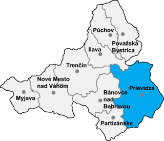
Nitrianske Sučany is a village and municipality in Prievidza District in the Trenčín Region of western Slovakia.
Malaxa is a village in the Chania regional unit on Crete in Greece. The 2011 census counted a population of 115 people in the village. In ancient times the Malaxa area was under the sphere of influence of the nearby powerful city of Kydonia. Malaxa lies on the feet of the Lefka Ori, and is separated from the large city of Chania by the Chania Plain.

Zarinja is a town in the Aragatsotn Province of Armenia. The town contains the seventh-century church of Saint Khach, rebuilt in the tenth century.

Czarne Błoto is a village in the administrative district of Gmina Zławieś Wielka, within Toruń County, Kuyavian-Pomeranian Voivodeship, in north-central Poland. It lies approximately 11 km (7 mi) west of Toruń and 32 km (20 mi) east of Bydgoszcz.
Wigrańce is a village in the administrative district of Gmina Sejny, within Sejny County, Podlaskie Voivodeship, in north-eastern Poland, close to the border with Lithuania. It lies approximately 9 kilometres (6 mi) south-east of Sejny and 108 km (67 mi) north of the regional capital Białystok.

Sordzha is a village in the Aghjabadi Rayon of Azerbaijan.
Rzalar is a village in the Agdam Rayon of Azerbaijan. The village forms part of the municipality of Qaradağlı.
Kəhrəmanlı is a village in the Yevlakh Rayon of Azerbaijan.
Qolqəti is a village and municipality in the Agdash Rayon of Azerbaijan. It has a population of 1,329.
Birinci Dördyol is a village in the municipality of Təzəkənd in the Agdam Rayon of Azerbaijan.
Birinci Baharlı is a village in the municipality of Üçoğlan in the Agdam Rayon of Azerbaijan.
Ridane is a town and commune in Bouïra Province, Algeria. According to the 1998 census it has a population of 3,029.
Sirevere is a village in Laekvere Parish, Lääne-Viru County, in northeastern Estonia.

Tønnesen Glacier is a broad glacier flowing north between Risemedet Mountain and Festninga Mountain, separating the Gjelsvik Mountains and the Mühlig-Hofmann Mountains in Queen Maud Land. It was mapped by Norwegian cartographers from surveys and air photos by the Norwegian Antarctic Expedition (1956–60) and named for J. Tønnesen, a meteorologist with the expedition.


