
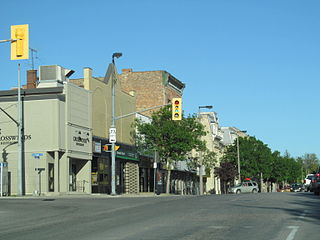
Oshawa is a city in Ontario, Canada, on the Lake Ontario shoreline. It lies in Southern Ontario, approximately 60 kilometres east of Downtown Toronto. It is commonly viewed as the eastern anchor of the Greater Toronto Area and of the Golden Horseshoe. It is the largest municipality in the Regional Municipality of Durham. The name Oshawa originates from the Ojibwa term aaz haway, meaning "the crossing place" or just "(a)cross".

Clarington is a lower-tier municipality in the Regional Municipality of Durham in Ontario, Canada. It was incorporated in 1973 as the town of Newcastle with the merging of the town of Bowmanville and the townships of Clarke and Darlington. In 1994, the town was renamed Clarington, a portmanteau of the names of the two former townships. Bowmanville is the largest community in the municipality and is the home of the municipal offices.

Durham Region Transit (DRT) is the regional public transit operator in Durham Region, Ontario, Canada, east of Toronto. Its headquarters are at 605 Rossland Rd East in Whitby, Ontario, and there are regional centres in Ajax, Whitby, and Oshawa. It was formed by the merger of Ajax/Pickering Transit, Whitby Transit, Oshawa Transit, and Clarington Transit.

Whitby—Oshawa was a federal electoral district in Ontario, Canada, that has been represented in the House of Commons of Canada since 2004. Following the 2012 federal electoral boundaries redistribution, the bulk of the district became part of the new Whitby district, while parts of it will be transferred to Oshawa and Durham.

One-room schools were commonplace throughout rural portions of various countries, including Prussia, Norway, Sweden, the United States, Canada, Australia, New Zealand, the United Kingdom, Ireland, and Spain. In most rural and small town schools, all of the students met in a single room. There, a single teacher taught academic basics to several grade levels of elementary-age boys and girls. While in many areas one-room schools are no longer used, it is not uncommon for them to remain in developing nations and rural or remote areas. Examples include remote parts of the American West, the Falklands, and the Shetland Islands.
Courtice is a community in Ontario, Canada, about 60 km (37 mi) east of Toronto, adjacent to Oshawa and west of Bowmanville in the Municipality of Clarington. Courtice Road connects with Highway 401 at Interchange 425, providing arterial access to the community. Darlington Provincial Park is located just south of Courtice.
Mitchell is a community in the municipality of West Perth, part of Perth County, Ontario, Canada. It is located at the intersection of Highways 8 and 23, 20 km northwest of Stratford, and 60 km north of London. Mitchell is no longer a separate entity. On January 1, 1998, the town amalgamated with the neighbouring Townships of Logan, Fullarton, and Hibbert to form the new Municipality of West Perth. As of 2016, the former town of Mitchell has a population of 4,573 in a land area of 4.81 square kilometres; it has 1,827 occupied private dwellings.

Stet, Missouri, United States, is an unincorporated community on the Ray/Carroll County line. It is located approximately fourteen miles northwest of Carrollton at the intersection of Missouri Supplemental Routes K and JJ.

Walsh is a medium-sized hamlet in Norfolk County, Ontario, Canada.

Odell School is an unincorporated community in northwestern Cabarrus County, North Carolina, United States, named for W. R. Odell Elementary School, a part of the Cabarrus County Schools system. It lies between Huntersville and Concord.

Odricks Corner is an unincorporated community in Fairfax County, Virginia, United States. Odricks Corner lies north of the Dulles Toll Road at the intersection of Spring Hill and Lewinsville Roads.

Courtice Secondary School is a public high school in the community of Courtice in Clarington, Ontario, Canada, at the corner of Nash and Courtice Roads. It was built in the late 1950s and opened in September 1960. The school has just under 1,000 students and is a part of the Kawartha Pine Ridge District School Board. It has five feeder schools: Courtice North P.S., Lydia Trull P.S., Courtice Intermediate School, Emily Stowe P.S., and S.T. Worden P.S.. Courtice Intermediate School is located in the same building as Courtice Secondary. It opened in September 2013 as a response to overcrowding at Dr. G. J. MacGillivray. Grade 7 and 8 students from the Dr. G. J MacGillivray area are now directed to Courtice Intermediate.; the French Immersion program for grades 7 and 8 in the Courtice area has also been moved to Courtice Intermediate. Beginning in the fall of 2014, Courtice Secondary will also be home to the French Immersion program for French Immersion students starting grade 9.
Mount Zion is a hill in Jerusalem.

Mossleigh is a hamlet in southern Alberta, Canada within Vulcan County. It is located on Highway 24, approximately 63 kilometres (39 mi) southeast of Calgary.
Kingsley No. 124 is a rural municipality in south-eastern Saskatchewan, Canada encompassing 844.61 square kilometers in area. The rural municipality maintains its office in Kipling, Saskatchewan. The rural municipality, in conjunction with the provincial government, is in charge of the maintenance of highways in its area. As well as this, the municipality provides policing, fire protection and municipal governance for the rural district, with a reeve as its administrator.

Oshawa Public Libraries (OPL) is a public library system that serves a population of more than 155,000 people in the City of Oshawa, Ontario, Canada. OPL has 4 branches, each serving its respective region of Oshawa, and sharing its collections in common amongst all the branches within the system. The City of Oshawa is situated on the Lake Ontario shoreline approximately 60 kilometres east of downtown Toronto.

Oshawa is a provincial electoral district in Ontario, Canada, that has been represented in the Legislative Assembly of Ontario since 1955.
Joppa is an unincorporated community located in Burnet County, Texas, United States. Joppa is located on the North Fork of the San Gabriel River seven miles northeast of the City of Bertram. First settlers of this farming and ranching community included the William Alexander Faires family who moved to the area in 1874 and the Martin Luther Ater family who moved from nearby Mahomet in 1875.
Panorama Film Studios, sometimes referred to as Hollyburn Film Studios, was a two sound stage and projection/dubbing theater complex constructed circa 1960 in the lower foothills of Hollyburn Mountain at West Vancouver, British Columbia. It was financed with help from UK investor(s) including Lord Folkestone, hence the name of the paved private road that ran from the Upper Levels Highway to the large studio parking lot. The studio address was 2280 Folkestone Way. Dirt mountain roads led from behind the studio up the side of Hollyburn mountain, at the time totally pristine tree-covered land. The building was eventually demolished and today the area is residential.
Bayleaf is an unincorporated community in Bartons Creek Township, Wake County, North Carolina. It has an elevation of 427 ft. It is located at the intersection of Six Forks Rd, Norwood Rd (SR


