| Momance River | |
|---|---|
 | |
| Country | Haiti |
The Momance River is a river of Haiti.
| Momance River | |
|---|---|
| | |
| Country | Haiti |
The Momance River is a river of Haiti.

Artibonite is one of the ten departments of Haiti. With an area of 4,887 km2 it is Haiti's largest department. As of 2015, its estimated population was 1,727,524. The region is the country's main rice-growing area. The main cities are Gonaïves and Saint-Marc. In February 2004 an insurgency tried unsuccessfully to declare Artibonite's independence.

Centre is one of the ten departments of Haiti, located in the center of the country along the border with the Dominican Republic. As of 2015, its estimated population was 746,236. Its capital is Hinche. It borders the Dominican Republic to the east and is the only landlocked department in Haiti.

The Artibonite River is a 320 km long river in Haiti. It is the longest as well as the most important river in Haiti and the longest on the island of Hispaniola. Forming part of the international border between Haiti and the Dominican Republic, the river's sources are in the Cordillera Central in the Dominican Republic, however most of its length lies in Haiti. The river empties into the Gulf of Gonâve.

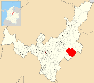
Tota is a town and municipality in the department of Boyacá, Colombia, part of the Sugamuxi Province. Tota is located approximately 40 km from Sogamoso and the municipality borders in the north Cuítiva, Aquitania in the east, Zetaquirá and San Eduardo in the south and westward of Tota the municipality of Pesca is located. Nearby and named after the village is Lake Tota, the largest lake of Colombia.
Anse d'Hainault is an arrondissement of the Grand'Anse Department located in southwestern Haiti. As of 2015, the population was 98,522 inhabitants. Postal codes in the Anse d'Hainault Arrondissement start with the number 72.
Labranzagrande is a town and municipality in the Colombian Department of Boyacá, part of the subregion of the La Libertad Province.

Bahon, sometimes called Bohon, is a commune in Grande-Rivière-du-Nord Arrondissement in the Nord, department of Haiti. It is located on the Grand Rivière du Nord (river). It was formerly (1915) located on the railroad south from Cap-Haïtien.
Arcahaie is an arrondissement in the Ouest of Haiti. As of 2015, the population was 198,551 inhabitants. Postal codes in the Arcahaie Arrondissement start with the number 64.
Croix-des-Bouquets is an arrondissement in the Ouest Department of Haiti. As of 2015, the population was 474,806 inhabitants. Postal codes in the Croix-des-Bouquets Arrondissement start with the number 63.
Saint-Louis-du-Nord is an arrondissement in the Nord-Ouest department of Haiti. As of 2015, the population was 146,567 inhabitants. Postal codes in the Saint-Louis-du-Nord Arrondissement start with the number 32.
The Swift River (Jamaica) is a river of Jamaica.The river had massive floods during the 1930s {1932-1940},which nearly brought the only major settlement,which shares the same name, to extinction.

The Grande Rivière de Jacmel or Rivière de la Cosse, is a river in Haiti. It is approximately 45 kilometers long.
The Rivière Montrouis is a river of Haiti.
The Rivière de Bainet is a river of Haiti.
The Rivière de Fer à Cheval is a river of Haiti. It is the primary tributary of the Artibonite River. This means that excess flow of water into the river can indirectly cause pressure on the Péligre Dam. This is notably the case in the aftermath of large-scale storms and hurricanes that hit Haiti.
The Rivière l’Estère is a river of Haiti.
Torsukattak Strait is a strait in the Qaasuitsup municipality in northwestern Greenland.

Charles Glacier is a small, steep glacier draining the south side of Borg Mountain, in the Borg Massif of Queen Maud Land. It was mapped by Norwegian cartographers from surveys and from air photos by the Norwegian–British–Swedish Antarctic Expedition (NBSAE) (1949–52) and named for Charles W. Swithinbank, a glaciologist with NBSAE.

Cooke Glacier is a glacier about 6 nautical miles (11 km) long flowing north from the northern end of the Fletcher Peninsula. It was named by the Advisory Committee on Antarctic Names after Kirsten Cooke Healey, of the United States Geological Survey (USGS), Woods Hole, Massachusetts, a computer graphics specialist from the mid-1990s onwards for the USGS project that is compiling the Satellite Image Atlas of Glaciers and 25 Glaciological and Coastal-Change Maps of Antarctica.

Standifer Bluff is a conspicuous rock bluff, a component of the Smith Bluffs which form the northwest coast of Dustin Island, standing 10 nautical miles (18 km) west-southwest of the north tip of the island. The bluff was photographed from helicopters of the USS Burton Island and Glacier in the U.S. Navy Bellingshausen Sea Expedition, February 1960. Named by Advisory Committee on Antarctic Names (US-ACAN) for J.N. Standifer, United States Geological Survey (USGS) photographic specialist in Antarctica in the 1967-68 season.
Coordinates: 18°34′N72°34′W / 18.567°N 72.567°W

A geographic coordinate system is a coordinate system that enables every location on Earth to be specified by a set of numbers, letters or symbols. The coordinates are often chosen such that one of the numbers represents a vertical position and two or three of the numbers represent a horizontal position; alternatively, a geographic position may be expressed in a combined three-dimensional Cartesian vector. A common choice of coordinates is latitude, longitude and elevation. To specify a location on a plane requires a map projection.
| This article related to a river in Haiti is a stub. You can help Wikipedia by expanding it. |