
Kayenta is a U.S. town which is part of the Navajo Nation and is in Navajo County, Arizona, United States. Established November 13, 1986, the Kayenta Township is the only "township" existing under the laws of the Navajo Nation, making it unique in this way.

The Four Corners is a region of the Southwestern United States consisting of the southwestern corner of Colorado, southeastern corner of Utah, northeastern corner of Arizona, and northwestern corner of New Mexico. Most of the Four Corners region belongs to semi-autonomous Native American nations, the largest of which is the Navajo Nation, followed by Hopi, Ute, and Zuni tribal reserves and nations. The Four Corners region is part of a larger region known as the Colorado Plateau and is mostly rural, rugged, and arid.

Monument Valley is a region of the Colorado Plateau characterized by a cluster of sandstone buttes, the largest reaching 1,000 ft (300 m) above the valley floor. It is located on the Utah-Arizona state line, near the Four Corners area. The valley is a sacred area that lies within the territory of the Navajo Nation Reservation, the Native American people of the area.

The Colorado Plateau, also known as the Colorado Plateau Province, is a physiographic and desert region of the Intermontane Plateaus, roughly centered on the Four Corners region of the southwestern United States. This province covers an area of 336,700 km2 (130,000 mi2) within western Colorado, northwestern New Mexico, southern and eastern Utah, northern Arizona, and a tiny fraction in the extreme southeast of Nevada. About 90% of the area is drained by the Colorado River and its main tributaries: the Green, San Juan, and Little Colorado. Most of the remainder of the plateau is drained by the Rio Grande and its tributaries.
Oljato-Monument Valley is a double community on the border of the U.S. states of Arizona and Utah. It includes the following census-designated places:

U.S. Route 163 is a 64-mile (103 km) U.S. Highway that runs from US 160 northward to US 191 in the U.S. states of Arizona and Utah. The southernmost 44 miles (71 km) of its length are within the Navajo Nation. The highway forms part of the Trail of the Ancients, a National Scenic Byway. The highway cuts through the heart of Monument Valley and has been featured in numerous movies and commercials.

The Vermilion Cliffs are the second "step" up in the five-step Grand Staircase of the Colorado Plateau, in northern Arizona and southern Utah. They extend west from near Page, Arizona, for a considerable distance, in both Arizona and Utah.

The Kayenta Formation is a geological formation in the Glen Canyon Group that is spread across the Colorado Plateau province of the United States, including northern Arizona, northwest Colorado, Nevada, and Utah. Traditionally has been suggested as Sinemurian-Pliensbachian, but more recent dating of detrital zircons has yielded a depositional age of 183.7 ± 2.7 Ma, thus a Pliensbachian-Toarcian age is more likely A previous depth work recovered a solid Lower-Middle Pliensbachian age from measurements done in the Tenney Canyon.
Rezball, short for "reservation ball," is a style of basketball associated with Native Americans, particularly at the high school level in the Southwestern United States, where many of the Indian reservations were created in the country.

Oljato-Monument Valley is a census-designated place (CDP) in San Juan County, Utah, United States. The population was 864 at the 2000 census.

Oljato-Monument Valley is a census-designated place (CDP) in Navajo County, Arizona, United States. The population was 154 at the 2010 census.

Comb Ridge is a linear north to south-trending monocline nearly 80 miles long in Southeastern Utah and Northeastern Arizona. Its northern end merges with the Abajo Mountains some eleven miles west of Blanding. It extends essentially due south for 45 km (28 mi) to the San Juan River. South of the San Juan the ridge turns to the southwest and is more subdued in expression as it extends for an additional 67 km (42 mi) to Laguna Creek 9 km (5.6 mi) east of Kayenta, Arizona.
Kayentavenator is a genus of small carnivorous tetanuran dinosaur that lived during the Early Jurassic Period; fossils were recovered from the Kayenta Formation of northeastern Arizona and were described in 2010.

The Trail of the Ancients is a collection of National Scenic Byways located in the U.S. Four Corners states of Utah, Colorado, New Mexico, and Arizona. These byways comprise:
Monument Valley High School is a high school in Kayenta, Arizona. It is the only high school under the jurisdiction of the Kayenta Unified School District.
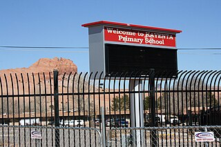
Kayenta Unified School District No. 27 is a school district headquartered in Kayenta, Arizona, located within the Navajo Nation.
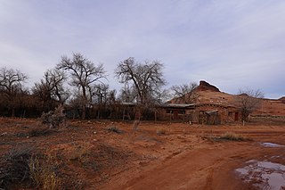
Oljato Trading Post was a trading post located on the western edge of Oljato–Monument Valley, Utah. The site was added to the National Register of Historic Places on June 20, 1980. In 2021, it was named by the National Trust for Historic Preservation in its list of America's Most Endangered Places.

Monument Valley High School is located in Oljato-Monument Valley, Utah. The school is in the San Juan School District, and serves grades 7–12. It is different from Monument Valley High School located in Kayenta, Arizona.

Louisa Wade Wetherill lived with her husband and children in remote trading posts among the Navajo people in New Mexico, Utah, and Arizona for more than 25 years and became an authority on Navajo culture. She spoke the Navajo language and became expert in medicinal herbs and plants known to the Navajo, art, especially sandpainting, traditional stories, and weaving. She was known by the Navajo as Asthon Sosi or "Slim Woman."