
The Inn is a river in Switzerland, Austria and Germany. The 518 km (322 mi) long river is a right tributary of the Danube, being the third largest tributary of the Danube by discharge. The highest point of its drainage basin is the summit of Piz Bernina at 4,049 m (13,284 ft). The Engadine, the valley of the En, is the only Swiss valley whose waters end up in the Black Sea.

The Isar is a river in Austria and in Bavaria, Germany. Its source is in the Karwendel mountain range of the Alps. The Isar river enters Germany near Mittenwald and flows through Bad Tölz, Munich, and Landshut before reaching the Danube near Deggendorf. With 295 km length, it is among the longest rivers in Bavaria. It is Germany's second most important tributary of the Danube.
Miesbach is a Landkreis (district) in Bavaria, Germany. It is bounded by the districts of Bad Tölz-Wolfratshausen, Munich and Rosenheim, and by the Austrian state of Tyrol.

The Amper, called the Ammer upstream of the Ammersee, through which it runs, is the largest tributary of the Isar in southern Bavaria, Germany. It flows generally north-eastward, reaching the Isar in Moosburg, about 185 kilometres (115 mi) from its source in the Ammergau Alps, with a flow of 45 m³/s. Including its tributary, Linder, it is 209.5 km (130.2 mi) long. Major tributaries are the Glonn, which rises near Augsburg; the Würm, which is the outflow of Lake Starnberg; and the Maisach.

Ladakh is an administrative territory of India that has been under its control since 1947. The geographical region of Ladakh union territory is the highest altitude plateau region in India, incorporating parts of the Himalayan and Karakoram mountain ranges and the upper Indus River and valley.

Taubenberg is a mountain with a height of 896 m amsl and area of 1847 ha in the Warngau municipality in the district of Miesbach in Bavaria, Germany. It is set apart from the Tegernsee mountains of the Bavarian Prealps. It is a popular hiking destination and the most important water supply area of the Bavarian capital Munich. About two-thirds of the mountain is owned by the city of Munich, the rest is freehold of local farmers and foresters.

The Mangfall Mountains, or sometimes Mangfall Alps, are the easternmost part of the Bavarian Prealps that, in turn, belong to the Northern Limestone Alps. The name comes from the river Mangfall, whose tributaries, the Rottach, Weißach, Schlierach and Leitzach, drain large parts of the area and form an important drinking water reservoir for the city of Munich.

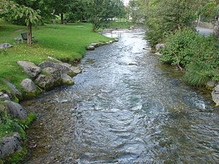
The Mangfall is a river of Upper Bavaria, Germany. The Mangfall is the outflow of the Tegernsee lake and discharges in Rosenheim from the left into the Inn. It is 63 km (39 mi) long.

The Eschach is a river of Baden-Württemberg, Germany. It flows into the Neckar south of Rottweil.
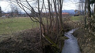
Festenbach is a river of Bavaria, Germany. It flows into the Mangfall near Thalmühl.

Weißach is a river of Bavaria, Germany. It flows into the Tegernsee, which is drained by the Mangfall, near Rottach-Egern.

Glonn is a river in Bavaria, Germany.
Schlierach is a river of Bavaria, Germany. It is the outflow of the Schliersee, and flows into the Mangfall near Weyarn.
The Eckbach is a small river in the northeastern Palatinate and the southeastern Rhenish Hesse. It is slightly over 39 kilometres (24 mi) long.

The Moosbach is a stream, approximately 6.6 kilometres (4.1 mi) long, in the South Palatine part of the Wasgau region in the German state of Rhineland-Palatinate. It is a right tributary of the Lauter, whose upper reaches are known as the Wieslauter.

The Hartlaber is a stream in Bavaria, Germany. It is a distributary of the Große Laber in Lower Bavaria.
The Wiesbach is a 44.4-kilometre-long (27.6 mi) river of Rhineland-Palatinate, Germany.
