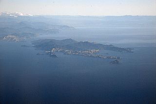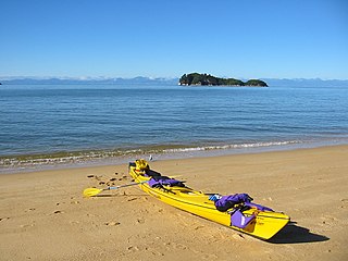
D'Urville Island, Māori name Rangitoto ki te Tonga, is the largest island in the Marlborough Sounds, on the northern coast of the South Island of New Zealand. It was named after the French explorer Jules Dumont d'Urville. With an area of approximately 150 square kilometres (58 sq mi), it is the eighth-largest island of New Zealand, and has around 52 permanent residents. The local authority is the Marlborough District Council.

Jules Sébastien César Dumont d'Urville was a French explorer and naval officer who explored the south and western Pacific, Australia, New Zealand, and Antarctica. As a botanist and cartographer, he gave his name to several seaweeds, plants and shrubs, and places such as d'Urville Island in New Zealand.

Tasman District is a local government district in the northwest of the South Island of New Zealand. It borders the Canterbury Region, West Coast Region, Marlborough Region and Nelson City. It is administered by the Tasman District Council, a unitary authority, which sits at Richmond, with community boards serving outlying communities in Motueka and Golden Bay / Mohua. The city of Nelson has its own unitary authority separate from Tasman District, and together they comprise a single region in some contexts, but not for local government functions or resource management (planning) functions.

Abel Tasman National Park is a national park at the north end of New Zealand's South Island. It covers 237.1 km2 (91.5 sq mi) of land between Golden Bay / Mohua and Tasman Bay / Te Tai-o-Aorere, making it the smallest of New Zealand's national parks. Despite this, the park is one of the most visited, partially due to the popularity of the Abel Tasman Coast Track which spans 60 km (37 mi) along the eastern and northern coastal areas of the park.

Tākaka Hill is a range of hills in the northwest of the South Island of New Zealand. Made of marble that has weathered into many strange forms and with numerous sink holes, it is typical karst country. The marble is Ordovician in age and from the Takaka Terrane.

Tasman Bay, originally known in English as Blind Bay, is a large V-shaped bay at the north end of New Zealand's South Island. Located in the centre of the island's northern coast, it stretches along 120 kilometres (75 mi) of coastline and is 70 kilometres (43 mi) across at its widest point. It is an arm of the Tasman Sea, lying on the western approach to Cook Strait.

Rākauroa / Torrent Bay is a bay in Abel Tasman National Park, New Zealand.

The rusty-winged starling is a species of starling in the family Sturnidae. It is found in the Santa Cruz Islands and Vanuatu.

Astrolabe was originally a horse-transport barge converted into an exploration ship of the French Navy. Originally named Coquille, she is famous for her travels with Jules Dumont d'Urville. The name derives from an early navigational instrument, the astrolabe, a precursor to the sextant.

French Pass is a narrow and treacherous stretch of water that separates D'Urville Island, at the north end of the South Island of New Zealand, from the mainland coast. At one end is Tasman Bay, and at the other end the outer Pelorus Sound / Te Hoiere leads out to Cook Strait.

The Torrent River is a river of the Tasman Region of New Zealand's South Island. It flows east to reach Torrent Bay on the Tasman Bay / Te Tai-o-Aorere coast of the Abel Tasman National Park. The Abel Tasman Track crosses the river close to its mouth.

Golden Bay / Mohua is a large shallow bay in New Zealand's Tasman District, near the northern tip of the South Island. An arm of the Tasman Sea, the bay lies northwest of Tasman Bay / Te Tai-o-Aorere and Cook Strait. It is protected in the north by Farewell Spit, a 26 km long arm of fine golden sand that is the country's longest sandspit. The Aorere and Tākaka rivers are the major waterways to flow into the bay from the south and the west.

Pepin Island is a privately owned tied island in New Zealand connected by a causeway to the settlement of Cable Bay, north-east of Nelson.

Tokangawhā / Split Apple Rock is a geological rock formation in Tasman Bay / Te Tai-o-Aorere off the northern coast of the South Island of New Zealand. Made of granite from the cretaceous, it is in the shape of an apple which has been cut in half. The cleft to produce two sides of the 'apple' was a naturally occurring joint. Joints occur commonly in granite and are planes of weakness that rain and waves exploit. The traditional Maori myth for the formation describes two gods breaking apart the rock.

Fisherman Island is a small uninhabited island off the coast of New Zealand. It is contained within Abel Tasman National Park and adjacent to Motuareronui / Adele Island.

Tonga Island is a small (0.15 km2) island in Tasman Bay / Te Tai-o-Aorere, off the northern coast of the South Island of New Zealand. It lies within the Abel Tasman National Park, about 1 kilometre (0.62 mi) off Onetahuti Beach. The island has a flourishing fur seal colony, and is surrounded by the Tonga Island Marine Reserve, which was inaugurated in 1993.
The history of the Nelson Region of New Zealand dates back to settlement by the Māori people in about the 12th century. The Nelson and Marlborough Region were known to the Māori as Te Tau Ihu o Te Waka a Maui which means "The Prow of the Canoe of Maui".

Pérrine Moncrieff was a New Zealand writer, conservationist and amateur ornithologist.

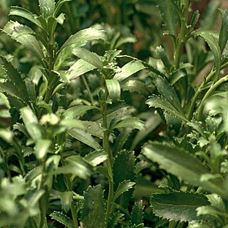
Lepidium banksii, known as coastal peppercress, is a rare species of flowering plant from the family Brassicaceae. It is endemic to New Zealand, formerly found around the coast of the northern South Island but now critically endangered.

Wainui Bay is within Golden Bay / Mohua, and at the south-eastern end of Golden Bay, in the Tasman Region of the South Island, New Zealand.


