The South Eastern Freeway is a 76 kilometre controlled-access highway in South Australia. It carries traffic over the Adelaide Hills between Adelaide and the River Murray, near Murray Bridge, connecting via the Swanport Bridge to the Dukes Highway which is the main road route to Victoria. It is often referred to by South Australians simply as the Freeway, as it was the first freeway in South Australia, and is still the longest, and the only one with "Freeway" in its name rather than "Expressway" or "Highway". It is a part of the National Highway network linking the state capital cities Adelaide to Melbourne and signed as National Highway M1. The South Eastern Freeway includes 500-metre-long twin-tube tunnels in the descent towards Adelaide, the first of their kind on the National Highway. It is designated as the M1.

The Adelaide Hills region is located in the southern Mount Lofty Ranges east of the city of Adelaide in the state of South Australia. The largest town in the area, Mount Barker, has a population of around 29,000 and is one of Australia's fastest growing towns.

The Shire of Plantagenet is a local government area in the Great Southern region of Western Australia, managed from the town of Mount Barker, 360 kilometres (224 mi) south of Perth and 50 kilometres (31 mi) north of Albany. The shire covers an area of 4,792 square kilometres (1,850 sq mi) and includes the communities of Narrikup, Rocky Gully, Kendenup and Porongurup.

Mount Barker is a town on the Albany Highway and is the administrative centre of the Shire of Plantagenet in the Great Southern region of Western Australia. At the 2016 census, Mount Barker had a population of 1,905.

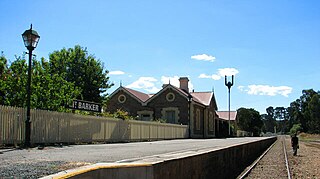
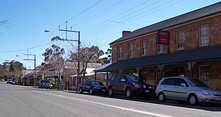
The Mount Barker District Council is a local government area centred on the town of Mount Barker just outside the Adelaide metropolitan area in South Australia.

Tarpeena is a town and a locality on the Riddoch Highway between Penola and Mount Gambier in the Limestone Coast region of South Australia.
Nairne is a small township in South Australia, founded by Matthew Smillie in 1839 and named for his wife's family. Nairne is about 7 kilometres (4 mi) from Mount Barker, South Australia, in the federal Division of Mayo and in the state electoral district of Kavel. At the 2011 census, Nairne had a population of 4,198.

Mount Barker is a mountain in the Mount Lofty Ranges in South Australia and namesake of the nearby town of Mount Barker.

The Bremer River, part of the lower Murray-Darling catchment, is a river that is located in the Adelaide Hills region in the Australian state of South Australia.

Allendale East is a town and locality in the Australian state of South Australia located in the state’s south-east about 391 kilometres (243 mi) south-east of the state capital of Adelaide and about 20 kilometres (12 mi) south of the municipal seat of Mount Gambier.

Kongorong is a locality in the Australian state of South Australia located southwest of Mount Gambier. It has an Australian rules football team and netball team. Kongorong Primary School had 61 students in 2010.
Nangwarry is a town and a locality in the Australian state of South Australia located about 352 kilometres (219 mi) south-east of the state capital of Adelaide and about 32 kilometres (20 mi) north-west of the regional centre of Mount Gambier.
Yahl is a locality in the Australian state of South Australia, and located in the state's south-east about 7 kilometres (4.3 mi) south-east of Mount Gambier, which is itself about 384 kilometres (239 mi) south east of the state capital of Adelaide.
Mount Barker was an electoral district of the House of Assembly in the Australian state of South Australia from 1857 to 1902.
The Courier is a weekly newspaper published in Mount Barker, South Australia. For much of its existence its full title was The Mount Barker Courier and Onkaparinga and Gumeracha Advertiser, later shortened to The Mount Barker Courier.

The County of Hindmarsh is one of the 49 cadastral counties of South Australia. It was proclaimed by Governor George Grey in 1842 and named for Governor John Hindmarsh.

Mount Mary is a small town on the Thiele Highway between Eudunda and Morgan in South Australia. It was also served by the Morgan railway line from 1878 until 1969 and is named for the Mount Mary railway station on that line.
The Corporate Town of Murray Bridge was a local government area in South Australia from 1924 to 1977.
This page is based on this
Wikipedia article Text is available under the
CC BY-SA 4.0 license; additional terms may apply.
Images, videos and audio are available under their respective licenses.