
Enderby Land is a projecting land mass of Antarctica. Its shore extends from Shinnan Glacier at about 67°55′S44°38′E to William Scoresby Bay at 67°24′S59°34′E, approximately 1⁄24 of the earth's longitude. It was first documented in western and eastern literature in February 1831 by John Biscoe aboard the whaling brig Tula, and named after the Enderby Brothers of London, the ship's owners who encouraged their captains to combine exploration with sealing.
Sibelius Glacier is a glacier, 12 miles (19 km) long and 6 miles (10 km) wide, flowing south into the Mozart Ice Piedmont 10 miles (16 km) southwest of Mount Stephenson situated in the northern portion of Alexander Island, Antarctica. The glacier was first sighted from the air by the British Graham Land Expedition in 1937. Mapped from air photos taken by the Ronne Antarctic Research Expedition in 1947-48, by Searle of the Falkland Islands Dependencies Survey in 1960. This feature was named by the United Kingdom Antarctic Place-Names Committee for Jean Sibelius (1865-1957), Finnish composer.
Silk Glacier is a glacier, 10 miles (16 km) long, draining the east slopes of the Churchill Mountains between Mount Frost and Mount Zinkovich to enter Nursery Glacier. Named by Advisory Committee on Antarctic Names (US-ACAN) for Cdt. P.R.H. Silk, RNZN, commanding officer of HMNZS Endeavour II in Antarctic waters, 1963-64.

Emmanuel Glacier is a glacier in the Royal Society Range of Victoria Land, descending from Mount Lister northwestward between Table Mountain and Cathedral Rocks to enter Ferrar Glacier. It was named by the British Antarctic Expedition, 1910–13, after Emmanuel College, Cambridge, England.

Mount Provender is a conspicuous rock mountain, 900 m, marking the northwest extremity of the Shackleton Range. It was first mapped in 1957 by the Commonwealth Trans-Antarctic Expedition and so named because members of the Commonwealth Trans-Antarctic Expedition established a depot of food and fuel and an airplane camp on the south side of the mountain in 1957 to support sledging parties working in the Shackleton Range.

Mount Christi is a mountain rising to 1,280 metres (4,200 ft) in the northern Imeon Range on Smith Island in the South Shetland Islands, Antarctica. The peak overlooks Kongur Glacier to the west-northwest, Saparevo Glacier to the north and Ritya Glacier to the southeast.

Yozola Glacier is the 5 km long and 1.7 km wide glacier in the Sofia University Mountains situated in the northern portion of Alexander Island in Antarctica, and draining north-northwestwards between Mount Braun and Balan Ridge to flow into Palestrina Glacier.
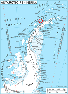
Mount Allan is the largest massif in the Traverse Mountains, isolated to the north and south by low passes, on the Rymill Coast, Palmer Land. Named in 1977 by the United Kingdom Antarctic Place-Names Committee (UK-APC) after Thomas J. Allan (1940–66), British Antarctic Survey (BAS) radio operator at Stonington Island, 1965–66, who lost his life while sledging with J.F. Noel near Tragic Corner, Fallieres Coast, in May 1966.
Mount Bergin is a mountain, 700 m, standing 4 nautical miles (7 km) west of Mount Maslen in the Raggatt Mountains, Enderby Land. It was plotted from air photos taken from ANARE aircraft in 1956. It was named by Antarctic Names Committee of Australia (ANCA) for R.D. Bergin, radio officer at Mawson station in 1956.
Mount Bitgood is a mountain between Mount Lockhart and Mount Colombo on the north side of the Fosdick Mountains, in the Ford Ranges of Marie Byrd Land. Mapped by United States Antarctic Service (USAS) (1939–41) and by United States Geological Survey (USGS) from surveys and U.S. Navy air photos (1959–65). Named by Advisory Committee on Antarctic Names (US-ACAN) for Charles D. Bitgood, geologist with the United States Antarctic Research Program (USARP) party to the Fosdick Mountains, 1967-68.
Branson Nunatak is a nunatak between Mount Burnett and Price Nunatak in the Framnes Mountains, Mac. Robertson Land. It was mapped by Norwegian cartographers from air photos taken by the Lars Christensen Expedition, 1936–37, and named Horntind. It was renamed by the Antarctic Names Committee of Australia for J. Branson, geophysicist at Mawson Station in 1962.
The Brugmann Mountains, rising to 850 metres (2,800 ft), are steep and rugged on the east slopes but are icecapped and descend gently toward the west, extending in a northeast–southwest arc along the east side of Liège Island, in the Palmer Archipelago. Their principal peaks are Mount Vesalius, Pavlov Peak, Mishev Peak, Mount Kozyak, Vazharov Peak and Balkanov Peak.
Navarrette Peak is a rock peak marking the southwest extremity of the Mount Petras massif, in the McCuddin Mountains of Marie Byrd Land. Mapped by United States Geological Survey (USGS) from surveys and U.S. Navy air photos, 1959-69. Named by Advisory Committee on Antarctic Names (US-ACAN) for Captain Claude Navarrette, U.S. Navy, Deputy Commander and Chief of Staff to the Commander, U.S. Naval Support Force, Antarctica, during Operation Deep Freeze 1972. He also served on the staff during 1969 and 1970.
Mount Denham is a mountain 1 nautical mile (2 km) northwest of Mount Keyser, in the eastern part of the Tula Mountains in Enderby Land. It was plotted from air photos taken from Australian National Antarctic Research Expeditions aircraft in 1957, and was named by the Antarctic Names Committee of Australia for W.M. Denham, a weather observer at Mawson Station in 1961.
Deschanel Peak is the summit of an isolated, partly ice-covered mountain, 750 metres (2,460 ft) high, rising from the south part of the glacier close southeast of Cape Berteaux on the west coast of the Antarctic Peninsula. The approved name derives from "Sommet Deschanel" given by J.B. Charcot, leader of the French Antarctic Expedition, in January 1909.
Purcell Snowfield is a snowfield, 15 nautical miles (28 km) wide, lying between the east portion of the Colbert Mountains and the west side of the Douglas Range in the central part of Alexander Island, Antarctica. The feature was mapped from air photos taken by the Ronne Antarctic Research Expedition (RARE), 1947–48, by Searle of the Falkland Islands Dependencies Survey (FIDS) in 1960. The snowfield was named by the United Kingdom Antarctic Place-Names Committee (UK-APC) for Henry Purcell (1659–1695), English composer.
Mount Fitzsimmons is a peak standing between Mount Jackling and Mount Shideler in the northern group of the Rockefeller Mountains on Edward VII Peninsula, Antarctica. It was discovered on January 27, 1929, by members of the Byrd Antarctic Expedition on an exploratory flight to this area, and was named for Roy Fitzsimmons, physicist in charge of the Rockefeller Mountains seismic station for the United States Antarctic Service during November–December 1940.
Steinemann Island is an island off the northeast coast of Adelaide Island, about 10 nautical miles (18 km) southwest of Mount Velain. Mapped from air photos taken by Ronne Antarctic Research Expedition (RARE) (1947–48) and Falkland Islands and Dependencies Aerial Survey Expedition (FIDASE) (1956–57). Named by United Kingdom Antarctic Place-Names Committee (UK-APC) for Samuel Steinemann, Swiss physicist who has made laboratory investigations on the flow of single and polycrystalline ice.
Spear Glacier is a glacier between the Hauberg Mountains and Peterson Hills, in southern Palmer Land. Mapped by United States Geological Survey (USGS) from surveys and U.S. Navy air photos, 1961-67. Named by Advisory Committee on Antarctic Names (US-ACAN) for Milton B. Spear, construction electrician at Eights Station in 1965.
Vaughan Glacier is a tributary glacier, 10 nautical miles (18 km) long, draining eastward from Mount Vaughan to enter Scott Glacier just south of Taylor Ridge, in the Hays Mountains of the Queen Maud Mountains. It was mapped by the United States Geological Survey (USGS) from surveys and U.S. Navy air photos, 1960–64, and was named by the Advisory Committee on Antarctic Names (US-ACAN) in association with Mount Vaughan.
