Moutere Hauriri / Bounty Islands Marine Reserve

Last updated
Moutere Hauriri / Bounty Islands Marine Reserve
Bounty Islands Sub-Antarctic New Zealand Panorama 1.jpg
Proclamation Island coastline
New Zealand Outlying Islands location map.svg
Red pog.svg
Location relative to New Zealand's South Island
Location New Zealand
Coordinates 47°48′08″S179°03′34″E / 47.8023243°S 179.0594567°E / -47.8023243; 179.0594567
Area104,626 hectares (258,540 acres)
Established2014
Governing body Department of Conservation

Moutere Hauriri / Bounty Islands Marine Reserve is a marine reserve covering an area of 104,626 hectares (258,540 acres) around New Zealand's Bounty Islands. It was established in 2014 and is administered by the Department of Conservation. [1] [2]

Contents

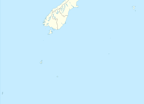
The island group of 20 igneous islets and rocks are scattered 700 kilometres (430 mi) east-southeast of the South Island. [3]

Permits are required to land on the islands. This is only given to visits with a high justification, and must strictly adhere to a minimum impact code. There is no safe anchorage or landing place, boats can only safely navigate through the islands about one day in four, and strict quarantine measures are in place. [1]

While fishing and landing are not permitted, people can travel through the marine reserve on cruises. [4]

The rest of the territorial sea is a type 2 marine protected area, with a ban on bottom trawling, Danish seining and dredging. [1]

Geography

The Moutere Hauriri / Bounty Islands Marine Reserve includes an area south, north and north-west of the island ground. [5]

The islands are made of bare, slipper granite from the Early Jurassic granitoids, [6] with no natural vegetation or soil. [4] The water around the islands is extremely clear, with visibility reaching up to 40 metres. [1]

History

The Māori name for the islands and marine reserve, Moutere Hauriri, roughly translates to "island of angry wind", referring to the rough sea conditions often found in the remote island group. [1]

The English name for the islands, Bounty, is named after the ship William Bligh was sailing during the first European discovery of the islands in 1788. [1]

The marine reserve was proposed in 2012. [7] A law change to create the reserve was introduced to Parliament in 2011, [8] and received legal recognition on 4 March 2014. [2] [9]

Moutere Mahue / Antipodes Island Marine Reserve and Moutere Ihupuku / Campbell Island Marine Reserve were created on the same day, under the same law change. [9]

Flora and fauna

The Bounty Islands are densely populated with the world's largest colony of over 20,000 New Zealand fur seals, about 30,000 breeding pairs each of Salvin’s mollymawks, erect-crested penguins, and fulmar prions, and about 500-600 pairs of Bounty Island Shag. The islands can be smelt and heard from a long distance away during the crowded summer breeding season. [1]

The layer of guano left from the breeding season provides food and shelter for beetles, weta and some flightless moths above the water, and sea sponges and shellfish below the water. [1]

The surrounding area is also teeming with underwater life. The diversity of species is similar to areas in the tropical and north Pacific, like the Galápagos Islands and Puget Sound. Brightly-coloured sponges, large mussels and barnacles live around the islands. Giant spider crabs and giant making crabs, with leg spans up to a meter long, also live in the rocky reefs near the shore. [1]

See also

Related Research Articles

<span class="mw-page-title-main">Auckland Islands</span> Volcanic archipelago in New Zealand

The Auckland Islands are an archipelago of New Zealand, lying 465 km (289 mi) south of the South Island. The main Auckland Island, occupying 460 km2 (180 sq mi), is surrounded by smaller Adams Island, Enderby Island, Disappointment Island, Ewing Island, Rose Island, Dundas Island, and Green Island, with a combined area of 570 km2 (220 sq mi). The islands have no permanent human inhabitants.

<span class="mw-page-title-main">Bounty Islands</span> Island group in New Zealand

The Bounty Islands are a small group of uninhabited granite islets and numerous rocks, with a combined area of circa 50 ha in the South Pacific Ocean. Territorially part of New Zealand, they lie about 670 km (420 mi) east-south-east of New Zealand's South Island, 530 km (330 mi) south-west of the Chatham Islands, and 215 km (134 mi) north of the Antipodes Islands. The group is a World Heritage Site.

<span class="mw-page-title-main">Snares Islands</span> Island group in New Zealand

The Snares Islands, known colloquially as The Snares, is a group of uninhabited islands lying about 200 km (120 mi) south of New Zealand's South Island and to the south-southwest of Stewart Island / Rakiura. The Snares consist of the main North East Island and the smaller Broughton Island and Alert Stack, as well as the Western Chain Islands some 5 km (3.1 mi) to the west-southwest. Collectively, the Snares have a total land area of 3.4 km2 (1.3 sq mi).

<span class="mw-page-title-main">Antipodes Islands</span> Subantarctic archipelago of New Zealand

The Antipodes Islands are inhospitable and uninhabited volcanic islands in subantarctic waters to the south of – and territorially part of – New Zealand. The 21 km2 (8.1 sq mi) archipelago lies 860 km (530 mi) to the southeast of Stewart Island/Rakiura, and 730 km (450 mi) to the northeast of Campbell Island. They are very close to being the antipodal point to Normandy in France, meaning that the city farthest away is Cherbourg-en-Cotentin, France.

<span class="mw-page-title-main">Campbell Islands</span> Island group in New Zealand

The Campbell Islands are a group of subantarctic islands, belonging to New Zealand. They lie about 600 km south of Stewart Island. The islands have a total area of 113 km2 (44 sq mi), consisting of one big island, Campbell Island, and several small islets, notably Dent Island, Isle de Jeanette Marie, Folly Island, Jacquemart Island, and Monowai Island. Ecologically, they are part of the Antipodes Subantarctic Islands tundra ecoregion. The islands are one of five subantarctic island groups collectively designated as a World Heritage Site by UNESCO.

<span class="mw-page-title-main">Cape Rodney-Okakari Point Marine Reserve</span>

Cape Rodney-Okakari Point Marine Reserve is a 5.5 km2 (2.1 sq mi) protected area in the North Island of New Zealand. All fishing, and the removal or disturbing of marine life or materials, is forbidden within the reserve.

<span class="mw-page-title-main">Wildlife of Antarctica</span> Antarctic wildlife

The wildlife of Antarctica are extremophiles, having adapted to the dryness, low temperatures, and high exposure common in Antarctica. The extreme weather of the interior contrasts to the relatively mild conditions on the Antarctic Peninsula and the subantarctic islands, which have warmer temperatures and more liquid water. Much of the ocean around the mainland is covered by sea ice. The oceans themselves are a more stable environment for life, both in the water column and on the seabed.

<span class="mw-page-title-main">Hikurangi Marine Reserve</span> New Zealand marine reserve

Hikurangi Marine Reserve is a marine reserve off the coast of the Kaikōura District, in the Canterbury Region of New Zealand's South Island. It is the largest and deepest marine reserve in New Zealand.

Long Island-Kokomohua Marine Reserve is a marine reserve, in the Marlborough Region of New Zealand's South Island. It covers an area of 619 hectares at the entrance to the Queen Charlotte Sound in the Marlborough Sounds. It was the first marine reserve established on the South Island.

<span class="mw-page-title-main">Moutere Ihupuku / Campbell Island Marine Reserve</span>

Moutere Ihupuku / Campbell Island Marine Reserve or Campbell Island / Moutere Ihupuku Marine Reserve is a marine reserve around Campbell island in the New Zealand Subantarctic Islands.

<span class="mw-page-title-main">Parininihi Marine Reserve</span>

Parininihi Marine Reserve is a marine reserve administered by the Department of Conservation, covering 1,800 hectares in the North Taranaki Bight. It is located offshore of the west coast of New Zealand's North Island, north-east of New Plymouth.

<span class="mw-page-title-main">Te Matuku Marine Reserve</span>

Te Matuku Marine Reserve is a marine reserve administered by the New Zealand Department of Conservation. It includes Te Matuku Bay, one of the largest and least disturbed estuaries on Waiheke Island, as well as a surrounding area of sea. It covers an area of 690 ha and was established in 2003.

<span class="mw-page-title-main">Moutere Mahue / Antipodes Island Marine Reserve</span> Marine reserve in New Zealand territorial waters

Moutere Mahue / Antipodes Island Marine Reserve is a marine reserve covering an area of 217,287 hectares around the Antipodes Islands south of New Zealand's South Island and Stewart Island / Rakiura. It was established in 2014 and is administered by the New Zealand Department of Conservation.

<span class="mw-page-title-main">Westhaven (Te Tai Tapu) Marine Reserve</span> Marine reserve in New Zealand territorial waters

Westhaven Marine Reserve is a marine reserve covering an area of 536 hectares in the Whanganui Inlet at the top of New Zealand's South Island. It was established in 1994 and is administered by the Department of Conservation.

Kahukura Marine Reserve is a marine reserve covering an area of 464 hectares in Charles Sound, in Fiordland on New Zealand's South Island. It was established in 2005 and is administered by the Department of Conservation.

<span class="mw-page-title-main">Te Tapuwae o Hua (Long Sound) Marine Reserve</span>

Te Tapuwae o Hua Marine Reserve is a marine reserve covering an area of 3,672 hectares in Te Awaroa / Long Sound in Fiordland on New Zealand's South Island. It was established in 2005 and is administered by the Department of Conservation.

<span class="mw-page-title-main">Moana Uta (Wet Jacket Arm) Marine Reserve</span> Marine reserve in New Zealand territorial waters

Moana Uta Marine Reserve is a marine reserve covering the entire length of Wet Jacket Arm in Fiordland on New Zealand's South Island, an area of 2,007 hectares. It was established in 2005 and is administered by the Department of Conservation.

<span class="mw-page-title-main">Piopiotahi (Milford Sound) Marine Reserve</span>

Piopiotahi Marine Reserve is a marine reserve covering an area of 690 hectares in the Milford Sound / Piopiotahi, in Fiordland on New Zealand's South Island. It was established in 1993 and is administered by the Department of Conservation.

<span class="mw-page-title-main">Taipari Roa (Elizabeth Island) Marine Reserve</span> Marine reserve in New Zealand territorial waters

Taipari Roa Marine Reserve is a marine reserve covering an area of 613 hectares around Elizabeth Island, in the inner Doubtful Sound / Patea of Fiordland on New Zealand's South Island. It was established in 2005 and is administered by the Department of Conservation.

<span class="mw-page-title-main">Te Awaatu Channel (The Gut) Marine Reserve</span>

Te Awaatu Channel Marine Reserve is a marine reserve covering an area of 93 hectares in Fiordland on New Zealand's South Island. It was established in 1993 and is administered by the Department of Conservation.

References

  1. 1 2 3 4 5 6 7 8 9 "Bounty Islands/Moutere Hauriri Marine Reserve". doc.govt.nz. Department of Conservation.
  2. 1 2 Hutching, Gerard. "Marine protected areas". Te Ara - the Encyclopedia of New Zealand . Ministry for Culture and Heritage.
  3. "Our isolated marine reserves". aa.co.nz. Automobile Association of New Zealand.
  4. 1 2 Vance, Andrea (21 February 2021). "Cruising New Zealand's subantarctic islands: Where the wild things are". stuff.co.nz. Stuff Travel.
  5. "Subantarctic Marine Reserves" (PDF). beehive.govt.nz. New Zealand Government.
  6. Scott, James (May 2019). "Geology of New Zealand's Sub-Antarctic Islands". New Zealand Journal of Geology and Geophysics. 62 (2566): 1–27.
  7. "New Zealand set to proclaim three new marine reserves around its sub-Antarctic islands". Agreement on the Conservation of Albatrosses and Petrels. 24 December 2012.
  8. "New Zealand's experience with collaborative processes" (PDF). eds.org.nz. Environmental Defence Society.
  9. 1 2 "Subantarctic Islands Marine Reserves Act 2014". legislation.govt.nz. New Zealand Government.