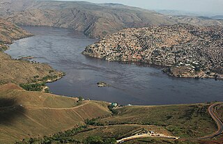
Matadi is the chief sea port of the Democratic Republic of the Congo and the capital of the Kongo Central province. It has a population of 245,862 (2004). Matadi is situated on the left bank of the Congo River, 148 km (92 mi) from the mouth and 8 km (5.0 mi) below the last navigable point before the rapids that make the river impassable for a long stretch upriver. It was founded by Sir Henry Morton Stanley in 1879.

Terra Nova Bay is a bay which is often ice free, about 64 km (40 mi) long, lying between Cape Washington and the Drygalski Ice Tongue along the coast of Victoria Land, Antarctica. It was discovered by the British National Antarctic Expedition under Scott, 1901–1904, and named by him after Terra Nova, one of the relief ships for the expedition. The Italian permanent Zucchelli Station is located in the bay, as is the Jang Bogo Station of South Korea.
Koziatyn is a town in the Vinnytsia Oblast (province) of western Ukraine. Serving as the administrative center of the Koziatyn Raion (district), the town itself is not a part of the district and is separately incorporated as the town of oblast significance, and is located 75 kilometres (47 mi) from oblast capital, Vinnytsia, at around 49°43′00″N28°50′00″E. It lies on the banks of the Huyva River. Population: 24,175 (2015 est.)
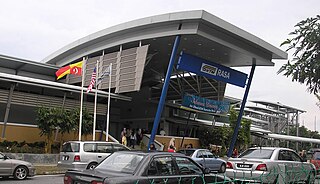
The Rasa Komuter station is a Malaysian commuter train station stationed at the northern side of and named after the town of Rasa, Hulu Selangor, Selangor. The station was opened on April 21, 2007 alongside the Batang Kali and Serendah stations. It was the third stop in the Rawang-Tanjung Malim shuttle service until the service was merged with the Port Klang Line in 2016.
Kongolo is a town in Tanganyika Province in the Democratic Republic of the Congo. It is located on the west bank of the Lualaba River, the largest headstream of the Congo River. It has 62,455 inhabitants.
The Battle of San Germano was the final battle in the Neapolitan War between an Austrian force commanded by Laval Nugent von Westmeath and the King of Naples, Joachim Murat. The battle started on 15 May 1815 and ended on 17 May, after the remaining Neapolitan force was routed at Mignano.
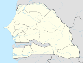
Gossas is a town in Fatick Region in western Senegal, about 90 km from the capital.
Oda is the name of several places in western Ghana, though most are known by a second name as well. From east to west:
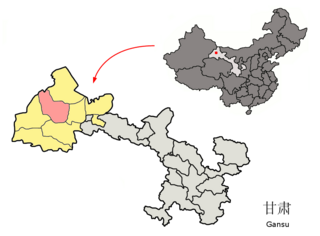
Guazhou County, formerly Anxi County, is a county in the northwest of Gansu province, the People's Republic of China. It is under the administration of Jiuquan City.

Songololo is a town in Kongo Central Province in the Democratic Republic of the Congo.
Idogo is a town in western Nigeria fairly close to the border with Benin.
Ango Ango is a town in the Bas-Congo province of the Democratic Republic of the Congo.
Kenge, Bas Congo is a town in Bas-Congo in the Democratic Republic of the Congo.

Fimbulheimen is a mountain range in Queen Maud Land, Antarctica. It stretches from Jutulstraumen by 1° west of Carsten Borchgrevink Ice at 18° east, about 200 km from the ice edge. Fimbulheimen is thus between Maudheim Plateau and Sør-Rondane.

Jubayt or Gebeit is a small town in eastern Sudan.
Ikungu is a town in central Tanzania.
Mungbere is a small town in Orientale Province, in the north of the Democratic Republic of Congo.
Gyzylgaya is a town in western Turkmenistan.

Aru is a town and the seat of Aru Territory in the Ituri Province of the Democratic Republic of the Congo. In 2004 its population was estimated to be 26,290. Aru has a small airport but no public electricity grid as of 2010.


