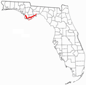
| Mud Swamp/New River Wilderness | |
|---|---|
IUCN category Ib (wilderness area) | |
  | |
| Location | Liberty County, Florida, USA |
| Nearest city | Sumatra, Florida |
| Coordinates | 30°03′26″N84°52′25″W / 30.05722°N 84.87361°W Coordinates: 30°03′26″N84°52′25″W / 30.05722°N 84.87361°W |
| Area | 8,090 acres (33 km2) |
| Established | September 28, 1984 |
| Governing body | U.S. Forest Service |
The Mud Swamp/New River Wilderness is part of Apalachicola National Forest, located in the Florida panhandle. The 8,090-acre (33 km2) refuge was established on September 28, 1984.

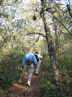
The Apalachicola National Forest is the largest U.S. National Forest in the state of Florida. It encompasses 632,890 acres and is the only national forest located in the Florida Panhandle. The National Forest provides water and land-based outdoors activities such as off-road biking, hiking, swimming, boating, hunting, fishing, horse-back riding, and off-road ATV usage.
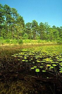
Mud Swamp consists of very poorly drained clay-rich soil, holding more water than nearby Bradwell Bay Wilderness. It has numerous scattered small islands. Biting insects, black bears and alligators make the swamp their home.

The Bradwell Bay Wilderness is part of the United States National Wilderness Preservation System, located in the Florida panhandle adjacent to the Apalachicola National Forest. The 24,602 acre (100 km²) wilderness was established on 3 January 1975 by the Eastern Wilderness Act. "Bay" in this case means "a recess of land, partly surrounded by hills," which, in this particular instance, is mostly titi swamp and standing water. The Sopchoppy River marks the Bradwell Bay's eastern edge.
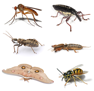
Insects or Insecta are hexapod invertebrates and the largest group within the arthropod phylum. Definitions and circumscriptions vary; usually, insects comprise a class within the Arthropoda. As used here, the term Insecta is synonymous with Ectognatha. Insects have a chitinous exoskeleton, a three-part body, three pairs of jointed legs, compound eyes and one pair of antennae. Insects are the most diverse group of animals; they include more than a million described species and represent more than half of all known living organisms. The total number of extant species is estimated at between six and ten million; potentially over 90% of the animal life forms on Earth are insects. Insects may be found in nearly all environments, although only a small number of species reside in the oceans, which are dominated by another arthropod group, crustaceans.

The American black bear is a medium-sized bear native to North America. It is the continent's smallest and most widely distributed bear species. American black bears are omnivores, with their diets varying greatly depending on season and location. They typically live in largely forested areas, but do leave forests in search of food. Sometimes they become attracted to human communities because of the immediate availability of food. The American black bear is the world's most common bear species.
The New River (Florida Panhandle) passes through it and is lined with Atlantic white cedar. It enters from the north and flows through cypress and gum swamps.

Taxodium is a genus of one to three species of extremely flood-tolerant conifers in the cypress family, Cupressaceae. The generic name is derived from the Latin word taxus, meaning "yew", and the Greek word εἶδος (eidos), meaning "similar to." Within the family, Taxodium is most closely related to Chinese swamp cypress and sugi.

Liquidambar, commonly called sweetgum, gum, redgum, satin-walnut, or American storax, is the only genus in the flowering plant family Altingiaceae and has 15 species. They were formerly often treated in Hamamelidaceae. They are decorative deciduous trees that are used in the wood industry and for ornamental purposes.

A swamp is a wetland that is forested. Many swamps occur along large rivers where they are critically dependent upon natural water level fluctuations. Other swamps occur on the shores of large lakes. Some swamps have hammocks, or dry-land protrusions, covered by aquatic vegetation, or vegetation that tolerates periodic inundation or soil saturation. The two main types of swamp are "true" or swamp forests and "transitional" or shrub swamps. In the boreal regions of Canada, the word swamp is colloquially used for what is more correctly termed a bog, fen, or muskeg. The water of a swamp may be fresh water, brackish water or seawater. Some of the world's largest swamps are found along major rivers such as the Amazon, the Mississippi, and the Congo.