History
The siding was opened 1 November 1877 as part of the extension of the Main South Line to Cootamundra. It was the southern-most extent of the line at the time.

An editor has nominated this article for deletion. You are welcome to participate in the deletion discussion , which will decide whether or not to retain it. |
Mullaly's Siding | |||||||||||
|---|---|---|---|---|---|---|---|---|---|---|---|
| General information | |||||||||||
| Coordinates | 34°39′07″S148°01′05″E / 34.652009°S 148.018002°E | ||||||||||
| Line(s) | Main South line | ||||||||||
| Tracks | 2 | ||||||||||
| Other information | |||||||||||
| Status | Demolished and closed | ||||||||||
| History | |||||||||||
| Opened | 1 November 1877 | ||||||||||
| Closed | Unknown | ||||||||||
| Services | |||||||||||
| |||||||||||
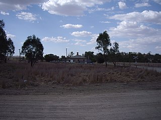
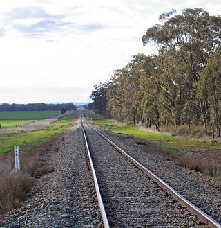
Mullaly's Siding was located immediately south of Cootamundra Station on the Main South Line in New South Wales. It served Scott and Mullaly's mill. [1] [2] [3]
The siding was opened 1 November 1877 as part of the extension of the Main South Line to Cootamundra. It was the southern-most extent of the line at the time.

Harden–Murrumburrah is a township and community in the Hilltops Region and is located in the South West Slopes of New South Wales in Australia. Harden is adjacent to both the Canberra region of the Australian Capital Territory and the Riverina Region in the southwest area of NSW. The town is a twin town between Harden and Murrumburrah.

The Australian state of New South Wales has an extensive network of railways, which were integral to the growth and development of the state. The vast majority of railway lines were government built and operated, but there were also several private railways, some of which operate to this day.

Cootamundra, nicknamed Coota, is a town in the South West Slopes region of New South Wales, Australia and within the Riverina. It is within the Cootamundra-Gundagai Regional Council. At the 2016 Census, Cootamundra had a population of 6,782. It is located on the Olympic Highway at the point where it crosses the Muttama Creek, between Junee and Cowra. Its railway station is on the Main Southern line, part of the Melbourne-to-Sydney line.
Minto railway station is located on the Main Southern line, serving the Sydney suburb of Minto. It is served by Sydney Trains T8 Airport & South line services.

Gerringong railway station is a single-platform intercity train station located in Gerringong, New South Wales, Australia, on the South Coast railway line. The station serves NSW TrainLink diesel multiple unit trains travelling south to Bomaderry and north to Kiama. Early morning and late night services to the station are provided by train replacement bus services. In the past, the station precinct also catered to freight trains carrying dairy products.

Canberra railway station is located on the NSW TrainLink Regional Southern Line in the Australian Capital Territory, Australia. It is located in the Canberra suburb of Kingston.

The Main Southern Railway is a major railway in New South Wales, Australia. It runs from Sydney to Albury, near the Victorian border. The line passes through the Southern Highlands, Southern Tablelands, South West Slopes and Riverina regions.
The Main Western Railway is a major railway in New South Wales, Australia. It runs through the Blue Mountains, and Central West regions. It is 825 kilometres (513 mi) long, of which 484 kilometres (301 mi) is currently operational.

Cootamundra Shire was a local government area in the Riverina region of New South Wales, Australia. The Shire was located adjacent to the Olympic Highway, the Burley Griffin Way and the Main South railway line. The Shire included the town of Cootamundra and the small towns of Stockinbingal, Brawlin and Wallendbeen and the locality of Frampton. The Shire was created on 1 April 1975 by the amalgamation of Jindalee Shire and the Municipality of Cootamundra.
Brawlin is a small community in the north east part of the Riverina and situated about 12 kilometres south of Cootamundra and 29 kilometres north of Coolac.
The Lake Cargelligo railway line is a railway line in Central Western New South Wales, Australia. The first sod was turned commencing construction on 8 June 1913 with the line opening on 13 November 1917. The line branches from the Main South line at Cootamundra and travels in a north-westerly direction to the small town of Lake Cargelligo. The line is used primarily for grain haulage, although passenger service was provided until 1983.

The Tumut and Kunama railway lines are disused railway lines in the south of New South Wales, Australia. The Tumut line was a 104 kilometres (65 mi) long branch of the Main South line, branching southwards from it at Cootamundra and heading to the town of Tumut. The line served the towns of Tumut and Gundagai, where the line crosses the Murrumbidgee River with a large iron girder bridge and wooden viaduct. Villages on the line included Brawlin, Muttama, Coolac and Tumblong.
Cootamundra Airport is a small airport in Cootamundra, New South Wales, Australia. The airport is also the venue for the annual GTR Challenge and Drag Battle motorsport event.

Cootamundra railway station is located on the Main Southern line in New South Wales, Australia. It serves the town of Cootamundra. The property was added to the New South Wales State Heritage Register on 2 April 1999.

Harden railway station is a heritage-listed railway station located on the Main Southern line in New South Wales, Australia. It serves the town of Harden. It was added to the New South Wales State Heritage Register on 2 April 1999.

The Temora railway station is a heritage-listed former railway station and now youth hub and mixed-use building located on the Lake Cargelligo railway line in Temora in the Temora Shire local government area of New South Wales, Australia. The station was built from 1893 to 1915 and served the Riverina town of Temora between 1 September 1893 until its closure for passenger services in the late 1970s. The station is also known as the Temora Railway Station group. The property was added to the New South Wales State Heritage Register on 2 April 1999.
The Cootamundra Herald is a former printed bi-weekly newspaper now existing only on-line and containing little or no news of direct relevance to the community of Cootamundra, New South Wales, Australia. The Herald website carries syndicated non-local copy with occasional government media releases referring to local issues. Following the purchase of the masthead in 2019 by Australian Community Media, the Herald office which had existed for 144 years in the main street was closed and local staff were forced to work part-time from home. The staff resigned or were eventually sacked, and there are now no local Herald employees generating content related to the town.
The Salt Clay Creek railway disaster was one of Australia's first railway accidents involving multiple fatalities. It occurred on the evening of 25 January 1885, when a mail train from Albury to Sydney failed to negotiate a flooded creek, around 5 km from Cootamundra. Seven people were killed and dozens seriously injured.
Cunningar is a locality in the Hilltops Council local government area, within the South West Slopes region of New South Wales, Australia. It is located immediately to the east of the town of Harden. There is a parish of the County of Harden of the same name, which comprises a part of the area of the locality.

North Yalgogrin is a locality in the Bland Shire local government area of New South Wales. There once was a village there, named Yalgogrin, but better known as Yalgogrin North.