
Manicaland is a province in eastern Zimbabwe. After Harare Province, it is the country's second-most populous province, with a population of 2.037 million, as of the 2022 census. Making it the third most densely populated province after Harare and Bulawayo provinces. Manicaland was one of five original provinces established in Southern Rhodesia in the early colonial period. The province endowed with country's major tourist attractions, the likes of Mutarazi Falls, Nyanga National Park and Zimbabwe's top three highest peaks. The province is divided into ten administrative subdivisions of seven rural districts and three towns/councils, including the provincial capital, Mutare. The name Manicaland is derived from one of the province's largest ethnic groups, the Manyika, who originate from the area north of the Manicaland province and as well as western Mozambique, who speak a distinct language called ChiManyika in Shona.
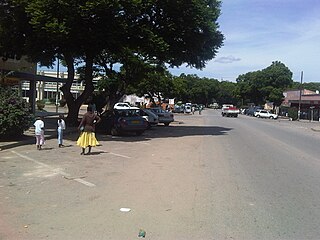
Rusape is a town in eastern Zimbabwe.

Chimanimani, originally known as Melsetter, is a mountainous district in Manicaland Province of eastern Zimbabwe. The district headquarters is the town of Chimanimani.
Buhera South is a constituency represented in the National Assembly of the Parliament of Zimbabwe. Created for the 1985 election, its territory consists of the southern portion of Buhera District, in Manicaland Province in eastern Zimbabwe. Its inaugural member, Kumbirai Kangai of ZANU–PF, held the seat for 23 years until 2008. The current MP since the 2023 election is Ngonidzashe Mudekunye of ZANU–PF.

West Nicholson or Tshabezi is a town in the Matabeleland South Province of Zimbabwe.
Buhera District is a district in Manicaland Province, in eastern Zimbabwe.

Bikita is a district in Masvingo Province in Zimbabwe. It borders with Gutu District, Zaka District, Chipinge District, Chiredzi District, and Buhera District. It is located about 80 kilometres (50 mi) east of Masvingo town. Its administration is at Nyika Growth Point but initially it was at Bikita Office, 10 km south of Nyika Growth Point towards Jerera Growth Point in Zaka District.

The Republic of Zimbabwe is broken down into 10 administrative provinces, which are divided into 64 districts and 1,970 wards.
Chinhoyi, previously known as Sinoia during the colonial era, is a city in central northern Zimbabwe in the Makonde District. It has a population of 90,800 and is primarily a college town, although it was originally founded as an Italian group settlement scheme. The nearby Chinhoyi Caves and national park are a popular attraction.
Joseph Chinotimba is a Zimbabwean political figure. He rose to prominence during the invasions of white-owned commercial farms that started after the 2000 constitutional referendum in Zimbabwe. He is widely regarded as a militant ZANU-PF cadre with unquestionable allegiance to the old guard of the ruling party. He is the national vice-chairman of the Zimbabwe National Liberation War Veterans Association.
Buhera is a village in Zimbabwe.
Eric Matinenga is a Zimbabwean case lawyer and politician who successfully defended Movement for Democratic Change (MDC) leader Morgan Tsvangirai during his treason trial in 2005. He was elected in 2008 as the MP for Buhera West, defeating the Zimbabwe African National Union – Patriotic Front's (ZANU-PF) candidate Tapiwa Zengeya.
Makonde District is a district in Zimbabwe.
Murambinda is a town in Zimbabwe.
Murambinda Mission Hospital (MMH), is a hospital in Zimbabwe. The hospital, also known as Murambinda Hospital, is located in the town of Murambinda, Buhera District, Manicaland Province, in eastern Zimbabwe. Its location is approximately 30 kilometres (19 mi), by road, northeast of the village of Buhera, where the district headquarters are located. This location lies approximately 140 kilometres (87 mi), by road, southwest of the city of Mutare (pop:184,205), the location of the provincial headquarters.
Sanga is a community made up of people in mainly six villages in Nyashanu area of Buhera District, Zimbabwe. It is within the traditional jurisdiction of Chief Headman Mabvuregudo and Chief (Mambo) Kandenga Nyashanu of the Mhofu (eland) clan. Sanga area is situated about 8 km from Masenga Mountain which is near Nyashanu Mission and about 8 km from Chiurwi/Dzapasi Mountain. Dzapasi Mountain played a significant role as a demobilisation point of armed forces at the end of Zimbabwe's Second War of Liberation, the Second Chimurenga. Sanga community has one service centre, called Sanga which hosts the Sanga Cattle Sales Pens popularly known as Sanga Market, Sanga Police Station and grocery shops like Manjovha, Mutemahuku, Vhiriri, Rugare and others. Sanga Market was traditionally a cattle trading point but now is a trading centre for cattle, small livestock, grains, hardware, groceries, clothes, kitchenware, mobile phones and various other accessories. Nearby service centres include Mumbijo Shopping Centre, also known as Chipoka, which is along Fari Road, Mashingaidze Shopping Centre at the intersection of Nyashanu Mission Road, Vhiriri Road and Fari Road; Mukutukutu 'Better Place' along Masenga Road, and Matsvai Changamire Shopping Centre along Betera Rodad. At Mumbijo you find shops like Maunganidze, Mugumbate or Tirivavi, Matsvai, Vhiriri and Mukuvare. At Mashingaidze there are shops like Mashingaidze, Gavi, Kwaramba, Dondo and Maponda. At Matsvai there are shops like Musengi and Mukuvari. Two service centres were proposed in 2014 at Sanga School turnoff and at Madhume Road turnoff, near Muchada Bus Stop but these were not approved by Buhera District Council. Other services include grinding mills that are found at the service centres or in the villages.
Edward J. Matenga is a Zimbabwean archaeologist and the former director of the Great Zimbabwe World Heritage Site 1998 – 2004. He was a curator at the Zimbabwe Museum of Human Sciences in Harare from 1988 to 1994. He is now an independent heritage management consultant based in Pretoria, South Africa. He is a member of the International Council on Monuments and Sites (ICOMOS).
John Mudiwa Washe Makumbe, often published as John Mw Makumbe, was a Zimbabwean political scientist, political philosopher and activist. He was a professor at the University of Zimbabwe for more than 25 years, and a frequent guest lecturer at Michigan State University. He was a pro-democracy opinion columnist and member of civil society organisations critical of Robert Mugabe and the ZANU–PF, as well as an activist for the welfare of albino people in Zimbabwe. Shortly before his death he became a prominent member of the Movement for Democratic Change, and he was expected to enter politics by contesting the Buhera West parliamentary constituency.
Nyashanu Mission is located in Buhera District, Manicaland Province, Zimbabwe in the area of Ishe Mabvuregudo in the local country of Mambo Nyashanu.