The Myths and Legends Byway is a Louisiana Scenic Byway that follows several different state highways, primarily: [1]
Louisiana Highway 111 (LA 111) is a state highway located in western Louisiana. It runs 45.72 miles (73.58 km) in a general north–south direction from U.S. Highway 190 (US 190) in Junction to LA 117 northeast of Leesville.
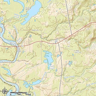
Burr Ferry is an unincorporated community at the junction of LA 8 and LA 111 south, in Vernon Parish, Louisiana, United States. The community is two miles from the site of the old Burr's Ferry on the Sabine River, at the Texas line. The Sabine River, at this location, is the site of two listings on the National Register of Historic Places; Burr's Ferry Bridge, and Burr's Ferry Earthworks.
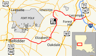
Louisiana Highway 112 is a state highway in Louisiana. It spans 80.9 miles (130.2 km) and runs from west to east. LA 112 is a mostly rural two lane highway with a maximum speed limit of 55 miles per hour (89 km/h) per hour. The western terminus is at an intersection with U.S. Route 171/U.S. Route 190 in Beauregard Parish and the eastern terminus at an intersection with US 167/US 71 in Rapides Parish. Although the highway runs west to east it meanders through three parishes and on the map appears to make a large S.
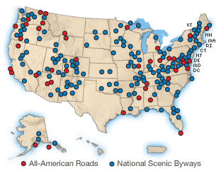
A National Scenic Byway is a road recognized by the United States Department of Transportation for one or more of six "intrinsic qualities": archeological, cultural, historic, natural, recreational, and scenic. The program was established by Congress in 1991 to preserve and protect the nation's scenic but often less-traveled roads and promote tourism and economic development. The National Scenic Byways Program (NSBP) is administered by the Federal Highway Administration (FHWA).
Louisiana Highway 27 (LA 27) is a state highway located in southwestern Louisiana. It runs 132.42 miles (213.11 km) in a general north–south direction from LA 14 in Holmwood to the junction of U.S. Highways 171 and 190 in DeRidder.
Louisiana Highway 26 (LA 26) is a state highway located in southwestern Louisiana. It runs 75.86 miles (122.08 km) in a northwest to southeast direction from a junction with the concurrent U.S. Highways 171 and 190 southeast of DeRidder to LA 14 in Lake Arthur.
The National Forest Scenic Byways are roads that have been designated by the U.S. Forest Service as scenic byways. Many are also National Scenic Byways (NSB). The program was initiated in 1987.
Louisiana Highway 66 (LA 66) is a state highway located in southeastern Louisiana. It runs 19.62 miles (31.58 km) in a general east–west direction from the main entrance of the Louisiana State Penitentiary at Angola to a junction with U.S. Highway 61 (US 61) north of St. Francisville.
The Bayou Teche Byway is a Louisiana Scenic Byway that follows several different state highways, primarily:
The Cane River National Heritage Trail is a Louisiana Scenic Byway that follows several different state highways, primarily:
The Flyway Byway is a Louisiana Scenic Byway that follows several different state highways:
The Louisiana Colonial Trails are a Louisiana Scenic Byway that follows several different state highways, primarily:
The Northup Trail is a Louisiana Scenic Byway that follows several different state highways, primarily:
The Southern Swamps Byway is a Louisiana Scenic Byway that follows several different state highways, primarily:
The Wetlands Cultural Byway is a Louisiana Scenic Byway that follows several different state highways, primarily:
The Zydeco Cajun Prairie Byway is a Louisiana Scenic Byway that follows several different state highways, primarily:
This article includes a list of roads, streets, highways, or other routes that are associated with the same title. If an internal link led you here, you may wish to change the link to point directly to the intended article. |