
The Arctic Archipelago, also known as the Canadian Arctic Archipelago, is a group of islands north of the Canadian mainland.

The Celebes Sea of the western Pacific Ocean is bordered on the north by the Sulu Archipelago and Sulu Sea and Mindanao Island of the Philippines, on the east by the Sangihe Islands chain, on the south by Sulawesi's Minahassa Peninsula, and on the west by Kalimantan in Indonesia. It extends 420 miles (675 km) north-south by 520 mi (840 km) east-west and has a total surface area of 110,000 square miles (280,000 km2), to a maximum depth of 20,300 feet (6,200 m). The sea opens southwest through the Makassar Strait into the Java Sea.

Vakaga is one of the 16 prefectures of the Central African Republic. Its capital is Birao. It covers an area of 46,500 km² and has a population of 37,595. The extremely low population density, less than 1 person/km², is a result of the capture of the majority of the region's inhabitants by slave-traders from the Sudan in the second half of the nineteenth century. Vakaga is known for its oil reserves.

The Little Hungarian Plain or Little Alföld is a plain of approximately 8,000 km² in northwestern Hungary, south-western Slovakia, and eastern Austria. It is a part of the Pannonian plain which covers most parts of Hungary.

The arrondissement of Mulhouse is an arrondissement of France in the Haut-Rhin department in the Grand Est region. At the 2015 arrondissements reform it was expanded with several communes from the arrondissements of Guebwiller and Thann. It has 79 communes.

Maikaze was one of 19 Kagerō-class destroyers built for the Imperial Japanese Navy during the 1930s.
Bắc Quang is a rural district of Ha Giang province in the northeastern region of Vietnam. As of 2003, the district had a population of 103,064. The district covers an area of 1,084 km². The district capital lies at Vĩnh Tuy.
Gò Quao is a rural district (huyện) of Kien Giang province in the Mekong River Delta region of Vietnam.
Nho Quan is a rural district of Ninh Bình Province in the Red River Delta region of Vietnam. As of 2003, the district had a population of 145,186. The district covers an area of 452 km². The district capital lies at Nho Quan.
Ba Tơ is a rural district (huyện) of Quảng Ngãi Province in the South Central Coast region of Vietnam. As of 2003 the district had a population of 47,268. The district covers an area of 1,133 km². The district capital lies at Ba Tơ.

Tápiószentmárton is a village in Pest county, Hungary.

Bağırbəyli is a village in the Ujar Rayon of Azerbaijan. The village forms part of the municipality of Quləbənd.
Kakhay is a village in the Agdash Rayon of Azerbaijan.
Çayırlı is a village and municipality in the Goychay Rayon of Azerbaijan. The municipality consists of the villages of Çayırlı and Qubadlı Şıxlı.
Vrchovnice is a village and municipality in Hradec Králové District in the Hradec Králové Region of the Czech Republic.

Philippi Glacier is coastal glacier about 15 mi long, flowing N to the E end of the West Ice Shelf, 15 mi W of Gaussberg. Delineated from aerial photographs taken by U.S. Navy (USN) OpHjp, 1946-47. Named by the ANCA for Emil Philippi, geologist with the German Antarctic Expedition (GerAE) under Erich von Drygalski, 1901–03, who made scientific observations in the vicinity of Gaussberg.

Jändja is a village in Türi Parish, Järva County in central Estonia.
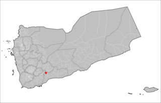
Sibah District is a district of the Abyan Governorate, Yemen. As of 2003, the district had a population of 15,996 inhabitants.

Arhab District is a district of the Sana'a Governorate, Yemen. As of 2003, the district had a population of 90,038 inhabitants.


