Gopalganj is a district in the Dhaka Division of Bangladesh. The district has 1,172,415 inhabitants and its surface area is 1,490 km2. The main town of the district is also called Gopalganj. It is the bank of the Madhumati river and located at 23°00’47.67" N 89°49’21.41". It is bounded by Faridpur district on the North, Pirojpur and Bagerhat district on the south, and Barisal district on the east and Narail district on the West. This district is also known as "GP" to the youth. Gopalganj is subdivided into five sub-districts (upazila/thana).

Pirojpur is a district (zilla) in south-western Bangladesh. It is a part of Barisal Division.

Bagerhat District is a district in south-western Bangladesh. It is a part of the Khulna Division.

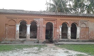
The Sixty Dome Mosque, is a mosque in Bagerhat, Bangladesh. It is a part of the Mosque City of Bagerhat, a UNESCO World Heritage Site. It is the largest mosque in Bangladesh from the sultanate period (1352–1576). It was built during the Bengal Sultanate by Khan Jahan Ali, the governor of the Sundarbans. It has been described as "one of the most impressive Muslim monuments in the whole of South Asia."

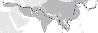
Asian Highway 1 (AH1) is the longest east-west route of the Asian Highway Network, running 20,557 km (12,774 mi) from Tokyo, Japan via Korea, China, Southeast Asia, Bangladesh, India, Pakistan, and Iran to the border between Turkey and Bulgaria west of Istanbul where it joins end-on with European route E80, running all the way to Lisbon, Portugal.

Bhanga is an upazila of Faridpur District in the Division of Dhaka, Bangladesh.

Gopalganj Sadar is an upazila of Gopalganj District in Dhaka Division, Bangladesh.

Bagerhat Sadar is an upazila of Bagerhat District in the Division of Khulna, Bangladesh. The municipality was established in 1958. It consists of 9 wards and 31 mahallas.

Fakirhat is a Upazila (sub-district) of Bagerhat District in the Division of Khulna, Bangladesh. The medieval Sixty Dome Mosque and the Khan Jahan Ali Mazar are situated here.

Morrelganj is an upazila of Bagerhat District in the Division of Khulna, Bangladesh. Morrelganj thana was established in 1909 and became an upazila in 1985.
South Bengal is a term used for the southern parts of Bengal including Southern Bangladesh and Southern West Bengal, state in India.
Bagerhat-2 is a constituency represented in the Jatiya Sangsad of Bangladesh. Since 6 August 2024 The constituency is vacant.
Gotapara Union is a Union parishad under Bagerhat Sadar Upazila of Bagerhat District in the division of Khulna, Bangladesh. It has an area of 30.72 km² and a population of 26,605.

Dhaka–Jessore line is a 172 km long under construction broad gauge railway. It is being constructed under the Ministry of Railways, Government of Bangladesh. The line will connect the capital of Bangladesh to Jessore via Dhaka District, Narayanganj District, Munshiganj District, Shariatpur District, Madaripur District, Faridpur District, Gopalganj District, Bangladesh, and Narail District. It is a project related to Padma Bridge.

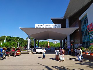
West Zone is a railway zone operated by Bangladesh Railway. 2,800 km of railway lines in Bangladesh are operated through four divisions in two Zones, West Zone being one of the two Zone. This Zone consists of Rangpur Division, Rajshahi Division, Khulna Division and of Dhaka Division of Bangladesh. The head office of West Zone is located in Rajshahi.

N804 or Dhaka- Faridpur Highway is a Bangladeshi national highway connecting Faridpur to Bhanga. It starts at Bhanga Interchange in Bhanga Upazila and ends at Bangabandhu Square at Faridpur.

The N806 is a Bangladeshi National Highway which connects Jashore to Bhatiapara via Narail & Kalna toward Bhanga Interchange. The route starts from Bhatiapara near Kashiani and ends at Manihar in Jashore city.
Bhanga Interchange, also known as Bhanga Roundabout, is a major road interchange in Bhanga, Faridpur District, Bangladesh which consists of a cloverleaf interchange. It connects at leats 21 districts of South Bengal in Bangladesh with Dhaka, capital of the country which is a junction of four national highways named Dhaka–Bhanga Expressway, Bhanga–Khulna highway, Dhaka–Faridpur highway and Dhaka–Patuakhali highway.


