
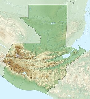
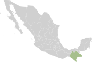
Chiapas, officially the Free and Sovereign State of Chiapas, is one of the states that make up the 32 federal entities of Mexico. It comprises 124 municipalities as of September 2017 and its capital city is Tuxtla Gutiérrez. Other important population centers in Chiapas include Ocosingo, Tapachula, San Cristóbal de las Casas, Comitán and Arriaga. It is the southernmost state in Mexico, and it borders the states of Oaxaca to the west, Veracruz to the northwest and Tabasco to the north, and the Petén, Quiché, Huehuetenango, and San Marcos departments of Guatemala to the east and southeast. Chiapas has a coastline along the Pacific Ocean to the south.

Soconusco is a region in the southwest corner of the state of Chiapas in Mexico along its border with Guatemala. It is a narrow strip of land wedged between the Sierra Madre de Chiapas mountains and the Pacific Ocean. It is the southernmost part of the Chiapas coast extending south from the Ulapa River to the Suchiate River, distinguished by its history and economic production. Abundant moisture and volcanic soil has always made it rich for agriculture, contributing to the flowering of the Mokaya and Olmec cultures, that were based on Theobroma cacao and rubber of Castilla elastica.

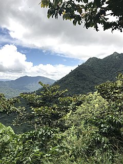
The Lacandon Jungle is an area of rainforest which stretches from Chiapas, Mexico, into Honduras and into the southern part of the Yucatán Peninsula. The heart of this rainforest is located in the Montes Azules Biosphere Reserve in Chiapas near the border with Guatemala in the Montañas del Oriente region of the state. Although most of the jungle outside the reserve has been partially or completely destroyed and damage continues inside the Reserve, the Lacandon is still the largest montane rainforest in North America and one of the last ones left large enough to support jaguars. It contains 1,500 tree species, 33% of all Mexican bird species, 25% of all Mexican animal species, 56% of all Mexican diurnal butterflies and 16% of all Mexico's fish species.

The Petén–Veracruz moist forests is an ecoregion of the tropical and subtropical moist broadleaf forest biome found in Belize, Guatemala, and Mexico.

The volcano Tacaná is the second highest peak in Central America at 4,060 metres (13,320 ft), located in the Sierra Madre de Chiapas of northern Guatemala and southern Mexico. It is also known in Mexico as Volcán Tacina.

Cuchillas del Toa is a Biosphere Reserve in Cuba. It is located in the eastern part of the country, mostly in the Guantánamo Province and reaching to the north into the Holguín Province. Most of the reserve is established in the drainage area of the Toa River, which flows for 118 km (73 mi) to the Atlantic Ocean in Baracoa.
The Sierra del Lacandón is a low karstic mountain range in Guatemala and Mexico. It is situated in the north-west of the department of El Petén and the south-east of Chiapas. Its highest points are located near the Mexican border at coordinates 17.244195°N 91.202145°W and 17.195087°N 91.086102°W The range consists of southeast to northwest trending ridges of folded Cretaceous limestone and dolomite hills rising above the lowlands of the Petén Basin.

Mapastepec is a town and municipality in the southeastern state of Chiapas, Mexico. Its name derives from the place name mapachtepec, "Hill of the Raccoon", a compound of the Nahuatl words mapachi ("raccoon") and tepetl ("mountain").
Prodesis was a development project in the Lacandon region of Chiapas, Mexico, that ran from 2004 to 2008. The aim of the project was to reduce pressure on the rainforest and combat poverty among its inhabitants, most of them being Mayan Indians and subsistence peasants.
The Chiapas conflict refers to the 1994 Zapatista uprising, the 1995 Zapatista crisis and their aftermath, and tensions between the indigenous peoples and subsistence farmers in the Mexican state of Chiapas from the 1990s to the present day.
Under UNESCO’s Man and the Biosphere Programme, there are 125 biosphere reserves recognized as part of the World Network of Biosphere Reserves in Latin America and the Caribbean. These are distributed across 21 countries in the region.
The Malpaso Dam, officially known as the Nezahualcóyotl Dam, is located in the Centro region of Chiapas, Mexico near the border with Tabasco and Veracruz. It was the first of several major dams built on the Grijalva River to generate hydroelectric energy and has the second largest reservoir in Mexico, after the Belisario Dominguez Dam. Construction of the dam occurred in the 1960s and flooded not only the riverbed but also hectares of rainforest and farmland, various towns and villages and archeological sites. These include the former town of Quechula, whose 16th century Dominican church will appear when water is at low levels, and the archeological site of San Isidro which contains one of only two known double Mesoamerican ball courts. Commissioning of the dam's 1,080 MW power station began in 1969 and ended in 1977. The reservoir and later construction of a federal highway has spurred ecotourism in the area.

The Chiapas Depression dry forests form one of the ecoregions that belong to the tropical and subtropical dry broadleaf forests biome, as defined by the World Wildlife Fund, in northwestern Central America.

The forests of Mexico cover a surface area of about 64 million hectares, or 34.5% of the country. These forests are categorized by the type of tree and biome: tropical forests, temperate forests, cloud forests, riparian forests, deciduous, evergreen, dry, moist, etc.. The agency in charge of Mexico's forests is the Comisión Nacional Forestal. Despite major reforms to the Mexican Constitution in 1992 regarding private land, Mexico would later enact major forest regulation laws in 1998 and 2003. Though no longer required to enforce land regulation in Mexico, Article 27 of the Mexican Constitution also still permits the Mexican Government to enact land regulation.

The Chiapas montane forests is a tropical moist broadleaf forest ecoregion in southern Mexico and extending into western Guatemala. It includes the montane tropical forests on the northern and northeastern slopes of the Chiapas highlands.
The Sierra Madre de Chiapas moist forests is a tropical moist broadleaf forest ecoregion in southern Mexico and southern Guatemala, extending into the northwestern corner of El Salvador.

Capitán Luis Ángel Vidal is a municipality in the Mexican state of Chiapas, located approximately 138 kilometres (86 mi) southeast of the state capital of Tuxtla Gutiérrez. Its inhabitants are of Guatemalan origin and speak the Mam language.

The Tehuantepec-El Manchon mangroves ecoregion covers a series of mangrove woodlands along the Pacific Ocean coast of the state of Chiapas, Mexico. The ecoregion is relatively large and continuous, with trees up to 25 meters in height. The region supports stands of a type of yellow mangrove that normally only grown further south. The coast of Mexico here is wet - over 2,500 mm/year of rain. Four RAMSAR wetlands of international important are found in the zone, and a UNESCO Biosphere Reserve. Of particular importance are the wide variety of permanent and migratory birds in the area.
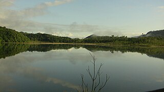
Nahá–Metzabok Biosphere Reserve is a biosphere reserve in southeastern Mexico. It is located in the state of Chiapas, on the northeastern flank of the Chiapas Highlands. The reserve protects montane rain forests, pine and oak forests, and natural lakes.