
The Chao Phraya is the major river in Thailand, with its low alluvial plain forming the centre of the country. It flows through Bangkok and then into the Gulf of Thailand.
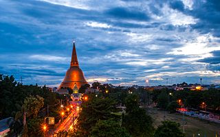
Nakhon Pathom is one of the central provinces (changwat) of Thailand. Neighbouring provinces are Suphan Buri, Ayutthaya, Nonthaburi, Bangkok, Samut Sakhon, Ratchaburi, and Kanchanaburi. The province has long been known for its fruit orchards, but now includes two leading universities and major industrial areas. Nakhon Pathom is one of the five provinces that forms the Bangkok Metropolitan Region.

Northern Thailand is geographically characterised by several mountain ranges, which continue from the Shan Hills in bordering Myanmar to Laos, and the river valleys which cut through them. Though like most of Thailand, it has a tropical savanna climate, its relatively high elevation and latitude contribute to more pronounced seasonal temperature variation, with cooler winters than the other regions. Historically it is related to the Lanna Kingdom and its culture.

The Pa Sak River is a river in central Thailand. The river originates in the Phetchabun Mountains, Dan Sai District, Loei Province, and passes through Phetchabun Province as the backbone of the province. It then passes through the eastern part of Lopburi Province and Saraburi Province, until it joins together with the Lopburi River northeast of Ayutthaya Island, before it runs into the Chao Phraya River southeast of Ayutthaya near Phet Fortress. It has a length of 513 km (319 mi) and drains a watershed of 16,291 km2 (6,290 sq mi). The annual discharge is 2.4 km3 (0.58 cu mi).

The Bang Pakong is a river in east Thailand. The river originates at the confluence of the Nakhon Nayok River and the Prachinburi River at Pak Nam Yothaka in Ban Sang District, Prachinburi Province. It empties into the Gulf of Thailand in the northeastern tip of the Bay of Bangkok. The watershed of the Bang Pakong is about 17,000 square kilometres (6,600 sq mi). It also powers a big power station near its mouth, near Highway 7.
The Lopburi River is a tributary of the Chao Phraya River in central Thailand. It splits from the Chao Phraya river at Tambon Bang Phutsa, Singburi. Passing through Tha Wung district and the town of Lopburi, it enters the Chao Phraya together with the Pa Sak River at the town of Ayutthaya. It is about 95 kilometres (59 mi) long.

The Yom River is a river in Thailand. It is the main tributary of the Nan River. The Yom River has its source in the Phi Pan Nam Range in Pong District, Phayao Province. Leaving Phayao, it flows through Phrae and Sukhothai as the main water resource of both provinces before it joins the Nan River at Chum Saeng District, Nakhon Sawan Province.
The Sakae Krang River is a tributary of the Chao Phraya River. It originates in Mae Wong National Park, Nakhon Sawan Province. It is 225 kilometres (140 mi) long, with most of its length in Uthai Thani Province. It joins the Chao Phraya River in Uthai Thani city near the Wat Tha Sung.

The Kraburi River, also Kra or Pak Chan River is the boundary river between Thailand and Myanmar at the Kra Isthmus of the Malay Peninsula. The river has its source in the Tenasserim Hills and flows into the Andaman Sea near the Thai town of Ranong and Kawthaung, Myanmar.

The Krabi River is a river in Southern Thailand. The Krabi river is 5 kilometres long, as it is the main channel within a larger estuary to the Andaman Sea. The other two main channels are the Yuan River to the south and Chi Lat to the west. The 31 km upper stretch of the river are named Khlong Krabi Yai, which originates at the Phanom mountain.

The Wang Thong River is a river in Thailand. Its source lies in the Phetchabun Mountains in the Khao Kho District, Thailand.
It flows through Thung Salaeng Luang National Park and forms Namtok Sri Dit and Namtok Kaeng Sopha in the Wang Thong District of Phitsanulok Province, and finally flows through into the Bang Krathum District, passing through Ban Sam Ruen and on to the border of Phitsanulok and Phichit, where it drains into the Nan River at 16°31′06″N 100°19′36″E.
The land drained by the Wang Thong River is part of the Nan Basin and the Chao Phraya Watershed.
Wang Nam Khu is a sub-district in the Mueang Phitsanulok District of Phitsanulok Province, Thailand.
Nam Ngim is a watercourse in Thailand. Its source is located in the Phi Pan Nam Range. It is a tributary of the Yom River, which is part of the Chao Phraya River basin.
Nam Mae Lai is a river in Phrae Province of Thailand. It is a tributary of the Yom River, part of the Chao Phraya River basin. It flows into the Yom at 18°13′12″N 100°11′26″E, next to the village of Ban Bun Charoen.
Nam Hao or Huai Nam Hao (ห้วยน้ำฮาว) is a watercourse of Thailand. It joins the Nan River near Ban Aham in Nan Province.
Pong Nam Ron is a tambon (subdistrict) of Fang District, in Chiang Mai Province, Thailand. In 2009 it had a total population of 5687 people. The tambon contains 7 villages.

Kanchanaburi railway station is a railway station located in Ban Nuea Subdistrict, Kanchanaburi City, Kanchanaburi. It is a class 1 railway station located 117.046 km (72.7 mi) from Thon Buri railway station. The line opened in 1942 by the Imperial Japanese Army, during the Second World War. After the war, the State Railway of Thailand bought the line from the Allied powers, and the station reopened in June 1949, from Nong Pladuk Junction.
Pak Nam Pho railway station is a railway station in the Pak Nam Pho Sub-district, Nakhon Sawan City, Nakhon Sawan. It is 250.559 km from Bangkok railway station and is a class 1 railway station. It is on the Northern Line of the State Railway of Thailand. The station opened on 31 October 1905 as part of the Northern Line extension from Lopburi to Pak Nam Pho. The line continued to Phitsanulok in 1908. Originally, this was the railway station for Nakhon Sawan City as passengers would alight here and cross the Chao Phraya River to reach the city, however its main purpose was removed as the new railway station built at Nong Pling replaced its role. Today, the station acts as a rail yard, a railway maintenance centre, and a junction for an occasionally-used freight line to Kamnansong Rice Mill.

Bang Ramat Railway Halt is a railway halt located in Chimphli Subdistrict, Taling Chan District, Bangkok, Thailand. It is located 4.29 km (2.7 mi) from Thon Buri Railway Station.

Charansanitwong Halt is a railway halt located in Bang Khun Non subdistrict, Bangkok Noi District, Bangkok, Thailand. It is located 1.54 km (1.0 mi) from Thon Buri Railway Station.


