This page is based on this
Wikipedia article Text is available under the
CC BY-SA 4.0 license; additional terms may apply.
Images, videos and audio are available under their respective licenses.

The White Nile is a river in Africa, one of the two main tributaries of the Nile; the other is the Blue Nile. The name comes from colouring due to clay carried in the water.
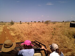
Kidepo Valley National Park is a 1,442 square kilometres (557 sq mi) national park in the Karamoja region in northeast Uganda. Kidepo is rugged savannah, dominated by the 2,750 metres (9,020 ft) Mount Morungole and transected by the Kidepo and Narus rivers.
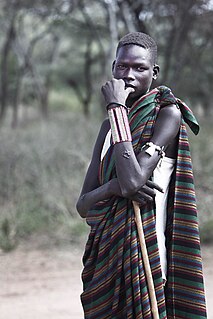
The Toposa are an ethnic group in South Sudan, living in the Greater Kapoeta region of the erstwhile Eastern Equatoria state.
They have traditionally lived by herding cattle, sheep and goats, and in the past were involved in the ivory trade. They have a tradition of constant low-level warfare, usually cattle raids, against their neighbors.

The Roman Catholic Diocese of Torit is a diocese located in Torit in the Ecclesiastical province of Juba in South Sudan.

Kapoeta Airport is an airport serving Kapoeta in South Sudan.

Kapoeta is a town in South Sudan. It is located in Kapoeta South County, in Namorunyang State, in southeastern South Sudan.
The Koss River is a river that flows in a north of northwest direction through the erstwhile Eastern Equatoria state of South Sudan, fed by streams from the Imatong Mountains to the west.

Budi County is an administrative area of Namorunyang State. Before the reorganisation of states in 2015, it was a part of Eastern Equatoria state in South Sudan, with headquarters in Chukudum.
Narus is a community in the Namorunyang State state of South Sudan. It is the headquarters of Kapoeta East County.

The Didinga Hills are an upland area in Namorunyang State of South Sudan, lying mainly within Budi County. Before the reorganisation of states, it was a part of Eastern Equatoria. They are named for the Didinga people who live in the region.
The Didinga Hills have rich and fertile soil that is used for cultivation of tobacco, potatoes, maize, and Dura.
The Singaita River is a river in Eastern Equatoria state of South Sudan that flows through the town of Kapoeta.
The Loyuro River is a stream in Eastern Equatoria State of South Sudan. The river originates in the east of Didinga Hills, flowing eastward into Greater Kapoeta and discharging into the swampy area northeast of Narus. The river floods during the rainy season, but ceases to flow at other times.
The Toposa people have a ritual center at Loyuro River.
Lolimi is a permanent water hole on the river, on the road between Narus and Kapoeta.
Kapoeta East County is an administrative region of Namorunyang State. Before reorganisation of states in 2015, it was a part of Eastern Equatoria state in South Sudan, bordered by Kenya to the south, Ethiopia to the east and Jonglei state to the west. It is part of the Greater Kapoeta region of the state. The largest ethnic group is the Toposa people.
The principal town is Narus.
The county includes the disputed Ilemi triangle, controlled by Kenya.
The emblem of the county is a horned bull, with big humps and a large tail.
Loyoro is a community in Eastern Equatoria state of South Sudan, about 50 kilometres (31 mi) as the crow flies to the north east of Narus.
It lies on the Loyoro River.
Loyoro is part of the Narus parish of the Catholic Diocese of Torit.
Lolim is a community in Eastern Equatoria state of South Sudan. It is on the road from Kapoeta to Narus
Lolim lies just north of the Loyuro River, which has a pool called Lolimi.
The community is mainly made up of Toposa people.
Nanyangachor is a community in Eastern Equatoria state of South Sudan. It is in the Eastern Uplands of Kapoeta East County, near the border with Ethiopia.
Kuron peace village was founded by emeritus bishop Paride Taban in Kuron, South Sudan, in 2005. It is situated in Kapoeta East County, Namorunyang State, on the southeast border of South Sudan, roughly 190 km from Narus and 75 km from Boma. The area is mainly inhabited by the Toposa ethnic community of the ateker ethnic cluster. Kuron peace village is situated near the Kuron river and close to the northern state boundary with Boma state. Its headquarter is based in Nanyangachor near Ethiopian highland. the main aim of establishing the village was to have a village without tribalism
