
Arable land is, according to one definition, land capable of being ploughed and used to grow crops. In Britain, it was traditionally contrasted with pasturable land such as heaths which could be used for sheep-rearing but not farmland.
Soil structure describes the arrangement of the solid parts of the soil and of the pore space located between them. It is determined by how individual soil granules clump, bind together, and aggregate, resulting in the arrangement of soil pores between them. Soil structure has a major influence on water and air movement, biological activity, root growth and seedling emergence.
In the World Reference Base for Soil Resources and similar soil classification systems, a sapric is a subtype of a histosol where virtually all of the organic material has undergone sufficient decomposition to prevent the identification of plant parts. Muck is a sapric soil that is naturally waterlogged or is artificially drained.
Eurobarometer is a series of public opinion surveys conducted regularly on behalf of the European Commission since 1973. These surveys address a wide variety of topical issues relating to the European Union throughout its member states.

Aridisols are a soil order in USA soil taxonomy. Aridisols form in an arid or semi-arid climate. Aridisols dominate the deserts and xeric shrublands, which occupy about one third of the Earth's land surface. Aridisols have a very low concentration of organic matter, reflecting the paucity of vegetative production on these dry soils. Water deficiency is the major defining characteristic of Aridisols. Also required is sufficient age to exhibit subsoil weathering and development. Limited leaching in aridisols often results in one or more subsurface soil horizons in which suspended or dissolved minerals have been deposited: silicate clays, sodium, calcium carbonate, gypsum or soluble salts. These subsoil horizons can also be cemented by carbonates, gypsum or silica. Accumulation of salts on the surface can result in salinization.

Soil classification deals with the systematic categorization of soils based on distinguishing characteristics as well as criteria that dictate choices in use.
Soil survey, soil mapping, is the process of classifying soil types and other soil properties in a given area and geo-encoding such information. It applies the principles of soil science, and draws heavily from geomorphology, theories of soil formation, physical geography, and analysis of vegetation and land use patterns. Primary data for the soil survey are acquired by field sampling and by remote sensing. Remote sensing principally uses aerial photography, but LiDAR and other digital techniques are steadily gaining in popularity. In the past, a soil scientist would take hard-copies of aerial photography, topo-sheets, and mapping keys into the field with them. Today, a growing number of soil scientists bring a ruggedized tablet computer and GPS into the field with them. The tablet may be loaded with digital aerial photos, LiDAR, topography, soil geodatabases, mapping keys, and more.
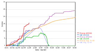
SNOTEL is an automated system of snowpack and related climate sensors operated by the Natural Resources Conservation Service (NRCS) of the United States Department of Agriculture in the Western United States.
Hydric soil is soil which is permanently or seasonally saturated by water, resulting in anaerobic conditions, as found in wetlands.

The National Cooperative Soil Survey (NCSS) in the United States is a nationwide partnership of federal, regional, state, and local agencies and institutions. This partnership works together to cooperatively investigate, inventory, document, classify, and interpret soils and to disseminate, publish, and promote the use of information about the soils of the United States and its trust territories. The activities of the NCSS are carried out on national, regional, and state levels.
The United States National Research Council conducts a survey and compiles a report on United States Research-Doctorate Programs approximately every 10 years, although the time elapsed between each new ranking has exceeded 10 years.

Subaqueous soils are soils formed in sediment found in shallow, permanently flooded environments or soils in any areas permanently covered by water too deep for the growth of rooted plants.

A buffer strip is an area of land maintained in permanent vegetation that helps to control air, soil, and water quality, along with other environmental problems, dealing primarily on land that is used in agriculture. Buffer strips trap sediment, and enhance filtration of nutrients and pesticides by slowing down runoff that could enter the local surface waters. The root systems of the planted vegetation in these buffers hold soil particles together which alleviate the soil of wind erosion and stabilize stream banks providing protection against substantial erosion and landslides. Farmers can also use buffer strips to square up existing crop fields to provide safety for equipment while also farming more efficiently.

The Conservation Effects Assessment Project (CEAP) was established in 2002 to quantify the environmental impact of the United States Department of Agriculture's (USDA) conservation program. The project focuses on how watersheds are affected. CEAP monitored 14 benchmark watershed sites. The CEAP's vision is to enhance "natural resources and healthier ecosystems through improved conservation effectiveness and better management of agricultural landscapes. The goal is "to improve efficacy of conservations practices and programs by quantifying conservation effects and providing the science and education base needed to enrich conservation planning, implementation, management decisions, and policy."
The Conservation Security Program (CSP) was a voluntary conservation program in the United States that supported stewardship of private agricultural lands by providing payments and technical assistance for maintaining and enhancing natural resources. The program promoted the conservation and improvement of soil, water, air, energy, plant and animal life, and other conservation purposes. Congress established the CSP under the Farm Security and Rural Investment Act of 2002 (FSRIA), which amended the Food Security Act of 1985. The program was administered by the Natural Resources Conservation Service (NRCS), an agency of the United States Department of Agriculture (USDA).
SSURGO refers to digital soils data produced and distributed by the Natural Resources Conservation Service (NRCS) - National Cartography and Geospatial Center (NCGC). The database has information on soil types and their distribution. The information covers soil characteristics, soil properties, and addresses limits, risks and suitability for various uses.
The National Society of Consulting Soil Scientists (NSCSS), was integrated into the Soil Science Society of America as of August, 2011. NSCSS was a scientific and professional society of soil scientists, principally in the U.S. but with non-U.S. members as well. Members engaged primarily in environmental consulting, but consulting was not a requirement of membership, and the member body included soil science educators as well as government soil scientists. Society consulting soil scientists provided professional services in the form of agricultural and environmental consulting with respect to using soil as a natural resource, especially as it relates to nutrient management, waste management, septic systems, wetlands, erosion, slope stability, land use planning, and land degradation.

A Limited Resource Farmer or Rancher is one of a larger group of “targeted farmers" that also includes beginning farmers and ranchers and socially disadvantaged farmers and ranchers. Limited Resource Farmers are characterized by having limited farm sales and income. The USDA created the Limited Resource Farmer and Rancher program to ensure that these farmers and ranchers can develop economically viable farms, have access to USDA support, and ensure that programs are in alignment with farmer and rancher needs and concerns.

The United States Geological Survey is a scientific agency of the United States government. The scientists of the USGS study the landscape of the United States, its natural resources, and the natural hazards that threaten it. The organization has four major science disciplines, concerning biology, geography, geology, and hydrology. The USGS is a fact-finding research organization with no regulatory responsibility.

