Pasca is a town and municipality in the Cundinamarca department of Colombia located in the Andes. It belongs to the Sumapaz Province. Pasca is situated on the Altiplano Cundiboyacense at a distance of 71 kilometres (44 mi) from the capital Bogotá. It borders Fusagasugá, Sibaté and Soacha in the north, Bogotá D.C. in the north and east, Arbeláez in the south and Fusagasugá in the west. The urban center is located at an altitude of 2,180 metres (7,150 ft) and the altitude ranges from 2,000 metres (6,600 ft) to 3,500 metres (11,500 ft).

The Nevado del Tolima is a Late Pleistocene to recently active andesitic stratovolcano located in the Tolima department, Colombia. The volcano lies south of Nevado del Ruiz volcano and is situated within the Los Nevados National Natural Park. The volcano, whose most recent activity dates to 1943 and last major eruption around 3600 years ago, overlies the Eocene El Bosque Batholith, dated at 49.1 ± 1.7 Ma.

Motavita is a town and municipality in the Colombian Department of Boyacá, part of the subregion of the Central Boyacá Province. It covers approximately 62 square kilometres (24 sq mi).

The Muisca Confederation was a loose confederation of different Muisca rulers in the central Andean highlands of present-day Colombia before the Spanish conquest of northern South America. The area, presently called Altiplano Cundiboyacense, comprised the current departments of Boyacá, Cundinamarca and minor parts of Santander with a total surface area of approximately 25,000 square kilometres (9,700 sq mi).

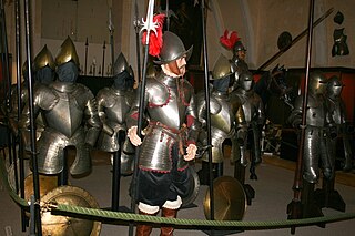
The Spanish conquest of the Muisca took place from 1537 to 1540. The Muisca were the inhabitants of the central Andean highlands of Colombia before the arrival of the Spanish conquistadors. They were organised in a loose confederation of different rulers; the zipa of Bacatá, with his headquarters in Funza, the zaque of [[Boyacá Department | Boyacá]], with his headquarters in Hunza, the iraca of the sacred City of the Sun Sugamuxi, the Tundama of Tundama, and several independent caciques. The leaders of the Confederation at the time of conquest were zipa Tisquesusa, zaque Quemuenchatocha, iraca Sugamuxi and Tundama in the northernmost portion of their territories. The Muisca were organised in small communities of circular enclosures, with a central square where the bohío of the cacique was located. They were called "Salt People" because of their extraction of salt in various locations throughout their territories, mainly in Zipaquirá, Nemocón and Tausa. For the main part self-sufficient in their well-organised economy, the Muisca traded with the European conquistadors valuable products as gold, tumbaga and emeralds with their neighbouring indigenous groups. In the Tenza Valley, to the east of the Altiplano Cundiboyacense where the majority of the Muisca lived, they extracted emeralds in Chivor and Somondoco. The economy of the Muisca was rooted in their agriculture with main products maize, yuca, potatoes and various other cultivations elaborated on elevated fields. Agriculture had started around 3000 BCE on the Altiplano, following the preceramic Herrera Period and a long epoch of hunter-gatherers since the late Pleistocene. The earliest archaeological evidence of inhabitation in Colombia, and one of the oldest in South America, has been found in El Abra, dating to around 12,500 years BP.
Bartolomé Camacho Zambrano was a Spanish conquistador who took part in the expedition of the Spanish conquest of the Muisca led by Gonzalo Jiménez de Quesada. He accompanied Gonzalo Suárez Rendón in the foundation of Tunja on August 6, 1539 and settled in the city. In 1583, Bartolomé Camacho Zambrano was mayor of Tunja together with Francisco de Avendaño.
Juan de Sanct Martín, also known as Juan de San Martín, was a Spanish conquistador. Little is known about De Sanct Martín, apart from a passage in El Carnero (1638) by Juan Rodríguez Freyle and Epítome de la conquista del Nuevo Reino de Granada, a work of uncertain authorship. He took part in the expedition from Santa Marta into the Eastern Ranges of the Colombian Andes led by Gonzalo Jiménez de Quesada and founded Cuítiva, Boyacá in 1550. Juan de Sanct Martín headed the left flank of the Spanish troops in the Battle of Tocarema against the Panche on August 20, 1538, while his fellow conquistador Juan de Céspedes commanded the right flank. In this battle, Juan de Sanct Martín killed the cacique of the Panche and was hurt himself. Juan de Sanct Martín had confronted the Panche the year before, when he was sent to the west while De Céspedes went south. Due to the resistance of the bellicose Panche, De Sanct Martín returned to the Spanish camp.
Pedro Fernández de Valenzuela was a Spanish conquistador who took part in the expedition of the Spanish conquest of the Muisca led by Gonzalo Jiménez de Quesada from 1536 to 1538. He was the cousin of Hernán Venegas Carrillo and after his journey in the New World returned to Córdoba. He was buried in the church of the former Hospital San Bartolomé de las Bubas in Córdoba.
Luis Lanchero, also known as Luis Lancheros was a Spanish conquistador and the founder of the town of Muzo, Boyacá, the most important emerald settlement in Colombia. Muzo was founded after twenty years of unsuccessful attempts to subjugate the Muzo to Spanish rule. Lanchero arrived in the New World in 1533 and died impoverished in Tunja in 1562.
Juan (Francisco) de Céspedes Ruiz was a Spanish conquistador who is known as the founder of the town of Pasca, Cundinamarca, in the south of the Bogotá savanna, Colombia. De Céspedes arrived in the Americas in 1521 and participated in the conquest of the Tairona and the foundation of Santa Marta under Rodrigo de Bastidas. From 1542 to 1543 and in 1546 he served as mayor of Bogotá and after that until 1570 as lieutenant general of the first president of Colombia. Juan de Céspedes married Isabel Romero, one of the first Spanish women who arrived at Colombian territories and had two legitimate sons and one daughter. His date of death is uncertain; in late 1573 or 1576.
Baltasar Maldonado, also written as Baltazar Maldonado, was a Spanish conquistador who first served under Sebastian de Belalcázar in the conquest of Quito and Peru, the foundations of Cali and Popayán, and later in the army of Hernán Pérez de Quesada in the Spanish conquest of the Muisca.

The Eastern Hills are a chain of hills forming the eastern natural boundary of the Colombian capital Bogotá. They are part of the Altiplano Cundiboyacense, the high plateau of the Eastern Ranges of the Colombian Andes. The Eastern Hills are bordered by the Chingaza National Natural Park to the east, the Bogotá savanna to the west and north, and the Sumapaz Páramo to the south. The north-northeast to south-southwest trending mountain chain is 52 kilometres (32 mi) long and its width varies from 0.4 to 8 kilometres. The highest hilltops rise to 3,550 metres (11,650 ft) over the western flatlands at 2,600 metres (8,500 ft). The Torca River at the border with Chía in the north, the boquerón Chipaque to the south and the valley of the Teusacá River to the east are the hydrographic limits of the Eastern Hills.
Juan Friede Alter was a Ukrainian-Colombian historian of Jewish descent who is recognised as one of the most important writers about Colombian history, the Spanish conquests and a proponent of indigenism; the defence of the rights and descriptions of the oppression of indigenous people.

Pedro Ruíz Corredor was a Spanish conquistador who participated in the Spanish conquest of the Muisca. He searched for El Dorado, returned to Spain, was sent back to the new world, helped consolidate newly conquered Peru for Spain, retired to his fiefdom to raise a family, and lived to a ripe old age.
Antonio Díaz de Cardoso was a Portuguese conquistador who participated in the Spanish conquest of the Muisca people.
Juan de Albarracín was a Spanish conquistador who participated in the Spanish conquest of the Muisca and Panche people. He was captain of the brigs which sailed up the Magdalena River from the Caribbean coast in 1536 and later discovered the high quality salt that lead the Spanish conquistadors along the Camino de la Sal up the slopes of the eastern ranges of the Colombian Andes towards the Muisca Confederation.
Antonio de Lebrija was born in 1507, in Alcántara, Extremadura, Spain; and died in 1540, in Brozas, also in Extremadura. He was a Spanish conquistador who participated in the Spanish conquest of the Muisca and the Chimila peoples. He was the treasurer of the conquest expedition which left Santa Marta in April 1536 following the high quality salt trail, the Camino de la Sal, along the Suárez River up the slopes of the Eastern Ranges of the Colombian Andes towards the Muisca Confederation.

The Sumapaz River is a major tributary of the Magdalena River in Colombia. The 95 kilometres (59 mi) long river originates in the Eastern Ranges of the Colombian Andes at the largest páramo in the world; Sumapaz, of which it takes its name. It forms the natural boundary between the departments of Cundinamarca and Tolima.