Devon is a ceremonial, non-metropolitan, and historic county in South West England. Devon is coastal with a variety of cliffs and sandy beaches. It has the largest open space in southern England, Dartmoor National Park. A predominantly rural county, Devon has a relatively low population density for a county in England. Its most populous settlement is the City of Plymouth. The county town of Devon, the City of Exeter, is the second most populous settlement. The county is bordered by Somerset to the north east, Dorset to the east, and Cornwall to the west. Its economy is heavily orientated around the tourism and agriculture industries.

Dartmouth is a town and civil parish in the English county of Devon. It is a tourist destination set on the western bank of the estuary of the River Dart, which is a long narrow tidal ria that runs inland as far as Totnes. It lies within the South Devon Area of Outstanding Natural Beauty and South Hams district, and had a population of 5,512 in 2001, reducing to 5,064 at the 2011 census. There are two electoral wards in the Dartmouth area. Their combined population at the above census was 6,822.

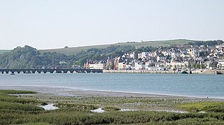
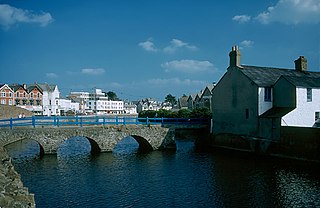
Bideford is a historic port town on the estuary of the River Torridge in north Devon, south-west England. It is the main town of the Torridge local government district.

Torquay is a seaside town in Devon, England, part of the unitary authority area of Torbay. It lies 18 miles (29 km) south of the county town of Exeter and 28 miles (45 km) east-north-east of Plymouth, on the north of Tor Bay, adjoining the neighbouring town of Paignton on the west of the bay and across from the fishing port of Brixham.

The Tamar is a river in south west England, that forms most of the border between Devon and Cornwall. A part of the Tamar Valley is a World Heritage Site due to its historic mining activities.

The South West Coast Path is England's longest waymarked long-distance footpath and a National Trail. It stretches for 630 miles (1,014 km), running from Minehead in Somerset, along the coasts of Devon and Cornwall, to Poole Harbour in Dorset. Because it rises and falls with every river mouth, it is also one of the more challenging trails. The total height climbed has been calculated to be 114,931 ft (35,031 m), almost four times the height of Mount Everest. It has been voted 'Britain's Best Walking route' twice in a row by readers of The Ramblers' Walk magazine, and regularly features in lists of the world's best walks.

A pier is a raised structure that rises above a body of water and usually juts out from its shore, typically supported by piles or pillars, and provides above-water access to offshore areas. Frequent pier uses include fishing, boat docking and access for both passengers and cargo, and oceanside recreation. Bridges, buildings, and walkways may all be supported by architectural piers. Their open structure allows tides and currents to flow relatively unhindered, whereas the more solid foundations of a quay or the closely spaced piles of a wharf can act as a breakwater, and are consequently more liable to silting. Piers can range in size and complexity from a simple lightweight wooden structure to major structures extended over 1,600 m (5,200 ft). In American English, a pier may be synonymous with a dock.

Bude is a seaside town in north east Cornwall, England, in the civil parish of Bude-Stratton and at the mouth of the River Neet. It was sometimes formerly known as Bude Haven. It lies southwest of Stratton, south of Flexbury and Poughill, and north of Widemouth Bay, located along the A3073 road off the A39. Bude is twinned with Ergué-Gabéric in Brittany, France. Bude's coast faces Bude Bay in the Celtic Sea, part of the Atlantic Ocean. The population of the civil parish can be found under Bude-Stratton.

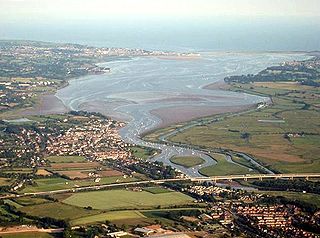
The River Exe in England rises at Exe Head, near the village of Simonsbath, on Exmoor in Somerset, 8.4 kilometres (5 mi) from the Bristol Channel coast, but flows more or less directly due south, so that most of its length lies in Devon. It flows for 60 miles (96 km) and reaches the sea at a substantial ria, the Exe Estuary, on the south coast of Devon. Historically, its lowest bridging point was the Old Exe Bridge in Exeter, the largest settlement on the river, but there is now a viaduct for the M5 motorway about 3 kilometres (2 mi) south of the city centre.

Ilfracombe is a seaside resort and civil parish on the North Devon coast, England, with a small harbour surrounded by cliffs.

Exmouth is a port town, civil parish and seaside resort, sited on the east bank of the mouth of the River Exe and 11 miles (18 km) southeast of Exeter.
The village of Hartland, whose parish incorporates the hamlet of Stoke to the west and the village of Meddon in the south, is the most north-westerly settlement in the county of Devon, England.

Teignmouth is a seaside town, fishing port and civil parish in the English county of Devon. It is on the north bank of the estuary mouth of the River Teign, about 12 miles south of Exeter. The town had a population of 14,749 at the 2011 census.

Dawlish is an English seaside resort town and civil parish in Teignbridge on the south coast of Devon; it is located 12 miles (19 km) from the county town of Exeter and from the larger resort of Torquay. Its 2011 population of 11,312 was estimated to have risen to 13,355 by 2019. It is to grow further as several housing estates are under construction, mainly in the north and east of the town. It had grown in the 18th century from a small fishing port into a well-known seaside resort, as had its near neighbour, Teignmouth, in the 19th century. Between Easter and October, the population can swell by an additional 20,000, largely in self-accommodation, caravan, camping and holiday parks.

Fremington is a large village, civil parish and former manor in North Devon, England, the historic centre of which is situated three miles (4.8 km) west of Barnstaple. The village lies between the south bank of the tidal estuary of the River Taw and a small inlet of that river known as Fremington Pill. The parish is surrounded clockwise from the north by the parishes of Heanton Punchardon, Ashford, West Pilton, Barnstaple, Tawstock, Horwood, Lovacott and Newton Tracey, and Instow.
Blackpool is a seaside town in England, United Kingdom.

The Braunton Canal is a cut made to straighten the course of the upper section of the River Caen, known as Braunton Pill, and to provide a new quay for the village of Braunton in North Devon, England. It crosses an area known as Braunton Marsh, which was the subject of Enclosure Acts in the early 19th Century, and was the only one of several schemes which was actually constructed.
South Devon is the southern part of Devon, England. Because Devon has its major population centres on its two coasts, the county is divided informally into North Devon and South Devon. In a narrower sense "South Devon" is used to refer to the part of Devon south of Exeter and Dartmoor, including Plymouth, Torbay and the districts of South Hams, West Devon and Teignbridge.

Torquay Tramways operated electric street trams in Torquay, Devon, England, from 1907. They were initially powered by the unusual Dolter stud-contact electrification, but in 1911 was converted to more conventional overhead-line supply. The line was extended into neighbouring Paignton in 1911 but the whole network was closed in 1934.

Totnes Community Hospitalis a health facility on Coronation Road in Totnes, Devon, England. It is managed by Torbay and South Devon NHS Foundation Trust.


