Related Research Articles

The Orange River is the longest river in Lesotho and the Orange River Basin extends extensively into South Africa, Namibia and Botswana to the north. It rises in the Drakensberg mountains in Lesotho, flowing westwards through South Africa to the Atlantic Ocean. The river forms part of the international borders between South Africa and Namibia and between South Africa and Lesotho, as well as several provincial borders within South Africa. Except for Upington, it does not pass through any major cities. The Orange River plays an important role in the South African economy by providing water for irrigation and hydroelectric power. The river was named the Orange River in honour of the Dutch ruling family, the House of Orange, by the Dutch explorer Robert Jacob Gordon. Other names include Gariep River, Groote River or Senqu River.

The Tugela River is the largest river in KwaZulu-Natal Province, South Africa. It is one of the most important rivers of the country.

The Highveld is the portion of the South African inland plateau which has an altitude above roughly 1500 m, but below 2100 m, thus excluding the Lesotho mountain regions to the south-east of the Highveld. It is home to some of the country's most important commercial farming areas, as well as its largest concentration of metropolitan centres, especially the Gauteng conurbation, which accommodates one-third of South Africa's population.

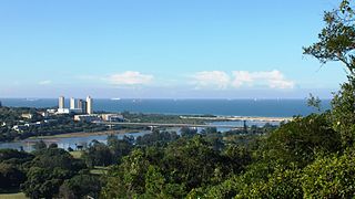
The Umgeni River or Mgeni River, is a river in KwaZulu-Natal, South Africa. It rises in the "Dargle" in the KZN midlands, and its mouth is at Durban, some distance north of Durban's natural harbour. The name is taken to mean the river of entrance in Zulu, though other meanings have been proposed.

The 1,000 kilometres (620 mi) long Tana River is the longest river in Kenya, and gives its name to the Tana River County. Its tributaries include the Thika, as well as several smaller rivers that flow only during the rainy season. The river rises in the Aberdare Mountains to the west of Nyeri. Initially it runs east before turning south around the massif of Mount Kenya. The river then runs into the Masinga Reservoir and Kiambere Reservoir, created by Masinga and Kiambere dams respectively]. Masinga and Kiambere reservoirs serve a dual purpose, hydro-electric power (HEP) generation and agricultural irrigation. Three further dams are located between Masinga and Kiambere, namely Kamburu, Gitaru and Kindaruma, that are used exclusively for HEP generation. Below the dams, the river turns north and flows along the north-south boundary between the Meru and North Kitui and Bisanadi, Kora and Rabole National Reserves. In the reserves the river turns east, and then south east. It passes through the towns of Garissa, Hola and Garsen before entering the Indian Ocean at the Ungwana Bay-Kipini area, at the end of a river delta that reaches roughly 30 km upstream from the river mouth itself. It runs through a desert, and irrigates the surrounding land.
The Upper Nepean Scheme is a series of dams and weirs in the catchments of the Cataract, Cordeaux, Avon and Nepean rivers of New South Wales, Australia. The scheme includes four dams and two weirs, and a gravity-fed canal system that feeds into a large storage reservoir to provide water to the Macarthur and Illawarra regions, the Wollondilly Shire, and metropolitan Sydney. The four dams and associated infrastructure are individually listed on the New South Wales State Heritage Register.

The Vanderkloof Dam is situated approximately 130 km (81 mi) downstream from Gariep Dam and is fed by the Orange River, South Africa's largest river. Vanderkloof Dam is the second-largest dam in South Africa, having the highest dam wall in the country at 108 metres (354 ft). The dam was commissioned in 1977; it has a capacity of 3,187.557 million cubic metres (2,584,195 acre⋅ft) and a surface area of 133.43 square kilometres (51.52 sq mi) when full. Other rivers flowing into this dam are the Berg River, two unnamed streams coming in from the direction of Reebokrand, the Knapsak River, Paaiskloofspruit, Seekoei River, Kattegatspruit and the Hondeblaf River, in a clockwise direction.

The Pongola or Phongolo River is a river in South Africa. It is a tributary of the Maputo River. It rises near Utrecht in northern KwaZulu-Natal, flows east through Pongola, is dammed at Pongolapoort, and crosses the Ubombo Mountains; then it flows north towards Mozambique, joining the Maputo River.

The Thuli River, former name Tuli River, is a major tributary of the Shashe River in Zimbabwe. It rises near Matopo Mission, Matobo District, and flows into the Shashe River near Tuli village.
Chelmsford Nature Reserve, also known as Chelmsford Dam Nature Reserve is a nature reserve administered by Ezemvelo KZN Wildlife and is situated on the Ngagane River, which is situated some 38 kilometres (24 mi) south of Newcastle, in the KwaZulu-Natal province of South Africa.
Dap Naudé Dam is dam on the Broederstroom River, near Polokwane, Limpopo, South Africa. It was established in 1958.
Metz Dam is an earth-fill type dam located on the Moetladimo River, near Trichardsdal, Limpopo, South Africa. The dam serves mainly for domestic supply, stock watering and irrigation and its hazard potential has been ranked significant (2).

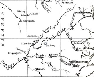
The Sand River is a river in the Free State, South Africa. It is located close to Welkom and Virginia in the gold mining center of the Free State. Its source is located close to Tweefontein NW of Ficksburg not far from the South Africa/Lesotho border, at 28°40′49″S27°41′23″E. This river is famous because of the historical Sand River Convention, an important event in South African history.

The Bushman's River is an east to north-easterly flowing tributary of the Tugela River, in the KwaZulu-Natal province of South Africa. It rises in the Drakensberg Mountain range, with its upper catchment in the Giant's Castle Game Reserve, north of the Giant's Castle promontory. It feeds the Wagendrift Dam and then flows past the town of Estcourt to join the Tugela River near the town of Weenen.

The Umbilo River is a river in KwaZulu-Natal, South Africa. The river rises in Kloof to the west of the city of Durban and the mouth of the river is situated in Durban harbour.

The Tyhume River is a river in Amathole District Municipality in the central part of the Eastern Cape province of South Africa. It springs in the forested mountains of Hogsback, part of the Amatola Mountains, and runs down the Tyhume River Valley and through the eastern verge of the small town of Alice, Eastern Cape, bordering most of the Fort Hare University grounds.

The Catumbela is a river in central Angola. The river mouth is at the Catumbela Estuary on the Atlantic Ocean at Catumbela, between Lobito and Benguela, and 240 kilometres (150 mi) from where it rises in the hills of Cassoco. The Catumbela supplies water to the city of Lobito. The mouth of the Catumbela was noted as a green vegetated region surrounded by barren land along the coast and a couple miles inland where it cuts a gorge through bare mountains. Alternate spellings are Catumbella and Cata-Bella.

10 Armoured Car Squadron was a contingent of the South African Armoured Corps posted in Sector 10, South West Africa, during the South African Border War.
References
Coordinates: 29°13′49.3″S27°13′29.4″E / 29.230361°S 27.224833°E

A geographic coordinate system is a coordinate system that enables every location on Earth to be specified by a set of numbers, letters or symbols. The coordinates are often chosen such that one of the numbers represents a vertical position and two or three of the numbers represent a horizontal position; alternatively, a geographic position may be expressed in a combined three-dimensional Cartesian vector. A common choice of coordinates is latitude, longitude and elevation. To specify a location on a plane requires a map projection.
| This article about a dam or floodgate in South Africa is a stub. You can help Wikipedia by expanding it. |