
Dodge City Regional Airport is three miles east of Dodge City, in Ford County, Kansas. It is used for general aviation and is subsidized by the Essential Air Service program.

Liberal Mid-America Regional Airport is two miles west of Liberal, in Seward County, Kansas. It is used for general aviation and is subsidized by the Essential Air Service program. Formerly Liberal Municipal Airport, it hosts the Mid-America Air Museum.

Cartersville Airport, Valley of Pumpkinvine Creek Field, is a public use airport located on a small hill by the Etowah River two nautical miles (4km) west of the headwaters of Pumpkinvine Creek and three nautical miles (6 km) southwest of the central business district of Cartersville, in Bartow County, Georgia, United States. It is owned by the Cartersville Bartow Airport Authority.

Lawrence Regional Airport is an airport three miles north of Lawrence, in Douglas County, Kansas, used for general aviation and air taxi.
Cessna Aircraft Field is a public use airport located four nautical miles southeast of the central business district of Wichita, in Sedgwick County, Kansas, United States. It is privately owned by the Cessna Aircraft Company.
Emporia Municipal Airport is a city-owned public-use airport, located five miles south of Emporia, in Lyon County, Kansas.

McMinnville Municipal Airport is three miles southeast of McMinnville, in Yamhill County, Oregon. The FAA's National Plan of Integrated Airport Systems for 2009–2013 categorized it as a general aviation facility. It is across Oregon Route 18 from the Evergreen Aviation & Space Museum, home to the Hughes H-4 Hercules Spruce Goose flying boat.
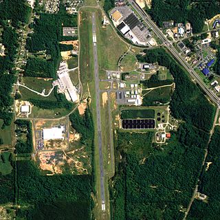
Delaware County Regional Airport is in Delaware County, Indiana three miles northwest of Muncie. Owned by the Delaware County Airport Authority, it was formerly Delaware County Airport and Johnson Field. The National Plan of Integrated Airport Systems for 2011–2015 categorized it as a general aviation facility.

Strother Field is a public airport in Cowley County, Kansas, six miles southwest of Winfield and north of Arkansas City. The airport is jointly owned by the two cities. The National Plan of Integrated Airport Systems for 2011–2015 categorized it as a general aviation facility.
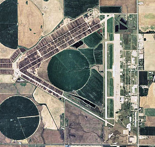
Independence Municipal Airport is six miles southwest of Independence, in Montgomery County, Kansas. The National Plan of Integrated Airport Systems for 2011–2015 categorized it a general aviation facility.
Thomas C. Russell Field is a city-owned public-use airport located two nautical miles (4 km) southwest of the central business district of Alexander City, a city in Tallapoosa County, Alabama, United States.
Guntersville Municipal Airport, also known as Joe Starnes Field, is a city-owned public-use airport located three nautical miles northeast of the central business district of Guntersville, a city in Marshall County, Alabama, United States. According to the FAA's National Plan of Integrated Airport Systems for 2009–2013, it is categorized as a general aviation facility.

Lanett Municipal Airport is a city-owned public-use airport located three nautical miles southwest of the central business district of Lanett, a city in Chambers County, Alabama, United States. According to the FAA's National Plan of Integrated Airport Systems for 2009–2013, it is categorized as a general aviation facility.

Scottsboro Municipal Airport, also known as Word Field, is a city-owned public-use airport located two nautical miles (3.7 km) northeast of the central business district of Scottsboro, a city in Jackson County, Alabama, United States. According to the FAA's National Plan of Integrated Airport Systems for 2009–2013, it is categorized as a general aviation facility.

Kokomo Municipal Airport is five miles northeast of Kokomo, in Howard County, Indiana. It is owned by the Kokomo Board of Aviation Commissioners. The FAA's National Plan of Integrated Airport Systems for 2009–2013 categorized it as a general aviation facility.
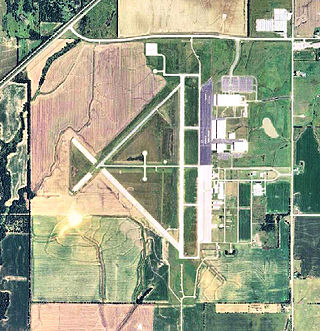
Pratt Regional Airport is a public airport five miles north of Pratt, in Pratt County, Kansas. Previously known as Pratt Industrial Airport, it is on the site of the former Pratt Army Airfield.
Jackson Municipal Airport is a city-owned public-use airport located two nautical miles north of the central business district of Jackson, a city in Jackson County, Minnesota, United States. It is included in the FAA's National Plan of Integrated Airport Systems for 2011–2015, which categorized it as a general aviation facility.
Baker Municipal Airport is a public-use airport located one nautical mile southeast of the central business district of Baker, a city in Fallon County, Montana, United States. The airport is owned by Baker City and Fallon County. It is included in the FAA's National Plan of Integrated Airport Systems for 2011–2015, which categorized it as a general aviation facility.
Denison Municipal Airport is a city-owned, public-use airport located two nautical miles (4 km) southwest of the central business district of Denison, a city in Crawford County, Iowa, United States. It is included in the National Plan of Integrated Airport Systems for 2011–2015, which categorized it as a general aviation facility.
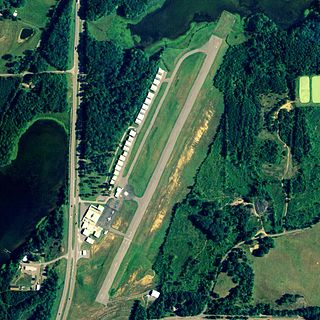
Kentland Municipal Airport is a public use airport located one nautical mile (2 km) southeast of the central business district of Kentland, in Newton County, Indiana, United States. It is owned by the Kentland Board of Aviation Commissioners. This airport was included in the National Plan of Integrated Airport Systems for 2011–2015, which categorized it as a general aviation facility.

