
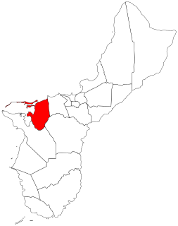
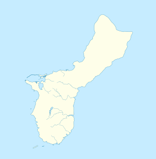
Asan-Maina is a village located on the western shore of the United States territory of Guam. The municipality combines the names of the coastal community of Asan with Maina, a community along the slopes of the Fonte River valley to the east. Asan was the northern landing site for United States Marines during Guam's liberation from the Japanese during World War II. Asan Beach Park is part of the War in the Pacific National Historic Park. The third community comprising Asan-Maina is Nimitz Hill Annex in the hills above Asan and Maina, which is the location of the Joint Region Marianas headquarters. Asan-Maina is located in the Luchan (Western) District.

Santa Rita is a village located on the southwest coast of the United States territory of Guam with hills overlooking Apra Harbor. According to the 2000 census it has a population of 7,500, down from 11,857 in 1990. Santa Rita is the newest village in Guam, having been established after the Second World War.
Piti is a village located on the central west coast of the United States territory of Guam. It contains northern and eastern coastlines of Apra Harbor, including Cabras Island, which has the commercial Port of Guam and the island's largest power plants. Piti was a pre-Spanish CHamoru village and, after Spanish colonization, became the primary port town on Guam. The town was largely destroyed during the 1944 liberation of Guam and the population relocated during the wartime construction of Apra Harbor.

Yona is a village in the United States territory of Guam.

The War in the Pacific National Historical Park is a multi-unit protected area in the United States territory of Guam, which was established in 1978 in honor of those who participated in the Pacific Theater of World War II. Uniquely among the National Park System, it honors the bravery and sacrifices of all those who participated in the Pacific Theater.

Agana Heights is one of the nineteen villages in the United States territory of Guam. It is located in the hills south of Hagåtña, in the central part of the island. United States Naval Hospital Guam is located in this largely residential village.

Nimitz Hill Annex is a community and census-designated place (CDP) in Asan-Maina, Guam. It contains the geographic feature of Nimitz Hill, and is located immediately northeast of the Nimitz Hill CDP in Piti. In normal conversation, the Nimitz Hill CDP and Nimitz Hill Annex CDP are often collectively referred to as "Nimitz Hill."
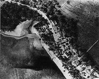
The Asan River is a river in the United States territory of Guam that lies entirely within the village of Asan-Maina. It originates in the highlands of Nimitz Hill Annex and flows through the Asan Inland Unit of War in the Pacific National Historical Park (WAPA) and enters the community of Asan. It then briefly re-enters WAPA at its Asan Inland Unit, with the mouth at the eastern end of Asan Memorial Park into Asan Bay. The river was thus a significant geographical feature of the Asan Invasion Beach for U.S. forces during the initial landings on Guam in July 1944.
Guam Highway 6 (GH-6) is one of the primary automobile highways in the United States territory of Guam. It is known alternately as Spruance Drive and Halsey Drive: both named for noteworthy US Navy Admirals that served in the Pacific Ocean theater of World War II: Raymond A. Spruance and William Halsey Jr., respectively.
Joint Region Marianas (JRM) is a U.S. Navy-commanded joint military command. JRM is the installation management authority for all United States Department of Defense installations on Guam and the Northern Mariana Islands. This includes Andersen Air Force Base (AFB), Naval Base (NB) Guam, and Marine Corps Base (MCB) Camp Blaz. Its headquarters is located in Nimitz Hill Annex, Asan-Maina, Guam. The command is an amalgamation of the United States Navy's NB Guam and United States Air Force's Andersen AFB, which were merged on October 1, 2009.

Talofofo is a village located in the southern part of the United States territory of Guam, on the east coast. The village center is located in the hills above the coast, while the smaller coastal community below the cliff is known as Ipan.

Dededo is the most populated village in the United States territory of Guam. According to the U.S. Census Bureau, Dededo's population was just under 45,000 in 2010. The village is located on the coral plateau of Northern Guam. The greater Dededo-Machanao-Apotgan Urban Cluster had a population of 139,825 as of the 2010 census, making up 87.7% of Guam's population and 29.8% of its area.

Merizo, is the southernmost village in the United States territory of Guam. Cocos Island is a part of the municipality. The village's population has decreased since the island's 2000 census.
Mangilao is a village on the eastern shore of the United States territory of Guam. The village's population has increased slightly following the island's 2000 census.
Asan is a city in South Korea.
The Asan Ridge Battle Area was the scene of some of the heaviest fighting in the 1944 Battle of Guam, the World War II battle in which Allied forces recaptured Guam from occupying Japanese forces. The area is now part of the Asan Inland Unit of the War in the Pacific National Historical Park, and was listed on the National Register of Historic Places in 1975. The area is just inland of the Asan Invasion Beach, one of the two major beachheads established by the Allies, and has a commanding view over that area. The landforms included in this area are Chorrito Cliff, Bundschuh Ridge, and Nimitz Hill, and they were heavily fortified by the Japanese prior to the battle. Surviving elements of these fortifications include two concrete pillboxes, and an unfinished battery of 4-inch guns.

The Fonte River Dam is a historic dam on the Fonte River on the island of Guam. It is located in the upper third of the river's main valley, which is located between Nimitz Hill Annex and Agana Heights, and lies below and west of the Libugon scenic overlook on Nimitz Hill. The dam, built in 1910, was part of the first organized effort by the United States Navy to provide a reliable water supply to the island's major settlement, Hagåtña. It is a concrete structure 150 feet (46 m) long, 24 feet (7.3 m) high, and has a 17 feet (5.2 m) base. It is almost complete obscured by jungle overgrowth.
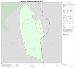
Nimitz Hill is a community and census-designated place (CDP) in Piti, Guam. is located immediately west of the Nimitz Hill Annex CDP in Asan-Maina, which contains the geographic feature of Nimitz Hill. In normal conversation, the Nimitz Hill CDP and Nimitz Hill Annex CDP are often collectively referred to as "Nimitz Hill."
Asan is a community and census-designated place (CDP) along the western coast of the U.S. territory of Guam. Asan, along with Maina and Nimitz Hill Annex, are the three communities in the village of Asan-Maina. It is known for being the location of northern invasion beach used by the United States during the retaking of Guam in 1944.
Nimitz Hill is a hill in Asan-Maina, Guam. It lies within the Nimitz Hill Annex CDP. The US Navy headquarters for Guam lie near the crest of the hill.