Niton is a village on the Isle of Wight in England.
Niton may also refer to:
- Niton (element) or radon
- Niton, Alberta, a locality in Yellowhead County, Alberta, Canada
- "Niton (The Reason)", a song by Eric Prydz
Niton is a village on the Isle of Wight in England.
Niton may also refer to:
NT or nt may refer to:

Edson is a town in west-central Alberta, Canada. It is located in Yellowhead County, 192 kilometres (119 mi) west of Edmonton along the Yellowhead Highway and 10 kilometres (6.2 mi) east of the intersection with Highway 47.

Niton is a village on the Isle of Wight, west of Ventnor, with a population of 2,082. It has two pubs, several churches, a pottery workshop/shop, a pharmacy, a busy volunteer-run library, a medical centre and two local shops including a post office. The post office includes a pub and café that serves as a local meeting place. The village also offers a primary school with a co-located pre-school and nursery.
Alberta Provincial Highway No. 16, commonly referred to as Highway 16, is a major east–west highway in central Alberta, Canada, connecting Jasper to Lloydminster via Edmonton. It forms a portion of the Yellowhead Highway, a major interprovincial route of the Trans-Canada Highway system that stretches from Masset, British Columbia, to Portage la Prairie, Manitoba, near Winnipeg. Highway 16 spans approximately 634 km (394 mi) from Alberta's border with British Columbia in the west to its border with Saskatchewan in the east. As of 2010, all but less than 96 km (60 mi) of the route was divided, with a minimum of two lanes in each direction. It is designated a core route in Canada's National Highway System.

Whitwell is a small village located on the south of the Isle of Wight, approximately 5 kilometres north-west of Ventnor, the village's nearest town. At the 2011 Census the appropriate civil parish was Niton and Whitwell. In addition to this, it is about five minutes away from its neighbouring small villages of Godshill and Niton, the latter of which, Whitwell forms a civil parish. According to 2001 census data, the total population of the village was 578. There is a variety of stone and thatched housing, as well as some more modern housing, the most recent of which was completed in 2006.
Niton Junction is a hamlet in west-central Alberta, Canada within Yellowhead County. It is located on the Yellowhead Highway approximately 45 kilometres (28 mi) east of Edson and 150 kilometres (93 mi) west of Edmonton. It is east of the Yellowhead Highway's junction with Highway 32 and west of Chip Lake. Niton Junction has an elevation of 845 metres (2,772 ft).
Little Atherfield is a small settlement on the Isle of Wight. It is near the coast in the Back of the Wight. The Isle of Wight is situated off the south coast of England. According to the Post Office the 2011 Census population of the village was listed in the civil parish of Niton and Whitwell.
The Isle of Wight Saturday League is a football competition based on the Isle of Wight, England. There are currently two divisions for first teams, known as Division One and Division Two, plus two for reserve teams. Winner of the league may be eligible for promotion to the Wessex League.
Puckaster is a hamlet on the Isle of Wight, England. Puckaster is on the southern coast of the Isle of Wight, south of Niton, between St. Catherine's Point and Binnel.

Bierley is a hamlet on the Isle of Wight, UK. Bierley is in the south of the Isle of Wight, north of Niton and 0.7 miles to the west of Whitwell. Bierley is at the corner of Kingates Lane and Newport Road.
M/V Pool Fisher was a British merchant vessel that sank off the Isle of Wight on 6 November 1979 with the loss of most of her crew.

The Church of St John the Baptist, Niton is a Church of England parish church in Niton, Isle of Wight.
And or AND may refer to:

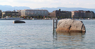
Metres above the Sea is the vertical datum used in Switzerland. Both the system and the term are also used in the Principality of Liechtenstein.

"Niton " is a single by Swedish DJ and producer, Eric Prydz. It was released by digital download on 6 February 2011 on Ministry of Sound. The music video was uploaded to YouTube on 9 December 2010. On 13 February 2011 the song entered the UK Singles Chart at number 45.
The Undercliff, Isle of Wight, England is a tract of semi-rural land, around 5 miles (8.0 km) long by 0.25–0.5 miles (0.40–0.80 km) wide, skirting the southern coast of the island from Niton to Bonchurch. Named after its position below the escarpment that backs this coastal section, its undulating terrain comprises a mix of rough pasture, secondary woodland, parkland, grounds of large isolated houses, and suburban development. Its sheltered south-facing location gives rise to a microclimate considerably warmer than elsewhere on the island. Although inhabited, the Undercliff is an area prone to landslips and subsidence, with accompanying loss of property over time. Settlements along the Undercliff, from west to east, are: lower Niton, Puckaster, St Lawrence, Steephill, the town of Ventnor, and Bonchurch.
The following is a timeline of the COVID-19 pandemic in Alberta.