Noosa National Park is a national park in Queensland, Australia, 121 km north of Brisbane. It is situated near Noosa Heads between the Pacific Ocean and the Sunshine Coasts's northern area of urban development and extends southwards, past Lake Weyba to Coolum.

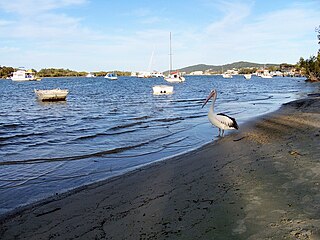
Sunshine Coast is a peri-urban area and the third most populated area in the Australian state of Queensland. Located 100 km (62 mi) north of the state capital Brisbane in South East Queensland, on the Coral Sea coastline, its urban area spans approximately 60 km (37 mi) of coastline and hinterland from Pelican Waters to Tewantin. The estimated urban population of Sunshine Coast as of June 2018 was 333,436, making it the 9th most populous in the country. The population of the area has grown steadily at an average annual rate of 2.4% year-on-year over the five years to 2018.

A cable ferry is a ferry that is guided across a river or large body of water by cables connected to both shores. Early cable ferries often used either rope or steel chains, with the latter resulting in the alternate name of chain ferry. Both of these were largely replaced by wire cable by the late 19th century.

Peregian Beach is a beach and small coastal town on the Sunshine Coast, Queensland, Australia. It is a suburb split between two local government areas with the eastern coastal in the Shire of Noosa and the western hinterland part in the Sunshine Coast Region.. In the 2016 census, Peregian Beach had a population of 3,791 people.

Noosa Heads is a coastal town and suburb of the Shire of Noosa on the Sunshine Coast, Queensland, Australia. It is located approximately 136 kilometres (85 mi) north of Brisbane, the state's capital.

The Annapolis Basin is a sub-basin of the Bay of Fundy, located on the southeastern shores of the bay, along the northwestern shore of Nova Scotia and at the western end of the Annapolis Valley.

The Shire of Noosa is a local government area about 130 kilometres (81 mi) north of Brisbane in the Sunshine Coast district of South East Queensland, Australia. The shire covers an area of 868.7 square kilometres (335.4 sq mi). The shire existed as a local government entity from 1910 until 2008, when it was amalgamated with the Shire of Maroochy and City of Caloundra to form the Sunshine Coast Region, and again from 1 January 2014, when it was re-established.

Eliza Anne Fraser was a Scottish woman who was aboard a ship that wrecked at an island off the coast of Queensland, Australia, on 22 May 1836, and who was taken in by the Badtjala (Butchella) people. She later wrote of her experience and claimed to have been captured by Aboriginal people. Fraser Island is named after her.

Double Island Point is a coastal headland in Queensland, Australia. It is the next headland north of Noosa and is within the Cooloola section of the Great Sandy National Park, at the southern end of Wide Bay.

The Raritan Bayshore region of New Jersey is a subregion of the larger Jersey Shore. It is the area around Raritan Bay from The Amboys to Sandy Hook, in Monmouth and Middlesex counties, including the towns of Perth Amboy, South Amboy, Sayreville, Old Bridge Township, Aberdeen Township, Keyport, Union Beach, Keansburg, Middletown, Atlantic Highlands, and Highlands. It is the northernmost part of the Jersey Shore, located just south of New York City. At Keansburg is a traditional amusement park while at Sandy Hook are found ocean beaches. The Sadowski Parkway beach area in Perth Amboy, which lies at the mouth of the Raritan River, was deemed the "Riviera of New Jersey" by local government. In the last years many of the beaches on the Bayshore area have been rediscovered and upgraded as the quality of the water continues to improve.
The Sunrise Trail is a scenic roadway in the Canadian province of Nova Scotia.

Lake Cootharaba is a lake on the Noosa River within the locality of Noosa North Shore in the Shire of Noosa, Queensland, Australia. It is the gateway to the Everglades, a popular tourist attraction for Noosa, being 20 km away from Noosa. The lake's major access is the town of Boreen Point, as well as the smaller camping-spot of Elanda Point.

Cooloola is a coastal locality in the Gympie Region, Queensland, Australia. In the 2016 census, Cooloola had a population of 3 people.

Teewah is a small holiday town within the locality of Noosa North Shore in the Shire of Noosa, Queensland, Australia. It is 25 km north of the large city centre of Noosa Heads. It is a well known camping area and offroad vehicles can drive on the beach.

Cherry Venture was a 1600 ton cargo ship of Scandinavian origin. It ran aground on Teewah Beach in South East Queensland, Australia on 6 July 1973 and remained on the beach for 34 years until its removal in early 2007.

Scarborough River is a 3.7-mile-long (6.0 km) coastal estuary and river draining through the Scarborough Marsh in Scarborough, Maine. It empties into Saco Bay between Pine Point Beach and Western Beach and marks the bay's northern end. The main tributaries are the Nonesuch River, Dunstan River, and Libby River, as well as smaller brooks and streams.
The Cooloola Great Walk is a 102 kilometres (63 mi) coastal bushwalking route in the Great Sandy National Park of South East Queensland, Australia. Opened in 2010, it runs from Noosa North Shore through Cooloola to Rainbow Beach, and is planned as a five-day trek. The hiking trail was officially opened by Climate Change and Sustainability Minister Kate Jones in March 2010.