Nuku, also known as Nuku Station, is the capital of Nuku District in Sandaun Province, Papua New Guinea. The district is the tertiary level of political division within Papua New Guinea, after the national and provincial levels. The population is approximately 800, though this is variable with the presence of government employees who may only spend short periods of time in the capital, though they may maintain a residence there. Nuku contains a government outpost, post office, medical center, and airstrip. There are several trade stores, and some Western goods can be purchased, though these are not consistent or reliable for any given item.
Nuku District is a district of the Sandaun Province of Papua New Guinea. Its capital is Nuku.
Sandaun Province is the north-westernmost province of Papua New Guinea. It covers an area of 35,920 km² and has a population of 248,411. The capital is Vanimo. In July 1998 the area surrounding the town Aitape was hit by an enormous tsunami caused by a Magnitude 7.0 earthquake which killed over 2,000 people.
Papua New Guinea, officially the Independent State of Papua New Guinea, is an Oceanian country that occupies the eastern half of the island of New Guinea and its offshore islands in Melanesia, a region of the southwestern Pacific Ocean north of Australia. Its capital, located along its southeastern coast, is Port Moresby. The western half of New Guinea forms the Indonesian provinces of Papua and West Papua.
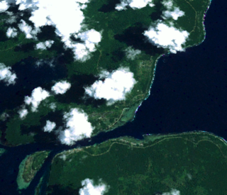
The global coordinates for Nuku are 3° 40’ 46.03” S x 142° 28’ 50.51” E and it lies at an average elevation of 815 feet, though the area is mountainous and the elevation is variable. The language of Nuku is Mehek, though Tok Pisin is also widely spoken. Nuku is accessible by motor vehicle, though the roads are quite rough and can be impassible during the rainy season. The nearest large town, Mai, is about two hours by motor vehicle or eight hours walking.
Mehek is a Tama language spoken by about 6300 people in a somewhat mountainous area along the southern base of the Torricelli Mountains in northwestern Papua New Guinea. Mehek is spoken in six villages of Sandaun Province: Nuku, Yiminum, Mansuku, Yifkindu, Wilwil, and Kafle. Mehek is most closely related to Pahi, with 51% lexical similarity, and spoken approximately 20 kilometers to the southwest. Mehek is a fairly typical Papuan language, being verb-final, having a relatively simple phonology, and agglutinative morphology. There is very little published information about Mehek. The literacy rate in Tok Pisin, spoken by nearly everyone, is 50-75%. Mehek is not written, so there is no literacy in Mehek. Tok Pisin is primarily used in the schools, with 50% children attending. There is also a sign language used by the large number of deaf people in the Mehek community.
Tok Pisin is a creole language spoken throughout Papua New Guinea. It is an official language of Papua New Guinea and the most widely used language in the country. However, in parts of Western, Gulf, Central, Oro Province and Milne Bay Provinces, the use of Tok Pisin has a shorter history, and is less universal, especially among older people. While it likely developed as a trade pidgin, Tok Pisin has become a distinct language in its own right. It is often referred to by Anglophones as "New Guinea Pidgin" or "Pidgin English".
A geographic coordinate system is a coordinate system that enables every location on Earth to be specified by a set of numbers, letters or symbols. The coordinates are often chosen such that one of the numbers represents a vertical position and two or three of the numbers represent a horizontal position; alternatively, a geographic position may be expressed in a combined three-dimensional Cartesian vector. A common choice of coordinates is latitude, longitude and elevation. To specify a location on a plane requires a map projection.
This page is based on this Wikipedia article Text is available under the CC BY-SA 4.0 license; additional terms may apply. Images, videos and audio are available under their respective licenses.
Related Research Articles
New Ireland Province, formerly New Mecklenburg, is the most northeastern province of Papua New Guinea.
For administrative purposes, Papua New Guinea is divided into administrative divisions called provinces. Provincial governments are branches of the national government – Papua New Guinea is not a federation of provinces. There are 22 provinces, that includes the autonomous region (Bougainville) and the National Capital District.
Tidore is a city, island, and archipelago in the Maluku Islands of eastern Indonesia, west of the larger island of Halmahera. In the pre-colonial era, the Sultanate of Tidore was a major regional political and economic power, and a fierce rival of nearby Ternate, just to the north.
East New Britain is a province of Papua New Guinea, consisting of the north-eastern part of the island of New Britain and the Duke of York Islands. The capital of the province is Kokopo, not far from the old capital of Rabaul, which was largely destroyed in a volcanic eruption in 1994. East New Britain covers a total land area of 15,816 square kilometres (6,107 sq mi), and the province's population was reported as 220,133 in the 2000 census, rising to 328,369 in the 2011 count. Provincial coastal waters extend over an area of 104,000 square metres. The province's only land border is with West New Britain Province to the west, and it also shares a maritime border with New Ireland Province to the east.
West New Britain is a province of Papua New Guinea on the islands of New Britain. The provincial capital is Kimbe. The area of the province is 20,387 km² with a population of 264,264 as of the 2011 census. The province's only land border is with East New Britain. There are seven major tribes, the Nakanai, Bakovi, Kove, Unea, Maleu, Kaulong and Arowe, speaking about 25 languages.
Western Province is a coastal province in southwestern Papua New Guinea, bordering the Indonesian province of Papua. The provincial capital is Daru. The largest town in the province is Tabubil. Other major settlements are Kiunga, Ningerum, Olsobip and Balimo.
East Sepik is a province in Papua New Guinea. Its capital is Wewak. East Sepik has an estimated population of 433,481 people and is 43,426 km square in size.
Central Province is a province in Papua New Guinea located on the southern coast of the country. It has a population of 237,016 people and is 29,998 square kilometres (11,582 sq mi) in size. The seat of government of Central Province, which is located within the National Capital District outside the province, is the Port Moresby suburb of Konedobu. On 9 October 2007, the Central Province government announced plans to build a new provincial capital city at Bautama, which lies within Central Province near Port Moresby, although there has been little progress in constructing it.
The University of Papua New Guinea (UPNG) is a university located in Port Moresby, capital of Papua New Guinea. It was established by ordinance of the Australian administration in 1965. This followed the Currie Commission which had enquired into higher education in Papua New Guinea. The University of Papua New Guinea Act No. 18, 1983 bill repealing the old Ordinance was passed by the National Parliament in August 1983.
Buka is located on the southern coast of Buka Island, in the Autonomous Region of Bougainville, in eastern Papua New Guinea (country).
This page is a list of Districts and Local-Level Government areas of Papua New Guinea.
Bank South Pacific is the largest bank in Papua New Guinea, with 35 branches throughout the country and in 6 countries. BSP currently services over 650,000 business banking customers throughout the Pacific. As at 31 December 2014, BSP had total assets valued at K15.8 billion. Bank South Pacific is listed on the Port Moresby Stock Exchange.
For administrative purposes, Papua New Guinea (PNG) is divided into administrative divisions called regions and provinces. Papua New Guinea is divided into four regions and 22 province-level divisions: 20 provinces plus the autonomous region (Bougainville) and the National Capital District.
New Guinea is a large island separated by a shallow sea from the rest of the Australian continent. It is the world's second-largest island, after Greenland, covering a land area of 785,753 km2 (303,381 sq mi), and the largest wholly or partly within the Southern Hemisphere and Oceania.
Komo-Magarima District is a district of the Hela Province of Papua New Guinea. Its capital is Magarima. The population was 132,746 at the 2011 census.
Aitape-Lumi District is a district of the West Sepik Province of Papua New Guinea. Its capital is Aitape. The provincial administration is called the Sandaun Provincial Administration. The provincial capital is Vanimo, about 200 km up the northwest coastline.
South Fly District is a district of the Western Province of Papua New Guinea. Its capital is Daru. The area of the district is 31,864 km², with a population of 46,407 at the 2000 census.
Baudisson Island is an island of Papua New Guinea, located south of New Hanover Island and west of the northern part of New Ireland. It is located between Selapiu Island and Manne Island. There is a plantation on the island.