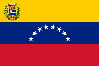
The Orinoco River is one of the longest rivers in South America at 2,140 kilometres (1,330 mi). Its drainage basin, sometimes known as the Orinoquia, covers 880,000 km2 (340,000 sq mi), with 76.3 percent of it in Venezuela and the remainder in Colombia. It is the third largest river in the world by discharge volume of water. The Orinoco River and its tributaries are the major transportation system for eastern and interior Venezuela and the llanos of Colombia. The environment in the Orinoco's basin is extremely diverse; it hosts a wide variety of flora and fauna.
In recreational mathematics, a Keith number or repfigit number is a number in the following integer sequence:

Amazonas State is one of the 23 states (estados) into which Venezuela is divided. It covers nearly a fifth of the area of Venezuela, but has less than 1% of Venezuela's population.

Sucre State is one of the 23 states of Venezuela. The state capital is Cumaná. Sucre State covers a total surface area of 11,800 km² and, as of the 2011 census, had a population of 896,921. The most important river in the state is the Manzanares River.

The Apure River is a river of southwestern Venezuela, formed by the confluence of the Sarare and Uribante near Guasdualito, in Venezuela, at 7°15′N70°40′W, and flowing across the llanos into the Orinoco. It provides significant transportation in the area.
The Cuyuni River is a South American river and a tributary of the Essequibo River. It rises in the Guiana Highlands of Venezuela where it descends northward to El Dorado, and turns eastward to meander through the tropical rain forests of Guyana. It finally turns southeastward, flowing to its confluence with the Mazaruni River. The Cuyuni River marks the limit of the disputed territory of Guayana Esequiba for approximately 100 kilometres (62 mi).

La Tortuga Island is an uninhabited island of Venezuela, the largest in the Federal Dependencies of Venezuela. It is part of a group of islands that include the Tortuguillos and Cayo Herradura. Isla La Tortuga has an area of 156 km2 (60 sq mi).
Lake Martin, located in St. Martin Parish, is a wildlife preserve and one of Louisiana's swamplands. The swamplands are home to a few trails as well as many different kinds of animals such as herons, egrets, ibis, bullfrogs, cottonmouths, alligators, and coypu (nutria) rats. Despite its classification as a wildlife reserve, however, there have been minor problems with litter and vandalism.

JeffVanderLou (JVL) is a neighborhood of St. Louis, Missouri. The neighborhood is situated between North Vandeventer Avenue on the northwest, Natural Bridge avenue on the northeast, North Jefferson Avenue on the East, Delmar Boulevard on the south, and North Compton Avenue and Martin Luther King Drive on the Southwest.

Cerro Marahuaca, also spelled Marahuaka, is a tepui in Amazonas state, Venezuela. It has an elevation of 2,832 metres (9,291 ft) above sea level and is the second-highest mountain of the entire Guayana Shield. Cerro Marahuaca shares a common base with the much larger Cerro Duida and together they form the Duida–Marahuaca Massif. Both tepuis are located entirely within the bounds of Duida–Marahuaca National Park.
Cuchivero River is a river of Venezuela. It is part of the Orinoco River basin.
Padamo River is a river of Venezuela. It is part of the Orinoco River basin.
Matacuni River is a river of Venezuela. It is part of the Orinoco River basin.
Mavaca River is a river of Venezuela. It is part of the Orinoco River basin.
Manaviche River is a river of Venezuela. It is part of the Orinoco River basin.

The Unare River is a river of Venezuela. It drains into the Caribbean Sea. In the 17th century the Dutch had a fort at the mouth of the river. It was constructed to protect their salt collection in the area. The other Dutch fort ever to stand on what is now Venezuelan soil stood on the little uninhabited islet La Tortuga, just west of Isla Margarita. It was built for the same reason as the one in Unare: to protect the salt harvesting activities of the Dutch. The Caribbean islands St. Maarten and Bonaire would subsequently satisfy the Dutch demand for salt.
Çeltek is a village in the district of Vezirköprü, Samsun Province, Turkey.
Big Prairie Township is an inactive township in New Madrid County, in the U.S. state of Missouri.
Dover Township is a township in Vernon County, in the U.S. state of Missouri.


