
Grassendale is a suburb of Liverpool, in Merseyside, England. It is located in the south of the city, bordered by Aigburth and Garston.

The Port of Liverpool is the enclosed 7.5 miles (12.1 km) dock system that runs from Brunswick Dock in Liverpool to Seaforth Dock, Seaforth, on the east side of the River Mersey and the Birkenhead Docks between Birkenhead and Wallasey on the west side of the river. The port was extended in 2016 by the building of an in-river container terminal at Seaforth Dock, name Liverpool2. The terminal can berth two 14,000 container Post-Panamax ships.
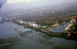
North Dock is a dock on the River Mersey at Garston, Liverpool, England. It is accessed from Old Dock, Garston, and is part of the Port of Garston. The direct curve from Allerton on the former St Helens and Runcorn Gap Railway opened on 1 January 1873 and the dock was completed in June 1875.

Stalbridge Dock is a dock on the River Mersey at Garston, Liverpool, England opened in February 1909. It has direct access to the River Mersey and provides access to Old Dock, Garston, and thence also to North Dock, Garston. It is part of the Port of Garston.

The Mersey Docks and Harbour Company (MDHC), formerly the Mersey Docks and Harbour Board (MDHB), owns and administers the dock facilities of the Port of Liverpool, on the River Mersey, England. These include the operation of the enclosed northern dock system that runs from Prince's Dock to Seaforth Dock, in the city of Liverpool and the dock facilities built around the Great Float of the Wirral Peninsula, located on the west side of the river.

Tranmere Oil Terminal is situated on the River Mersey, 1 1⁄2 mi (2.4 km) south of Birkenhead. It was opened on 8 June 1960 to handle vessels of up to 65,000 tons, and is connected to the Stanlow Oil Refinery by a 15 mi (24 km) pipeline. Part of the terminal occupies the site of a former ferry service to Liverpool, with the extant pier considerably modified.

The Port of Runcorn is in the town of Runcorn, Cheshire, England. It is situated to the west of a point where the River Mersey narrows, known as Runcorn Gap. Originally opening directly into the Mersey, with the building of the Manchester Ship Canal, it now links with this canal.
Cast Iron Shore was a name given to the banks of the Mersey in south Liverpool due to the presence of an iron foundry. St Michael's Church, opened in 1815, was known as the Cast Iron Church because of the extensive use of cast iron in its construction.

St Helens and Runcorn Gap Railway, later known as St Helens Railway, was an early railway company in Lancashire, England, which opened in 1833. It ran originally from the town of St Helens to the area which would later develop into the town of Widnes. Branches were opened to Garston, Warrington and Rainford. The company was taken over by the London and North Western Railway in 1864. The line from St Helens to Widnes and the branch to Rainford are now closed, the latter terminating at the Pilkington Glass' Cowley Hill works siding near Gerard's Bridge, but part of the lines to Garston and to Warrington are still in operation.
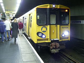
The Northern line is one of the two commuter rail lines operated by Merseyrail in Merseyside, England, with the Wirral line being the other. A third line, the City Line, is not owned or operated by Merseyrail. All three lines are funded by Merseytravel.
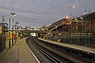
Brunswick railway station serves the Toxteth district of Liverpool, England, on the Northern Line of the Merseyrail network. The station serves the nearby district of Dingle and is situated on a short section of track between two tunnels, between the now in-filled Toxteth and Harrington Docks. The station also serves businesses on the Brunswick Dock estate. The residential area of Grafton Street is reached by steps or ramp from the southbound platform.
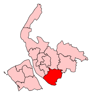
Garston and Halewood is a constituency created in 2010 represented in the House of Commons of the UK Parliament since 2010 by Maria Eagle of the Labour Party.

The Garston and Liverpool Railway line ran from the St Helens and Runcorn Gap Railway line at Garston Docks to Brunswick railway station, later to central Liverpool. The company was formed on 17 May 1861 and the line opened on 1 June 1864.
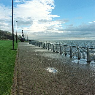
Otterspool Promenade is a riverside walk and accompanying area of parkland in the Aigburth and Grassendale districts of Liverpool, Merseyside, England. The promenade runs along the bank of the River Mersey from just north of Garston docks to Otterspool Park. A narrower footpath and cycleway continues along the riverbank to the city centre, ending at the Albert Dock. The promenade adjoins the former private parkland estates of Cressington Park, Fulwood Park and Grassendale Park. It is notable for the excellent views it gives of shipping in the Mersey and over the river to the Wirral.
Speke and Garston Coastal Reserve is a park in south Liverpool, Merseyside, England. It was developed on part of the former site of Liverpool John Lennon Airport.

The Mersey and Irwell Navigation was a river navigation in North West England, which provided a navigable route from the Mersey estuary to Salford and Manchester, by improving the course of the River Irwell and the River Mersey. Eight locks were constructed between 1724 and 1734, and the rivers were improved by the construction of new cuts several times subsequently. Use of the navigation declined from the 1870s, and it was ultimately superseded by the Manchester Ship Canal, the construction of which destroyed most of the Irwell section of the navigation and the long cut between Latchford and Runcorn.
New Heys Comprehensive School or New Heys Community College was an English comprehensive school in Liverpool specialising within Business.
Old Dock was the world's first commercial wet dock, built on the River Mersey in Liverpool, England.
The Old Garston River or Garston River, sometimes referred to as the Garston Brook, is a tributary of the River Mersey in Garston, Merseyside, a district of Liverpool. Having been encroached upon by urban development, it is now a subterranean river, culverted for all of its length, although unlike many culverted urban rivers it has not been incorporated into the sewer system.


