Old Plank Road Trail may refer to:
- Old Plank Road Trail (Wisconsin), a trail in Fond du Lac County and Sheboygan County in Wisconsin
- Old Plank Road Trail (Illinois), a trail in Cook County and Will County in Illinois
Old Plank Road Trail may refer to:
Sauk may refer to:

Frankfort is a village in Will County and Cook County in the U.S. state of Illinois. It is a southern suburb of Chicago, and is approximately 28 miles south of the city. As of the 2020 census, the population was 20,296.

The Rock River is a tributary of the Mississippi River, approximately 299 miles (481 km) long, in the U.S. states of Wisconsin and Illinois. The river was known as the Sinnissippi to Sauk and Meskwaki Native Americans; the name means "rocky waters".

US Highway 16 (US 16), also called Grand River Avenue for much of its length in the state, was one of the principal roads prior to the post-World War II construction of freeways in the state of Michigan. Before the creation of the United States Numbered Highway System in 1926, the highway had been designated as a state highway numbered M-16. The modern route of Grand River Avenue cuts across the Lower Peninsula in a northwest–southeast fashion from near Grand Rapids to Detroit. Before the late 1950s and early 1960s, US 16 followed other roads between Muskegon and Grand Rapids, and then Grand River Avenue through Lansing to Detroit. In the years immediately preceding the creation of the Interstate Highway System, US 16 was shifted from older roads to newer freeways. Later, it was co-designated as an Interstate. When the gap in the freeway was filled in around Lansing, the US 16 designation was decommissioned in the state. The freeway was solely designated Interstate 96 (I-96) east of Grand Rapids and I-196 west of that city.

A plank road is a road composed of wooden planks or puncheon logs. Plank roads were commonly found in the Canadian province of Ontario as well as the Northeast and Midwest of the United States in the first half of the 19th century. They were often built by turnpike companies.

The Chicago and North Western was a Class I railroad in the Midwestern United States. It was also known as the "North Western". The railroad operated more than 5,000 miles (8,000 km) of track at the turn of the 20th century, and over 12,000 miles (19,000 km) of track in seven states before retrenchment in the late 1970s. Until 1972, when the employees purchased the company, it was named the Chicago and North Western Railway.
A Beltline is a short-line railway operating in and around a city, principally to transfer freight between long-haul railroads and/or other modes of transportation. The term may also refer to:
Batavia may refer to:
The Grand Illinois Trail is a multipurpose recreational trail in the northern part of the U.S. state of Illinois. At over 575 miles (925 km) in length, it is the longest trail in Illinois. Parts of it are in the coast-to-coast American Discovery Trail.

The Ozaukee - Sheboygan Interurban Trail is a roughly 40-mile (64 km) long rail trail in Ozaukee, and Sheboygan Counties, in Wisconsin. The south end of the trail is in Milwaukee County but only runs 1 mile through the county.

Ulao, Wisconsin is an unincorporated community in the Town of Grafton in Ozaukee County, Wisconsin, United States. It is located at the intersection of Ulao Road and the old Chicago and Northwestern railroad running from Milwaukee to Green Bay. Today, I-43 runs a few hundred feet to the west of the town. The Ulao Creek flows through the community.

The Wisconsin and Calumet Railroad was a Class III shortline railroad that operated in the southern portion of Wisconsin and northern portion of Illinois from 1985 until 1997.

Copper Falls State Park is a 3,068-acre (1,242 ha) state park in Wisconsin. The park contains a section of the Bad River and its tributary the Tylers Forks, which flow through a gorge and drop over several waterfalls. Old Copper Culture Indians and later European settlers mined copper in the area. The state park was created in 1929 and amenities were developed by the Civilian Conservation Corps and the Works Progress Administration. In 2005 the park was listed on the National Register of Historic Places as a site with 10 contributing properties.

The Old Plank Road Trail is a 22-mile (35 km) long public rail trail in Cook County and Will County within the U.S. state of Illinois. It stretches westward from Chicago Heights to Joliet, serving fast-growing suburbs such as Frankfort and New Lenox.

The Sauk Trail was originally a Native American trail running through what are present-day Illinois, Indiana and Michigan in the United States. From west to east, the trail ran from Rock Island on the Mississippi River to the Illinois River near modern Peru then along the north bank of that river to Joliet, and on to Valparaiso, Indiana. Then it ran northeasterly to La Porte and into southern Michigan running through Niles, Sturgis, Ypsilanti, and ending at the Detroit River near Detroit.
The Galena–Chicago trail was a stagecoach route located in northern Illinois that ran from the mid-to-late 1830s until 1854. As indicated by its name, the route linked Chicago, located in the northeast of the state, with Galena which was located in the lead mining district of the northwest. The Chicago-Galena trail includes the "Stagecoach Trail" that runs between Galena and Lena, Illinois. East of Lena the stage route follows U.S. Route 20 and Business U.S. Route 20 through Eleroy, Freeport and Rockford to Belvidere. This road began as the old State Road number 2 established on 15 January 1836 and laid out by June 1837.

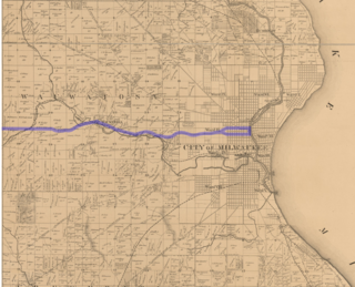
The Milwaukee–Watertown Plank Road, known more commonly in the modern era as the Watertown Plank Road, was a plank road important to the early development of southeastern Wisconsin, especially to its terminal cities Milwaukee and Watertown, in the period shortly after statehood. Construction began in 1848 and it was completed in 1853.

The Wisconsin State Trunk Highway System is the state highway system of the U.S. state of Wisconsin, including Wisconsin's segments of the Interstate Highway System and the United States Numbered Highway System, in addition to its other state trunk highways. These separate types of highways are respectively designated with an I-, US, or STH- prefix. The system also includes minor roads designated as Scenic Byways, four routes intended to promote tourism to scenic and historic areas of the state; and as Rustic Roads, lightly traveled and often unpaved local roads which the state has deemed worthy of preservation and protection. The state highway system, altogether totaling 11,753 miles (18,915 km) across all of Wisconsin's 72 counties, is maintained by the Wisconsin Department of Transportation (WisDOT).
The Old Plank Road Trail is a 37.6-mile (60.5 km) shared-use path in Fond du Lac County and Sheboygan County in Wisconsin. It runs for approximately 21 miles (34 km) in Sheboygan County before entering Fond du Lac County, bordering Wisconsin Highway 23 (WIS 23) the entire way.