
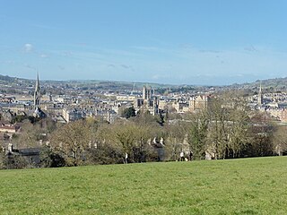
Bath is a city in the ceremonial county of Somerset, in England, known for and named after its Roman-built baths. At the 2021 Census, the population was 94,092. Bath is in the valley of the River Avon, 97 miles (156 km) west of London and 11 miles (18 km) southeast of Bristol. The city became a UNESCO World Heritage Site in 1987, and was later added to the transnational World Heritage Site known as the "Great Spa Towns of Europe" in 2021. Bath is also the largest city and settlement in Somerset.

Somerset is a ceremonial county in South West England. It is bordered by the Bristol Channel, Gloucestershire, and Bristol to the north, Wiltshire to the east and the north-east, Dorset to the south-east, and Devon to the south-west. The largest settlement is the city of Bath, and the county town is Taunton.
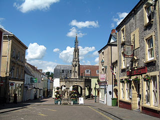
Shepton Mallet is a market town and civil parish in Somerset, England, some 16 miles southwest of Bath, 18 miles south of Bristol and five miles east of Wells. It had an estimated population of 10,810 in 2019. Mendip District Council was based there. The Mendip Hills lie to the north and the River Sheppey runs through the town, as does the route of the Fosse Way, the main Roman road between north-east and south-west England. There is evidence of Roman settlement. Its listed buildings include a medieval parish church. Shepton Mallet Prison was England's oldest, but closed in March 2013. The medieval wool trade gave way to trades such as brewing in the 18th century. It remains noted for cider production. It is the closest town to the Glastonbury Festival and nearby the Royal Bath and West of England Society showground.

Hounslow is a large suburban district of West London, England, 10+3⁄4 miles west-southwest of Charing Cross. It is the administrative centre of the London Borough of Hounslow, and is identified in the London Plan as one of the 14 metropolitan centres in Greater London.

Mere is a market town and civil parish in Wiltshire, England. It lies at the extreme southwestern tip of Salisbury Plain, close to the borders of Somerset and Dorset. The parish includes the hamlets of Barrow Street, Burton, Charnage, Limpers Hill, Rook Street and Southbrook.
Bath and North East Somerset (B&NES) is a unitary authority district in Somerset, South West England. Bath and North East Somerset Council was created on 1 April 1996 following the abolition of the county of Avon. It is part of the ceremonial county of Somerset.
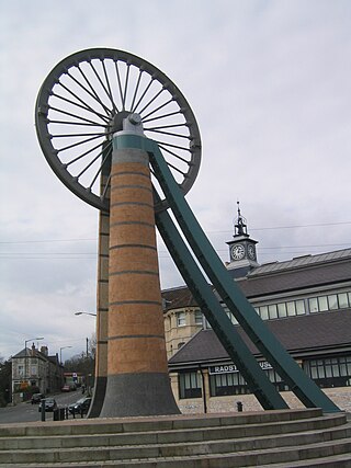
Radstock is a town and civil parish on the northern slope of the Mendip Hills in Somerset, England, about 9 miles (14 km) south-west of Bath and 8 miles (13 km) north-west of Frome. It is within the area of the unitary authority of Bath and North East Somerset. The Radstock built-up area had a population of 9,419 at the 2011 Census.

Midsomer Norton is a town near the Mendip Hills in Bath and North East Somerset, England, 10 miles (16 km) south-west of Bath, 10 miles (16 km) north-east of Wells, 10 miles (16 km) north-west of Frome, 12 miles (19 km) west of Trowbridge and 16 miles (26 km) south-east of Bristol. It has a population of around 13,000. Along with Radstock and Westfield it used to be part of the conurbation and large civil parish of Norton Radstock, but is now a town council in its own right. It is also part of the unitary authority of Bath and North East Somerset.
Chew Stoke is a small village and civil parish in the affluent Chew Valley, in Somerset, England, about 8 miles (13 km) south of Bristol and 10 miles north of Wells. It is at the northern edge of the Mendip Hills, a region designated by the United Kingdom as an Area of Outstanding Natural Beauty, and is within the Bristol and Bath green belt. The parish includes the hamlet of Breach Hill, which is approximately 2 miles (3.2 km) southwest of Chew Stoke itself.

Avon and Somerset Police is the territorial police force responsible for law enforcement in the five unitary authority areas of Bristol, Bath and North East Somerset, North Somerset, Somerset, and South Gloucestershire, all in South West England.
Monkton Combe is a village and civil parish in north Somerset, England, 3 miles (4.8 km) south of Bath. The parish, which includes the hamlet of Tucking Mill, had a population of 554 in 2013. It was formerly known as Combe, owing to its geography, while it was also known as Monckton Combe and Combe Monckton until last century.

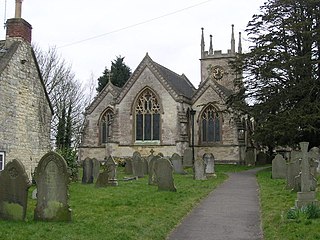
Paulton is a large village and civil parish, with a population of 5,302, located to the north of the Mendip Hills, very close to Norton Radstock in the unitary authority of Bath and North East Somerset (BANES), England.
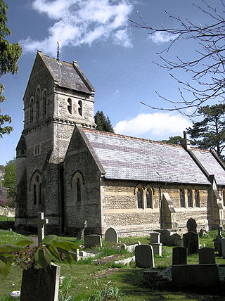
Camerton is a village and civil parish in Somerset, 6 miles (9.7 km) south west of Bath, lying on the Cam Brook. The parish has a population of 655.

Freshford is a village and civil parish in the Avon valley 6 miles (10 km) south-east of Bath, in the county of Somerset, England. The parish has a population of 551. It is in the Cotswolds Area of Outstanding Natural Beauty (AONB), within the Green Belt and is in a conservation area.

Compton Martin is a small village and civil parish within the Chew Valley in Somerset and in the Bath and North East Somerset unitary authority in England. The parish has a population of 508. It lies between Chew Valley Lake and Blagdon Lake, north of the Mendip Hills, approximately 10 miles (16 km) south of Bristol on the A368 road Weston-super-Mare to Bath, between Blagdon and West Harptree.
Claverton is a small village and civil parish about 2 miles (3 km) east of Bath at the southern end of the Cotswolds Area of Outstanding Natural Beauty, in Somerset, England. The parish has a population of 115.
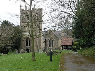
Timsbury is a village and civil parish in England, in the Bath and North East Somerset unitary authority of the county of Somerset. It lies 8 miles (13 km) south-west of Bath, close to the Cam Brook river. The parish, which includes the hamlets of Radford and Wall Mead, and part of Meadgate hamlet, had a population of 2,624 in 2011.

The Grade I listed buildings in Somerset, England, demonstrate the history and diversity of its architecture. The ceremonial county of Somerset consists of a non-metropolitan county, administered by Somerset County Council, which is divided into five districts, and two unitary authorities. The districts of Somerset are West Somerset, South Somerset, Taunton Deane, Mendip and Sedgemoor. The two administratively independent unitary authorities, which were established on 1 April 1996 following the breakup of the county of Avon, are North Somerset and Bath and North East Somerset. These unitary authorities include areas that were once part of Somerset before the creation of Avon in 1974.
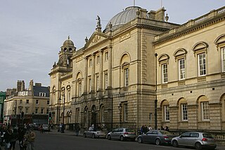
Guildhall is an 18th-century municipal building in central Bath, Somerset, England. It is a Grade I listed building.

The Empire Hotel in Bath, Somerset, England, was built in 1901 and has been designated as a Grade II listed building. It is situated on Orange Grove close to both Bath Abbey and Pulteney Bridge and adjacent to the Old Police Station.

 Part of the interior, pictured in 2024