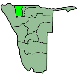
Oshana is one of the fourteen regions of Namibia, its capital is Oshakati. The name Oshana describes the most prominent landscape feature in the area, namely the shallow, seasonally inundated depressions which underpin the local agro ecological system. Although communications are hindered during the rainy season, the fish which breed in the oshanas provide an important source of dietary protein.

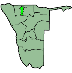
Elim is a village in the north-east of the Republic of Namibia. It is the district capital of the Elim Constituency in the administrative Omusati Region. It is situated in a formerly forested area that has largely been converted into agricultural grassland.
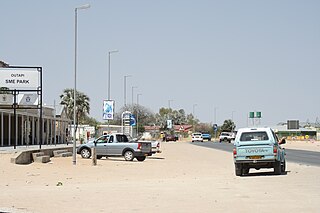
Ruacana is a town in Omusati Region, northern Namibia and the district capital of the Ruacana electoral constituency. It is located on the border with Angola on the river Kunene. The town is known for the picturesque Ruacana Falls nearby, and for the Ruacana Power Station.
Articles related to Namibia include:
Jhonny Haikella Hakaye is a Namibian politician. A member of the South West Africa People's Organization (SWAPO), Hakaye was first elected to the National Council in 1993. He is the Chief Whip for SWAPO in the National Council.

The 2009 Angola, Namibia and Zambia floods was a natural disaster which began in early March 2009 and resulted in the deaths of at least 131 people and otherwise affected around 445,000 people. The floods affected seven regions of Namibia, three provinces of Zambia, two regions of Angola and part of Botswana. The floodwaters damaged buildings and infrastructure and displaced at least 300,000 people. A state of emergency was declared in northern Namibia and there were fears that a disease epidemic would ensue. The Red Cross agencies and governments of the two countries responded to the disaster, and aid was distributed by the World Health Organization.
Oshikuku is a town in Omusati Region in the north of Namibia. It is the district capital of Oshikuku Constituency.
Okahao is a town in the Omusati Region of northern Namibia and the district capital of the Okahao electoral constituency. It is situated in the Ongandjera tribal area 73 kilometres (45 mi) west of Oshakati on the main road MR123.
Tsandi is a village in the Omusati Region of northern Namibia and the district capital of the Tsandi electoral constituency. It is situated on the main road MR123.

Anamulenge Constituency is an electoral constituency in the Omusati Region of Namibia. It has 12,470 inhabitants, its district capital is the settlement of Anamulenge.

Etayi Constituency is an electoral constituency in the Omusati Region of Namibia. It has 34,970 inhabitants, its district capital is the settlement of Etayi. The constituency contains the settlements of Iipandayamiti, Oneheke, Onheleiwa, Otindi, Ekangolinene, Oshivanda, Onamhindi, Omutundungu, Olupandu, Onampira, Oshipya, and Oikokola.
Ogongo Constituency is a electoral constituency in the Omusati Region northern part of Namibia. It has 18,498 inhabitants, its district capital is the settlement of Ogongo. The constituency further contains the settlements of Eengolo, Eendombe, Pyamukuyu, Iipanda, Ombathi, and Omuthitu.

Okalongo Constituency is an electoral constituency in the Omusati Region of Namibia on the border to Angola. It has 28,657 inhabitants. The constituency's capital is the settlement of Okalongo. It further contains villages such as: Onandjaba, Omatwadiva, Onaidjimba, Okafitu Kauvale, Olwiili, Ongolo, Ondudu, Onembaba, Ondobe Yehumba, Ondobe Yefidi, Ohakapeke, Olupandu, Epoko, Olupito, Onambome and many more.

Ruacana Constituency is an electoral constituency in the Omusati Region of Namibia on the border to Angola. It has 10,722 inhabitants, its district capital is the settlement of Ruacana.
Shikongo Iipinge Senior Secondary School is a school in Tsandi in the Omusati Region in Namibia. Currently it has 442 students and 20 teachers. It was founded by Chris Iipinge, circuit inspector and first principal of the school, in 1985.
Nakayale, also known as Nakayale Keengulu is a village in northern Namibia near Outapi in Omusati Region situated 86km northwest of Oshakati and 4km from Outapi. It is in Anamulenge Constituency. The village normally receives an annual average rainfall of 440 millimetres (17 in), although in the 2010/2011 rainy season 723 millimetres (28.5 in) were measured.