
The Mackenzie River is a river in the South Island of New Zealand.
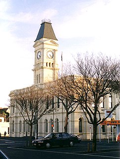
Waitaki District is a territorial authority that is located in the Canterbury and Otago regions of the South Island of New Zealand, and it straddles the traditional border between the two regions, the Waitaki River.
The Shag River is located in Otago in the South Island of New Zealand. It rises in the Kakanui Range, flowing southeast for 50 kilometres (31 mi) before reaching the Pacific Ocean on the south side of Shag Point east of Palmerston. The Dunback Branch railway that operated from the 1880s to 1989 largely followed the route of the river from its junction with the Main South Line near Shag Point township to its terminus in Dunback.
The Hakataramea River flows generally south through the Hakataramea Valley, which is separated from the more inland Mackenzie Basin by the Kirkliston Range in Canterbury, New Zealand.
The Grays River is a tributary of the Tekapo River in the Mackenzie Basin of New Zealand. It flows southwest for 25 kilometres (16 mi), joining the larger river southeast of Lake Pukaki.
The Murchison Glacier is an 18-kilometre (11 mi) long glacier flowing through Aoraki/Mount Cook National Park in the South Island of New Zealand. Lying to the east of the Malte Brun range and west of the Liebig Range, high in the Southern Alps, it flows from the Tasman Saddle at 2,435 m mostly southwestwards to around 1,110 m. The Murchison River, which takes its meltwater, flows under the larger Tasman Glacier to the south.

Tărtășești is a commune in the Dâmbovița County, southern Romania, located 30 kilometres (19 mi) northwest of Bucharest. It has a population of 5,121. It is composed of three villages: Bâldana, Gulia and Tărtășești.
The St Matthias Islands are a small archipelago group of islands in the Bismarck Archipelago, in northern Papua New Guinea. They are within New Ireland Province.

Lowcliffe is a lightly populated locality in the mid-Canterbury region of New Zealand's South Island. It is situated on the shore of the Pacific Ocean between the mouths of the Hinds and Rangitata Rivers. Nearby settlements include Coldstream to the west by the Rangitata River, Longbeach to the east on the other side of the Hinds River's mouth, and Hinds to the north. The closest towns of significant size are Ashburton to the northeast and Geraldine to the west.

The Huxley River is in the South Island of New Zealand. It feeds into the Hopkins River which in turn feeds into Lake Ohau.
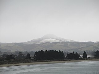
Mount Watkin/Hikaroroa is a 616-metre peak located north-west of Waikouaiti, Otago, New Zealand. It is on the east side of the North Branch of the Waikouaiti River.
The Kauru River is a river of North Otago, New Zealand. A tributary of the Kakanui River, it rises in the east of the Kakanui Mountains and flows into that river west of Kia Ora.
The Potts River is a river of the Canterbury Region of New Zealand's South Island. It flows generally south from the southern end of the Arrowsmith Range through a steep-sided valley between the Potts Range to the west and the Big Hill Range to the east.
The Sinclair River is a river of the Canterbury Region of New Zealand's South Island. It flows south from the Jollie Range and is one of the headwaters of the Clyde River, part of the upper Rangitata River system.
The Te Naihi River is a river of the Otago region of New Zealand's South Island. It flows generally northwest to reach the Waiatoto River 35 kilometres (22 mi) southwest of Haast. Much of the river's length is within Mount Aspiring National Park.
The Thurso River is a river in northern Fiordland, New Zealand. It rises west of Mount Pembroke and flows westward into the Tasman Sea north of Milford Sound.
The Tongaporutu River is a river of the Taranaki Region of New Zealand's North Island. It initially flows north from its origins near Tahora, turning west to reach the Tasman Sea coast close to the settlement of Tongaporutu, 15 kilometres south of Mokau.
The Willberg River is a river of the West Coast Region of New Zealand's South Island. It initially flows northwest before turning southwest, reaching the Poerua River 12 kilometres south of Harihari.

Kukri Hills is a prominent east-west trending range, about 25 nautical miles (46 km) long and over 2,000 metres (6,600 ft) high, forming the divide between Ferrar Glacier on the south and Taylor Glacier and Taylor Valley on the north, in Victoria Land, Antarctica.
Mount Edixon is a mountain, 2,080 metres (6,820 ft) high, located 6 nautical miles (11 km) southeast of Bowers Peak in the Lanterman Range, Bowers Mountains of Victoria Land, Antarctica. The topographical feature was so named by the northern party of the New Zealand Geological Survey Antarctic Expedition, 1963–64, for Lieutenant Commander James R. Edixon, a pilot with U.S. Navy Squadron VX-6, who, with considerable willingness and skill, was responsible for the expedition's air support. The mountain lies situated on the Pennell Coast, a portion of Antarctica lying between Cape Williams and Cape Adare.


