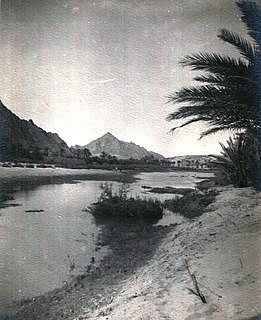
Oued Jeneien

Last updated

Oued Jeneien is a wadi of Taţāwīn, Tunisia. [1] It is also known as Wādī al Janā’in, and Oued Djeneien. [2] [3] in the far south of the country.
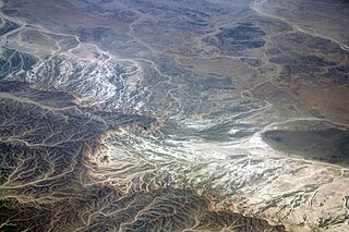
Wadi River valley, especially a dry (ephemeral) riverbed that contains water only during times of heavy rain

Wadi, alternatively wād, is the Arabic term traditionally referring to a valley. In some instances, it may refer to a dry (ephemeral) riverbed that contains water only when heavy rain occurs.

Tataouine Governorate Governorate in Tunisia

Tataouine Governorate is the southernmost of the twenty-four governorates of Tunisia, the only one to border Algeria and Libya. It is also the largest in covering an area of 38,889 km² and has a population of 149,453, nearly tied for second least-populated with Kebili (156,961) after Tozeur (107,912). The capital is Tataouine.

Tunisia Country in Northern Africa

Tunisia, officially the Republic of Tunisia, is a country in the Maghreb region of North Africa, covering 163,610 square kilometres. Its northernmost point, Cape Angela, is the northernmost point on the African continent. It is bordered by Algeria to the west and southwest, Libya to the southeast, and the Mediterranean Sea to the north and east. Tunisia's population was 11.435 million in 2017. Tunisia's name is derived from its capital city, Tunis, which is located on its northeast coast.

The wadi is at Latitude 31°39'55.47", Longitude: 9°49'10.16" and 273 meters above Sea level. The wadi is an internal stream flowing, and dissipating into the Sahara rather than flowing into the Mediterranean [4] The wadi is near the settlements of Gara M'hamed Ali and Tarfa. [5]

Latitude The angle between zenith at a point and the plane of the equator

In geography, latitude is a geographic coordinate that specifies the north–south position of a point on the Earth's surface. Latitude is an angle which ranges from 0° at the Equator to 90° at the poles. Lines of constant latitude, or parallels, run east–west as circles parallel to the equator. Latitude is used together with longitude to specify the precise location of features on the surface of the Earth. On its own, the term latitude should be taken to be the geodetic latitude as defined below. Briefly, geodetic latitude at a point is the angle formed by the vector perpendicular to the ellipsoidal surface from that point, and the equatorial plane. Also defined are six auxiliary latitudes which are used in special applications.

Longitude A geographic coordinate that specifies the east-west position of a point on the Earths surface

Longitude, is a geographic coordinate that specifies the east–west position of a point on the Earth's surface, or the surface of a celestial body. It is an angular measurement, usually expressed in degrees and denoted by the Greek letter lambda (λ). Meridians connect points with the same longitude. By convention, one of these, the Prime Meridian, which passes through the Royal Observatory, Greenwich, England, was allocated the position of 0° longitude. The longitude of other places is measured as the angle east or west from the Prime Meridian, ranging from 0° at the Prime Meridian to +180° eastward and −180° westward. Specifically, it is the angle between a plane through the Prime Meridian and a plane through both poles and the location in question.

Sea level Average level for the surface of the ocean at any given geographical position on the planetary surface

Mean sea level (MSL) is an average level of the surface of one or more of Earth's oceans from which heights such as elevation may be measured. MSL is a type of vertical datum – a standardised geodetic datum – that is used, for example, as a chart datum in cartography and marine navigation, or, in aviation, as the standard sea level at which atmospheric pressure is measured to calibrate altitude and, consequently, aircraft flight levels. A common and relatively straightforward mean sea-level standard is the midpoint between a mean low and mean high tide at a particular location.

Related Research Articles

Tan-Tan Place in Guelmim-Oued Noun, Morocco

Tan-Tan is a city in Tan-Tan Province in the region of Guelmim-Oued Noun in southwestern Morocco. It is a desert town with a population of 73,209. It is the largest city in the province and second largest city in the region after the capital Guelmim. It is located on the banks of the wadi Oued Ben Jelil, which flows into the Draa River 15 km north of the town. The Draa River at 1,100 km is the longest in Morocco and flows into the Atlantic Ocean soon after the confluence with the wadi. The town also has an airport, Tan Tan Plage Blanche Airport.

Bay of Arguin

The Bay of Arguin is a bay on the Atlantic shore of Mauritania.

Medjerda River river

The Medjerda River, the classical Bagrada, is a river in North Africa flowing from northeast Algeria through Tunisia before emptying into the Gulf of Tunis and Lake of Tunis. With a length of 450 km (280 mi), it is the longest river of Tunisia. It is also known as the Wadi Majardah or Mejerha.

Djedi River river in Algeria

Djedi River or Djeddi River is a wadi in Algeria and one of the largest rivers of Sahara. It starts in the Saharan Atlas mountains, at elevation of about 1,400 meters (4,600 ft), flows for about 480 kilometers (300 mi) approximately from west to east, and discharges into Chott Melrhir lake at about –40 meters (130 ft) below mean sea level, which is the lowest point of Algeria. It is fed by rains and melting snow and has a permanent flow only in its upper part. The river rises on the southern slopes of Djebel Amour, near the town of Aflou, and feeds several date palm groves, such as the Laghouat oasis, which largely depend on this supply; water is also taken from numerous wells dug near the river. During the rain season in winter, the river helps to rise the water level of Chott Melrhir, and in summer, the lake and lower reaches of the river dry out. The river is up to several kilometers wide, but its banks are rarely covered with water. The river bed mostly consists of gypsum and mud and bears traces of erosion associated with the large variations of the flow. Although the soil in and around the river appears arable, it is barren due to the high concentration of salt. For the same reason, the soil absorbs much condensation overnight that keeps it partly humid during much of the day.

Wadi Abadilah Place in Fujairah, United Arab Emirates

WadiAbadilah is a wadi in Fujairah, United Arab Emirates which runs North East towards the coast at Dibba. At Masafi, it forms a confluence with the Wadi Ham, which runs South East towards the city of Fujairah.

Oued Saoura Intermittent river mainly in Béchar Province, Algeria

Oued Saoura is an intermittent river, or wadi, formed from the confluence of the Oued Guir and Oued Zouzfana at Igli, forming the Saoura valley. While in the past the flow of the river was steady and plentiful, in recent years it has diminished due to the construction of the Djorf Torba dam on the Oued Guir.

Oued Zouzfana Intermittent river in Morocco and Algeria

Oued Zouzfana is an intermittent river, or wadi, that flows through the Oriental region in southeastern Morocco and Béchar Province in southwestern Algeria.

Sebaiera, Uad Sebaiera or Zbayra is a hamlet and wadi(Arabic for valley) in Western Sahara in Oued Ed-Dahab Province in the region of Dakhla-Oued Ed-Dahab on the Moroccan side of the wall in Western Sahara. There is an astronomical station there but it is very small and a few tiny shacks that seem to be permanently inhabited and nomads seasonally settle in Sebaiera. It is located in a wadi(valley) called Oued Zbayra and ephemeral river called Oued Zbayra. The structures in this hamlet are so tiny and utterly unassuming that they are not visible on Google Maps and the nomad's tents are only seasonal and also tiny so it is unlikely Google Maps ever shows them. Its elevation is 220 meters. It lies 104 kilometers east of Chalwa(Cnalwa) and is reachable only by jeep or dirt road.

Oued Beni Barbar is a wadi in Algeria. It is in the Nemencha area of the sahel, a semi-arid region north of the Sahara and is near Seiar and Bled Izaouene. Its headwater is in Djebel Metred and Djebel Moussa. The river has an average elevation of 81 metres (266 ft) above sea level. The wadi is named for the Beni Barbar tribe who invaded and settled the area in the Middle Ages. The Oued is a ravine, delimited by relatively strong banks, which in the rainy season becomes a stream.

Ksar-Bou-Saïd is a village in Tunisia on the wadi Oued Bou Saïd south of Tataouine, in the Sahel semi-arid region bordering the Sahara.

Oued Zeroud watercourse in Tunisia

Zeroud Oued is a stream in central Tunisia at Latitude, it flows via Sebkhet Cherita Lake, into the Mediterranean Sea at the Gulf of Hammamet.

Gara M'hamed Ali is a hill in Taţāwīn, Tunisia.

Borj Gourbata

Borj Gourbata was an ancient Roman-Berber town in Qafşah, Tunisia. It is located at latitude 34°16'22.01", longitude 8°32'56" and 135 meters above sea level. The town is in the Sahel region of Tunisia, but at the junction of the Oued ech Cheria and the Oued el Jemel Wadis, making it an important Oasis in the Sahara. It is situated between Gafsa and Chott el Jerid.

Oued Sidi Salah is a wadi of eastern Tunisia. It rises in the hinterland behind the city of Sfax and empties into the Chott El Merdasia near Sidi Mansour, on the Mediterranean coast. The wadi takes its name from Dar Mahommed Salah which it flows past.

Oued es Segui is a wadi in Tunisia and is nearby to Henchir el Adame Bou Krelal, Henchir el Haramine and Henchir Bou Zaïane. Oued es Segui is also close to Oued er Rebaï river and Enfidete Djibinia ech Chott.

Oued El Abid

Oued El Abid is a wadi in the north-east of Tunisia.

The Oued El Abid River is a river in Morocco, near Douar El. The El-Abid River is at Latitude33°7'12.8" (33.1202°)n and Longitude8°6'2.5"(8.1007°)w and has an average elevation of 40 metres (130 ft) above sea level. It rises in the High Atlas Mountains and enters the Atlantic Ocean at Azemmour west of Casablanca.

Bou Sellam River

The Bou Sellam River is a river of the Maghreb region in Algeria, in Bordj Bou Arréridj Province.

The Oued Isser is a river of Algeria. It begins in Médéa Province, is the main river, with Oued Sébaou of the Medea, which runs through the Lower Kabylie of Djurdjura Wilaya of Bouira, then flows into the Mediterranean near the coastal town of Djinet in Lower Kabylia, attached to the province of Boumerdes.

References

  1. Rand McNally, The New International Atlas,1993.
  2. http://mapcarta.com/fr/17286050 Oued Jeneien ] at mapcarta.com.
  3. Oued Jeneien at getamap.net.
  4. Oued Jeneien at geoview.info.
  5. Oued Jeneien at aroundguides.com.