
Wadi, alternatively wād, North African Arabic Oued, is the Arabic term traditionally referring to a valley. In some instances, it may refer to a wet (ephemeral) riverbed that contains water only when heavy rain occurs.
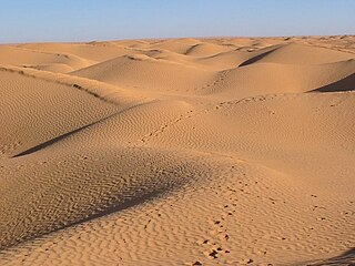
The Grand Erg Oriental is a large erg or "field of sand dunes" in the Sahara Desert. Situated for the most part in Saharan lowlands of northeast Algeria, the Grand Erg Oriental covers an area some 600 km wide by 200 km north to south. The erg's northeastern edge spills over into neighbouring Tunisia.

Zeribet El Oued is a city in Biskra Province, Algeria. In 2007, its population was recorded as 25.613. It is located at 80 km east of Biskra at the foot of the Aurès mountains.

The North Saharan steppe and woodlands is a desert ecoregion, in the deserts and xeric shrublands biome, that forms the northern edge of the Sahara. It extends east and west across Northern Africa, south of the Mediterranean dry woodlands and steppe ecoregion of the Maghreb and Cyrenaica, which is part of the Mediterranean forests, woodlands, and scrub biome. Winter rains sustain shrublands and dry woodlands that form an ecotone between the Mediterranean climate regions to the north and the hyper-arid Sahara Desert ecoregion to the south.

The Saquia el-Hamra is a wadi and intermittent river which rises in the northeast of Western Sahara, some 30 kilometres (19 mi) southeast of Farsia. The wadi continues west, passing close to Haouza and Smara before joining with the intermittent Oued el Khatt just south of Laayoune on the Atlantic coast. The wadi gives its name to the Saquia el-Hamra region.
Tissint is a small town near Tata, Morocco in Tata Province in the Souss-Massa region of Morocco. It has a population of 9,927 as of 2004.

Oued Saoura is an intermittent river, or wadi, formed from the confluence of the Oued Guir and Oued Zouzfana at Igli, forming the Saoura valley. While in the past the flow of the river was steady and plentiful, in recent years it has diminished due to the construction of the Djorf Torba dam on the Oued Guir.
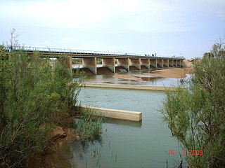
Oued Guir is an intermittent river or wadi that flows through the Drâa-Tafilalet and Oriental regions in southeastern Morocco and Béchar Province in western Algeria.
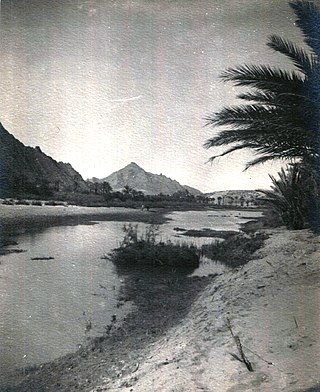
Oued Zouzfana is an intermittent river, or wadi, that flows through the Oriental region in southeastern Morocco and Béchar Province in southwestern Algeria.
Mechtat el Mehedia is a village in Djidioua commune, Relizane Province, Algeria. the village is located on the Plaine du Cheliff on the left (west) bank of the Oued Ang el Djemel, an intermittent tributary of the Chelif River.
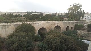
The Meliane River, also known as Oued Miliane is a wadi that flows into the Gulf of Tunis located in the North Eastern coast of Tunisia.

Oued el Melah or Wadi el Melah is an intermittent wadi of Tunisia whose course is located on the territory of the governorates of Gafsa and Tozeur. Generally dry, except when it rains, the wadi has its mouth in Chott el-Gharsa.
Oued es Segui is a wadi in Tunisia and is nearby to Henchir el Adame Bou Krelal, Henchir el Haramine and Henchir Bou Zaïane. Oued es Segui is also close to Oued er Rebaï river and Enfidete Djibinia ech Chott.

Oued El Abid is a wadi in the north-east of Tunisia.
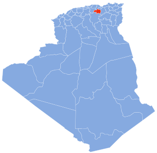
The Bou Sellam River is a river of the Maghreb region in Algeria, in Bordj Bou Arréridj Province.
The Oued Isser is a river of Algeria. It begins in Médéa Province, is the main river, with Oued Sébaou of the Medea, which runs through the Lower Kabylie of Djurdjura Wilaya of Bouira, then flows into the Mediterranean near the coastal town of Djinet in Lower Kabylia, attached to the province of Boumerdes.
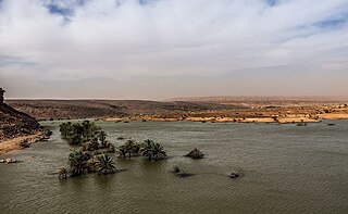
Oued Seguellil is a wadi in Mauritania. It begins in the Adrar Plateau and runs south-west passing through the town of Atar and getting lost in the surrounding sands.

Oued el Maleh, Oued el Malah, Wadi el Maleh, etc. is a wadi in Aïn Témouchent Province, Algeria. The name literally means "Salty Wadi". It was known in the past in Spanish as Rio Salado or "Salty River".

The glossary of Arabic toponyms gives translations of Arabic terms commonly found as components in Arabic toponyms. A significant number of them were put together during the PEF Survey of Palestine carried out in the second half of the 19th century.