Mad, mad, or MAD may refer to:
PLN or pln or variation, may refer to:
Gangtok District is an administrative district of the Indian state of Sikkim. It was renamed in 2021 as a result of administrative reorganisation of the state, which also saw three subdivisions of the East Sikkim district spawned off as a separate Pakyong district.

Singtam is a town which lies mostly in Gangtok District and partly in Pakyong District in the Indian state of Sikkim about 30 kilometres (19 mi) from the state capital Gangtok. The town lies on the banking of the rivers Teesta and Ranikhola, which join together just below the town. NH10 and NH510 meet in Singtam. The Indreni Bridge and Sherwani Bridge over the river Teesta are in the town. Singtam District Hospital, the district hospital of Pakyong District, lies at Golitar, Singtam.

Pakyong is a city and district headquarters of Pakyong district in the Indian state of Sikkim, located in the foothills of the Himalayas. Pakyong Airport is the only airport of Sikkim, which is not operational. The "National Research Centre for Orchids" is also located here.
A myr is a unit of time, one million years, used in astronomy, geology and biology.
Ranipool is a small suburban town located in the bank of river Ranikhola at the junction of National Highway 10 and National Highway 717A in Gangtok District of the Indian state of Sikkim. It is 12 km before from Gangtok capital. It has three roads which lead to Singtam, Pakyong and Gangtok. It falls under the Gangtok Municipal Corporation. It is named after the Bridge which Connects the National highway to Gangtok and holds quite a significant role in traffic communications.
Pakyong Airport is a non-operational domestic airport near Gangtok, the capital of Sikkim, India.

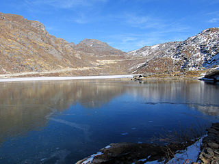
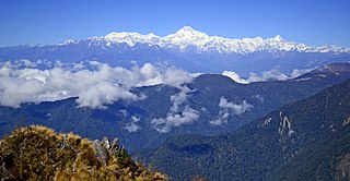
Dzuluk or Zuluk or Jhuluk or Jaluk is a small hamlet located at a height of 9,400 feet (2,900 m) on the rugged terrain of the lower Himalayas in Rongli Subdivision of Pakyong District, which lies in the Indian state Sikkim. This place is relatively an emerging and offbeat destination in Sikkim. Today it is a tourist destination for the view of the eastern Himalayan mountain range including the Kanchenjunga.
Pakyongdistrict is a district in the Indian state of Sikkim, administered from Pakyong. The district was formed in 2021 from three former subdivisions of the East Sikkim district, viz., Pakyong Subdivision, Rangpo Subdivision and Rongli Subdivision. The remaining Gangtok Subdivision of the former district was named as the Gangtok district, which now bounds the Pakyong district in the northwest. In addition, the district is now bounded by the Kalimpong district of West Bengal, Bhutan, China and the Namchi district of Sikkim.
This page is based on this
Wikipedia article Text is available under the
CC BY-SA 4.0 license; additional terms may apply.
Images, videos and audio are available under their respective licenses.