
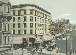
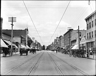
The Pacific Electric Railway Company, nicknamed the Red Cars, was a privately owned mass transit system in Southern California consisting of electrically powered streetcars, interurban cars, and buses and was the largest electric railway system in the world in the 1920s. Organized around the city centers of Los Angeles and San Bernardino, it connected cities in Los Angeles County, Orange County, San Bernardino County and Riverside County.

Slauson station is an elevated light rail station on the A Line of the Los Angeles Metro Rail system. The station is located within the historic right-of-way of the Pacific Electric Railway and elevated over the intersection of Slauson Avenue, after which the station is named, in the unincorporated Los Angeles County community of Florence.

The West Santa Ana Branch is a rail right-of-way formerly used by the Pacific Electric's (PE) Santa Ana route in Los Angeles County and Orange County in Southern California. The Los Angeles County Metropolitan Transportation Authority (Metro) owns the segment of the right-of-way in Los Angeles County, and the Orange County Transportation Authority (OCTA) owns the segment in Orange County.
The Fullerton Line was an interurban route of the Pacific Electric Railway. It ran between Downtown Los Angeles and Fullerton, California. It opened in 1917 and hosted passenger service until 1938; the line was retained for freight for some time thereafter. After abandonment, the right of way between La Habra and Fullerton was mostly converted to a rail trail or built over.

The Santa Ana Line was an interurban railway route connecting Los Angeles and Santa Ana in Orange County. It ran between 1905 and 1958 and was predominantly operated by the Pacific Electric Railway for its history.

The Long Beach Line was a major interurban railway operated by the Pacific Electric Railway between Los Angeles and Long Beach, California via Florence, Watts, and Compton. Service began in 1902 and lasted until 1961, the last line of the system to be replaced by buses.
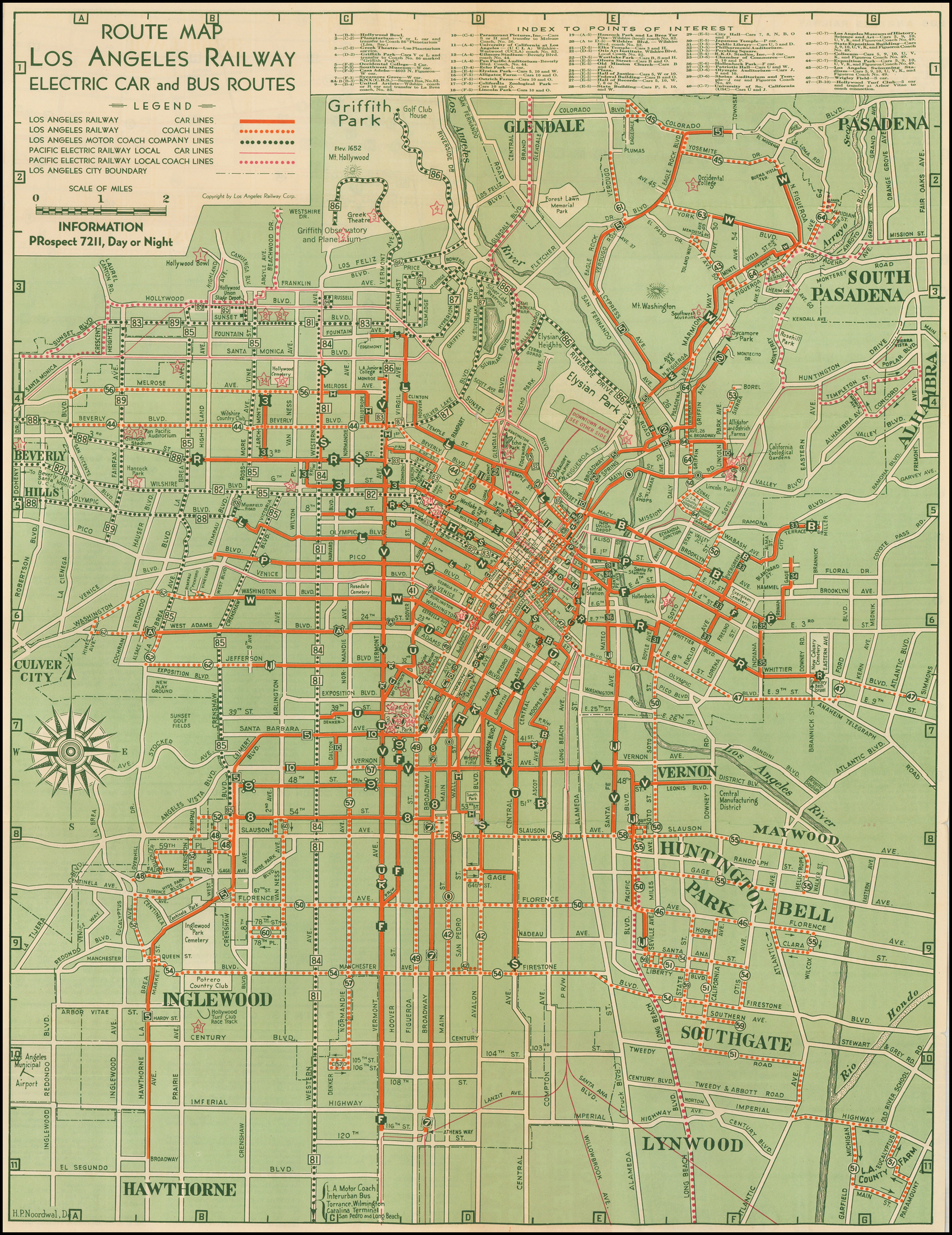
J was a streetcar line in Los Angeles, California. It was operated by the Los Angeles Railway from 1911 to 1945, by Los Angeles Transit Lines from 1945 to 1958, and by the Los Angeles Metropolitan Transit Authority from 1958 to 1963.
V was a streetcar service in Los Angeles, California. It was operated by the Los Angeles Railway from 1920 to 1958, and by the Los Angeles Metropolitan Transit Authority from 1958 to 1963.
7 was a streetcar line in Los Angeles, California. The service was operated by the Los Angeles Railway from 1932 to 1955. It ran from Spring and 2nd Streets to Athens and 116th Street, by way of Spring Street, Main Street, Broadway Place, Broadway, and Athens Way. During its Los Angeles Transit Lines days, around 1950 to 1955, Line 7 was rerouted off South Broadway to Central Avenue, at least as far north as 7th Street across Olympic Boulevard to possibly Vernon Avenue, covering trackage that was abandoned rail by line U, when that line was converted to trolley bus August 3, 1947.
F was a streetcar line in Los Angeles, California. It was operated by the Los Angeles Railway from 1911 to 1955.
The OC Streetcar is a modern streetcar line currently under construction in Orange County, California, running through the cities of Santa Ana and Garden Grove. The electric-powered streetcar will be operated by the Orange County Transportation Authority (OCTA), and will serve ten stops in each direction along its 4.15-mile (6.68 km) route. With the exception of a short loop in downtown Santa Ana, the line will be double-tracked for its entire length. Most of the route follows the original path of the Pacific Electric Railway "Red Cars" that served Santa Ana in the early 20th century, before being abandoned in 1950. Construction on the streetcar broke ground on November 30, 2018. As of October 2023, the line's expected revenue service date has been pushed to August 2025, per OCTA staff, despite initial plans for a 2021 start.
The Southeast Gateway Line, formerly the West Santa Ana Branch Transit Corridor, is a planned light rail line, mostly following the Pacific Electric's historic West Santa Ana Branch, connecting Downtown Los Angeles to the city of Artesia, along with other cities in southeastern Los Angeles County.
Bellflower station is a planned light rail station in the Los Angeles Metro Rail system. It is part of the Southeast Gateway Line project. The segment of the corridor is expected to begin operations in 2035.
Paramount/Rosecrans station is a planned elevated light rail station in the Los Angeles Metro Rail system. It is located at the intersection of Paramount Boulevard and Rosecrans Avenue in Paramount, California and is part of the Southeast Gateway Line project. The segment of the corridor is expected to begin operations in 2035.
The San Bernardino–Riverside is a former Pacific Electric (PE) interurban railway line in the Inland Empire. Unlike most of the company's services, trains did not travel to Downtown Los Angeles and instead provided a suburban service between San Bernardino and Riverside.
Pioneer station is a planned light rail station in the Los Angeles Metro Rail system. It will be the southern terminus of the Southeast Gateway Line project, located in Artesia at Pioneer Boulevard. The segment of the corridor is expected to begin operations in 2035. The route may later on be further expanded along the West Santa Ana right-of-way, but Metro has not yet announced any plans to do so.
Florence/Salt Lake station is a planned light rail station in the Los Angeles Metro Rail system. It is located at the intersection of Florence Avenue and Salt Lake Avenue in Huntington Park, California and is part of the Southeast Gateway Line project. The segment of the corridor is expected to begin operations in 2035.
Firestone station is a planned elevated light rail station in the Los Angeles Metro Rail system. It is located near the intersection of Firestone Boulevard and Atlantic Avenue in South Gate, California and is part of the Southeast Gateway Line project. The segment of the corridor is expected to begin operations in 2035.
Gardendale station is a planned light rail station in the Los Angeles Metro Rail system. It is located near the intersection of Garfield Avenue and Gardendale Street in Downey, California and is part of the Southeast Gateway Line project. The segment of the corridor is expected to begin operations in 2035.
I-105/C Line station is a proposed infill light rail transfer station in the Los Angeles Metro Rail system. It is located near Century Boulevard above Interstate 105 in Paramount, California and is part of the Southeast Gateway Line project. A new infill station for a C Line transfer. The segment of the corridor is expected to begin operations in 2035.
