The Piscataquis River is a major tributary of the Penobscot River, found in Piscataquis County, Maine, United States. It starts from the confluence of its East Branch and West Branch in Blanchard. The river flows in a mostly eastern direction until it meets the Penobscot at Howland. It is approximately 65 miles (105 km) in length.
Elorza is a town in the Apure State in Venezuela. Elorza is on the region of the Venezuelan Llanos and it had 26.800 inhabitants as of 2012. It is the capital of the Rómulo Gallegos Municipality. The current mayor is Solfreddy Solorzano.

Dactinomycin, also known as actinomycin D, is a chemotherapy medication used to treat a number of types of cancer. This includes Wilms tumor, rhabdomyosarcoma, Ewing's sarcoma, trophoblastic neoplasm, testicular cancer, and certain types of ovarian cancer. It is given by injection into a vein.
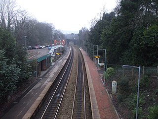
Llanishen railway station is a railway station serving the areas of Llanishen and Lisvane in Cardiff, south Wales. It is a stop on the Rhymney Line of the Valley Lines network.
St. Charles West High School is a public high school in St. Charles, Missouri that is part of the City of St. Charles School District.

The Muota is a river in the Swiss canton of Schwyz and a tributary of Lake Lucerne. It has a length of 29 km (18 mi).
Kensal Green & Harlesden was a railway station on the North London Line. It was opened by Hampstead Junction Railway in 1861, and closed in 1873. On closure, it was replaced by Kensal Rise railway station.
Masparro River is a river of Venezuela. It is part of the Orinoco River basin.
The East Branch Oyster River is a tributary of the Oyster River in Knox County, Maine. From its source in Rockland, the stream runs 4.8 miles (7.7 km) southwest to its confluence with the main stem of the Oyster River, on the border between Warren and Thomaston.
The East Branch Sebasticook River is a tributary of the Sebasticook River in central Maine in the United States. It is part of the Kennebec River watershed. From the outflow of Lake Wassookeag in Dexter, the river runs about 12.7 miles (20.4 km) south to Sebasticook Lake. From the outflow of the lake in Newport, the river runs about 9.5 miles (15.3 km) southwest to its confluence with the Sebasticook in Detroit.
The Muddy River is a 4.7-mile-long (7.6 km) river in Topsham, Maine, which empties into Merrymeeting Bay. The river is also known to be very muddy.
The West Branch Eastern River is a 10.4-mile-long (16.7 km) tributary of the Eastern River in Maine. It is part of the Kennebec River watershed. The West Branch begins near South Windsor and flows southwest through the town of Whitefield, joining the East Branch at East Pittston to form the Eastern River.
The West Branch Pleasant River is a 36.1-mile-long (58.1 km) tributary of the Piscataquis River in Piscataquis County, Maine. From a location north of Fourth West Branch Pond in Shawtown, the river runs about 18 miles (29 km) counterclockwise around the White Cap Mountain massif, then about 18 miles (29 km) southeast to its confluence with the East Branch of the Pleasant River in Brownville.

Maria Muschbukta is an open bay between Fulgeberget and Kvalrossen, on the western coast of the island of Jan Mayen. It is named after the shipowner Maria Musch. She was a member of the Kleine Noordse Compagnie, which sent a ship to Jan Mayen in 1616. This ship was the first to use the bay to hunt whales. The name is shown on Joan Blaeu's 1662 map of the island.
The Morse River is a 1.7-mile-long (2.7 km) tidal river in Phippsburg, Maine. It flows directly into the Atlantic Ocean, 2 miles (3 km) west of the mouth of the Kennebec River.
Twifo ntafrewaso is a town in the Central region of Ghana. The town is known for the twifo oil palm plantation(TOPP). The school is a second cycle institution.

Sudoeste Rio-Grandense is one of the seven mesoregions of the state of Rio Grande do Sul in Brazil. It consists of 19 municipalities, grouped in three microregions:
Tinghir Province is a province of Morocco in the Drâa-Tafilalet Region. The province had a population of 322,412 people in 2014.

Lycée Nelson Mandela is a senior high school in Nantes, France.
Willow Creek in Lassen County, California, is a tributary of the Susan River. The Willow Creek Wildlife Area offers wildlife viewing, bird watching and hunting along the creek.

