Panj is a city in Tajikistan. Panj may also refer to:
- Panj (river), on the border between Tajikistan and Afghanistan
- Panj District, Khatlon Province, Tajikistan
- Panj Free Economic Zone, Khatlon Province
- Panj, Iran, a village in Isfahan Province
Panj is a city in Tajikistan. Panj may also refer to:

Khatlon Region, one of the four provinces of Tajikistan, is the most populous of the four first level administrative regions. It is situated in the southwest of the country, between the Hisor (Gissar) Range in the north and the river Panj in the south and borders on Afghanistan in the southeast and on Uzbekistan in the west. During Soviet times, Khatlon was divided into Kurgan-Tyube (Qurghonteppa) Oblast – with the Kofarnihon and Vakhsh river valleys – and Kulob Oblast – with the Kyzylsu and Yakhsu river valleys. The two regions were merged in November 1992 into today's Khatlon Region. The capital city is Bokhtar, formerly known as Qurghonteppa and Kurgan-Tyube.
Sarband or Sar-e Band may refer to:

Tajikistan is a highly agrarian country, with its rural population at more than 70% and agriculture accounting for 60% of employment and around 20% of GDP in 2020. As is typical of economies dependent on agriculture, Tajikistan has a low income per capita: Soviet Tajikistan was the poorest republic with a staggering 45% of its population in the lowest income “septile”. In 2006 Tajikistan still had the lowest income per capita among the Commonwealth of Independent States (CIS) countries: $1,410 compared with nearly $12,000 for Russia. The low income and the high agrarian profile justify and drive the efforts for agricultural reform since 1991 in the hope of improving the population's well-being.

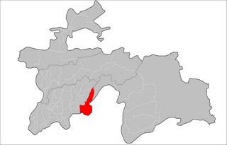
Panj District is a district in Khatlon Region, Tajikistan. Its capital is Panj. The population of the district is 119,700. The district has been an area of ethnic tensions betweek its Uzbek and Tajik residents. During the early Soviet period the district was officially named Kirovobod District.

Shamsiddin Shohin District, is a district in Khatlon Region, southeastern Tajikistan. Its capital is the village Shuroobod.

Vanj District or Nahiya-e Vanj is a district in eastern Tajikistan, in the north-west of the Gorno-Badakhshan Autonomous Region, with administrative capital Vanj.

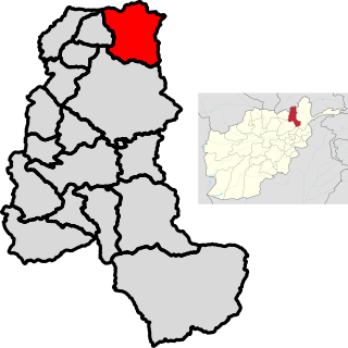
Khwahan District is one of the 28 districts of Badakhshan province, located in northeastern Afghanistan. The district capital is Khwahan. The district borders Raghistan to the southwest, Kuf Ab in the northeast, the Panj River in the northwest, and Shuro-obod district, Khatlon province of Tajikistan. Kuh-e kallat
Khorasan commonly refers to:

Chah Ab District is a district of Takhar Province, Afghanistan. Its district center is Chah Ab. The district's economy is primarily based on agriculture and livestock.

Darqad District is a district of Takhar Province, Afghanistan. The district has 34 villages. Darqad did not change between the 325 and 398 district sets. Near the end of 2018, the district was considered to be Taliban-influenced, as opposed to the Afghan government. The district was Taliban-controlled by August 2021.

The Kofarnihon is one of the major tributaries of the Amu Darya in Tajikistan. The river is 387 kilometres (240 mi) long and has a basin area of 11,600 square kilometres (4,500 sq mi). It rises on the southern slopes of Gissar Range in Vahdat district, formerly Kofarnihon district, and flows in the general south-western direction past the cities of Vahdat and Dushanbe, where it turns south and runs through Khatlon Province toward the border with Afghanistan. It falls into Amudarya some 40 km west of the confluence point of Vakhsh and Panj rivers. The Kofarnihon is an important source of drinking water, and yet it is highly polluted by irrigation runoff and inadequately cleaned recycled water around the cities of Dushanbe and Vahdat.
The Qizilsu or Kyzylsu is a river that rises on the southern slopes of the Vakhsh Range in the north-east of Tajikistan's Khatlon Region and runs south-west until joining the Panj on the border with Afghanistan. The river is 230 kilometres (140 mi) long and has a basin area of 8,630 square kilometres (3,330 sq mi). It merges with the Yakhsu (Akhshu) as a major left tributary south of the town of Kulyab. It irrigates the cotton-growing Qizilsu Valley between Kulob and Panj in the south-east of Khatlon Province. It is not the Kyzyl-Suu River that rises in Kyrgyzstan and flows through Tajikistan as Surkhob, then Vakhsh, following a course north-west of Qizilsu.

Hamadoni District is a district in the south-east of Khatlon Region of Tajikistan, located south of Kulob and stretching along a section of the Panj on the border with Afghanistan. Between 1950 and 2004 it was called Moskovskiy town, then renamed in honor of Mir Sayyid Ali Hamadani, a 14th-century Persia Great Islamic preacher, traveller, poet, and scholar who preached Islam in different parts of world, and is buried in Khatlon.
Mu'minobod, previously known as Muminabad, Leningradskiy or Leningrad is a settlement in south Tajikistan. It is the administrative capital of the Muminobod District in the eastern part of Khatlon Province, located north-east of the city of Kulob, not far from the Panj River and the international border with Afghanistan. The population of the town is 14,100.

Dashti Qala District is a district of Takhar Province, Afghanistan. It split from Khwaja Ghar District in June 2005. This district borders Tajikistan. Ai-Khanoum, probably founded by the Seleucid Empire, is located in this district. In 2018, this district was considered contested between the government and the Taliban.
Panj Free Economic Zone is a free economic zone in Khatlon Province in Tajikistan.
Lohur may refer to one of two locations in Tajikistan:
Tojikiston is the Tajik and Uzbek word for Tajikistan, a country in Central Asia.
The 2020 Tajikistan Cup is the 29th edition of the Tajikistan Cup, the knockout football tournament of Tajikistan, with the winner of the cup qualifying for the 2021 AFC Cup.
The 2021 Tajikistan Cup was the 30th edition of the Tajikistan Cup, the knockout football tournament of Tajikistan, with the winner of the cup qualifying for the 2022 AFC Cup.