History
Papakura North became recognised as an independent suburb when the Papakura District was overtaken by Auckland's urban sprawl, and was separated from the other areas east and west of the town centre. The previous area was referred to as a small area of greater Papakura, but has now developed into a single suburban area, stretching south of the Addison complex, west of the Southern Railway Line (parallel to Porchester Road), down to Old Wairoa Road, and right to the western border of the Papakura Military Camp.

Papakura District was a local council territory in New Zealand's Auckland Region that was governed by the Papakura District Council from 1989 until 2010. The area makes up the southernmost part of the Auckland metropolitan area.
Arimu Road and Russell Road properties were originally vacated by army personnel, until the mid-1990s when they were sold off for private use. However this area still remains a Defence Area as ordered by the NZ SAS for security purposes. Access points to the Papakura Military Camp on Russell Road and Walters Road are secured by electric fencing and the area is not listed in Google Maps. The speed limit down the north side of Arimu Road still remains 30 km/h and the surrounding area is often monitored by army staff. Training exercises often take place in the restricted camp area.

Papakura Military Camp is a New Zealand Army military camp located in the Auckland suburb of Papakura North, in northern New Zealand. It is the home of the New Zealand Special Air Service.

Google Maps is a web mapping service developed by Google. It offers satellite imagery, aerial photography, street maps, 360° panoramic views of streets, real-time traffic conditions, and route planning for traveling by foot, car, bicycle and air, or public transportation.
People
The most common ethnic group in Papakura North is European as at 2006, with 71.0 percent. Maori residents only make up 19.7 percent of the suburb, and Asian residents consisting of 7.5 percent.

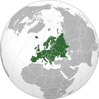
Europe is a continent located entirely in the Northern Hemisphere and mostly in the Eastern Hemisphere. It is bordered by the Arctic Ocean to the north, the Atlantic Ocean to the west and the Mediterranean Sea to the south. It comprises the westernmost part of Eurasia.
According to the 2006 New Zealand census, (for residents aged 15 years and older) the most common occupational group in Papakura North is Professionals, and the least common group is Community and personal service workers, with an unemployment rate of 6.5 percent of the Papakura North population.
This page is based on this
Wikipedia article Text is available under the
CC BY-SA 4.0 license; additional terms may apply.
Images, videos and audio are available under their respective licenses.

The Wellington Region is a local government region of New Zealand that occupies the southern end of the North Island. The region covers an area of 8,049 square kilometres (3,108 sq mi), and is home to a population of 521,500.

Territorial authorities are the second tier of local government in New Zealand, below regional councils. There are 67 territorial authorities: 13 city councils, 53 district councils and the Chatham Islands Council. District councils serve a combination of rural and urban communities, while city councils administer the larger urban areas. Five territorial authorities also perform the functions of a regional council and thus are unitary authorities. The Chatham Islands Council is a sui generis territorial authority that is similar to a unitary authority.

Pukekohe is a town in the Auckland Region of the North Island of New Zealand. Located at the southern edge of the Auckland Region, it is in South Auckland, between the southern shore of the Manukau Harbour and the mouth of the Waikato River. The hills of Pukekohe and nearby Bombay Hills form the natural southern limit of the Auckland region. Pukekohe is located within the political boundaries of the Auckland Council, following the abolition of the Franklin District Council on 1 November 2010.
Takanini is a suburb of Auckland, in northern New Zealand. It is located on the shores of the Pahurehure Inlet, 28 kilometres southeast of the Auckland CBD.

Waitakere City is a former territorial authority district in the west of Auckland, New Zealand, which was governed by the Waitakere City Council from 1989 to 2010. It was New Zealand's fifth largest city, with an annual growth of about 2%. In 2010 the council was amalgamated with other regional authorities into one new Auckland Council.

Drury is a rural town near Auckland, in northern New Zealand. Located 36 kilometres to the south of Auckland CBD, under authority of the Auckland Council. Drury lies at the southern border of the Auckland metropolitan area, 12 kilometres to the northeast of Pukekohe, close to the Papakura Channel, an arm of the Manukau Harbour.

The Great South Road was the northern section of the earliest highway between Auckland and Wellington, in the North Island of New Zealand.

Point Chevalier is a suburb and peninsula in the city of Auckland in the north of New Zealand. It is located five kilometres to the west of the city centre on the southern shore of the Waitematā Harbour.

Auckland City is the part of Auckland urban area covering the isthmus and most of the islands of the Hauraki Gulf. The core of Auckland City is the Auckland CBD, a major financial and commercial centre, surrounded by many suburbs. It was formerly the name of a local authority district that was governed by Auckland City Council; it lay within the wider Auckland Region, which was governed by Auckland Regional Council. Auckland City was disestablished as a local government district on 1 November 2010, when Auckland City Council was amalgamated with other councils of the Auckland Region into the new Auckland Council.
Conifer Grove is an upper-middle class suburb of Auckland, in northern New Zealand. Located on the eastern shores of the Pahurehure Inlet, on the Manukau Harbour, under authority of the Auckland Council. The suburb makes up the western side of the Takanini urban area and is in the Manurewa-Papakura ward of Auckland City. The suburb is known for its tree-lined streets, bay views, and until 2018 its border with the Manukau Golf Course.
Red Hill is a suburb of Auckland, in northern New Zealand. Located 34 kilometres to the southwest of Auckland CBD, under authority of the Auckland Council. The suburban area of Red Hill makes up the southernmost part of the Auckland metropolitan area, however majority of the area is rural. The suburb lies on an ancient Pā Site known in Māori as Pukekiwiriki. The area is also situated on a no longer active volcano, and an old fault line in the region. Red Hill is located in the Manurewa-Papakura ward, one of the thirteen administrative divisions of Auckland city.
Opaheke is a suburb of Auckland, in northern New Zealand. Located to the south of the Papakura, and 32 kilometres south of Auckland CBD. Opaheke was under authority of the Papakura District Council. The suburb makes up the southernmost part of the Auckland metropolitan area.
Rosehill is a suburb of Auckland, in northern New Zealand. Located to the south of Pahurehure, under authority of the Auckland Council. The suburb makes up the southernmost part of the Auckland metropolitan area, and is located in the Manurewa-Papakura ward, one of the thirteen administrative divisions of Auckland city.
Hingaia is a rural coastal suburb of Auckland, New Zealand. Located on the shores of the Pahurehure Inlet, to the southwest of the Papakura Town Centre, under local authority of the Papakura District Council. Hingaia is the smallest suburb and most eastern area in the Papakura District.
Clendon Park is a suburb of Auckland in northern New Zealand. It is located to the west of Manurewa and north of Weymouth. The suburb is in the Manurewa-Papakura ward, one of the twenty one local boards of Auckland Council.


