
King's Cross is a district in the London Boroughs of Camden and Islington, located on either side of Euston Road, in the outskirts of north London and central London, England, 1.5 miles (2.4 km) north of Charing Cross. It is bordered by Barnsbury to the north, Clerkenwell to the southeast, Angel to the east, Holborn and Bloomsbury to the south, Euston to the west and Camden Town to the northwest. It is served by two major rail termini, St Pancras and King's Cross. King's Cross station is the terminus of one of the major rail routes between London and the North.

Camden Town, often shortened to Camden, is an area in the London Borough of Camden, around 2.5 miles (4.1 km) north-northwest of Charing Cross. Historically in Middlesex, it is identified in the London Plan as one of 34 major centres in Greater London.

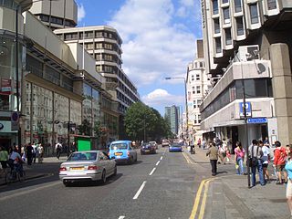
Euston Road is a road in Central London that runs from Marylebone Road to King's Cross. The route is part of the London Inner Ring Road and forms part of the London congestion charge zone boundary. It is named after Euston Hall, the family seat of the Dukes of Grafton, who had become major property owners in the area during the mid-19th century.

Camden Town is a London Underground station in Camden Town. It is a major junction for the Northern line, as it is where the Edgware and High Barnet branches merge from the north, and is also where they split to the south into the Bank and Charing Cross branches for the journey through Central London. It is particularly busy with visitors to the Camden markets at weekends, and, until 2019, was exit-only on Sundays to prevent overcrowding.

Euston is a London Underground station. It directly connects with its National Rail railway station above it. The station is in Travelcard Zone 1.

Swiss Cottage is an area of Hampstead in the London Borough of Camden, England. It is centred on the junction of Avenue Road and Finchley Road and includes Swiss Cottage tube station. Swiss Cottage lies 3.25 miles (5.23 km) north-northwest of Charing Cross. The area was named after a public house in the centre of it, known as "Ye Olde Swiss Cottage".

South Hampstead railway station is on Loudoun Road in the London Borough of Camden. It is served by London Overground services on the Watford DC line. It is about 550 yards (500 m) south west of Swiss Cottage Underground station.

York Way is a major road in the London Borough of Islington, running north for one mile from the junction of Pentonville Road and Euston Road, adjacent to King's Cross railway station towards Kentish Town and Holloway. At its northern end, the road becomes Brecknock Road. For its entire length York Way forms the boundary between the London Boroughs of Islington and Camden.
The A400 road is an A road in London that runs from Charing Cross to Archway in North London. It passes some of London's most famous landmarks.
Camden Road is a main road in London running from the junction of Camden High Street and Camden Town Underground station up to Holloway Road. It is part of the A503 which continues east as Tollington Road.

Angel is an area on the northern fringes of Central London within the London Borough of Islington. It is 2 miles (3.2 km) north-northeast of Charing Cross on the Inner Ring Road at a busy transport intersection. The area is identified in the London Plan as one of 35 major centres in London. It is a significant commercial and retail centre, and a business improvement district. Angel straddles the ancient boundary of the parishes of Clerkenwell and Islington that later became the metropolitan boroughs of Finsbury and Islington. It is named from the former Angel Inn which stood on the corner of Islington High Street and Pentonville Road. Since 1965 the whole area has formed part of the London Borough of Islington in Greater London.
This is a list of the etymology of street names in the area of Regent's Park in London ; the area has no formal boundaries, though it generally thought to be delimited by Prince Albert Road to the north, Park Village East and Hampstead Road/the Euston railway line/Eversholt Street to the east, Euston Road and Marylebone Road to the south and Park Road and Baker Street to the west.

Gloucester Avenue is a street in the Primrose Hill area of London, England. Located in the London Borough of Camden, it is a residential road featuring many nineteenth century properties including several pubs as well as the neo-Georgian Cecil Sharp House. For much of its route it runs adjacent to the West Coast Main Line out of Euston Station.

Regent's Park Road is a street in the Primrose Hill area of London, England. Located in the London Borough of Camden, it runs in a curving crescent shape. For some of its route it follows alongside the eastern edge of Primrose Hill park and also includes the commercial centre of the area. Despite its name the street does not run as far as Regent's Park although the adjacent Prince Albert Road does.

Loudoun Road is a street in the St John's Wood area of London. Most of its route is in the City of Westminster, but it crosses into the London Borough of Camden at its northern end in South Hampstead. It runs roughly parallel to Finchley Road to its east while Abbey Road, London is to the west. It runs north from Grove End Road, not far from St John's Wood tube station, and crosses or is joined by a number of streets including Marlborough Place, Carlton Hill and Boundary Road. It finishes at a roundabout junction with several streets including Belsize Road and Fairhazel Gardens. South Hampstead railway station is at the northern end of the street.

Adelaide Road is a street in London running east to west between Chalk Farm and Swiss Cottage. Located in the London Borough of Camden it is part of the longer B509 route which continues as Belsize Road through South Hampstead. The Belsize Park area of Hampstead is to its north while Primrose Hill is to the south. It runs parallel to Fellows Road and Eton Avenue. Along its route it meets or is crossed by several streets including Primrose Hill Road and Avenue Road. At its eastern end is Chalk Farm tube station at the junction with Haverstock Hill, which opened in 1907. It takes its name from Queen Adelaide, wife of William IV.

Fitzroy Road is a street in the Primrose Hill area of London. Located in the London Borough of Camden, it is a residential road lined with Victorian era houses. It runs roughly northeastwards from Regent's Park Road at the edge of Primrose Hill to Gloucester Avenue. Fitzroy Road is crossed around halfway along its route by Chalcot Road that links it to Chalcot Square to the north. The Princess of Wales pub stands at the corner with Chalcot Road.

Delancey Street is a mainly residential street in Camden Town, London, England. Located in the London Borough of Camden, it runs roughly west to east in a curve from Camden High Street to Parkway. It is met or crossed by Arlington Road, Albert Street, Gloucester Avenue, and Mornington Terrace. Eastwards of Camden High Street the route continues as Pratt Street as far as the Regent's Canal.

Mornington Terrace is a street in Camden Town. Located in the London Borough of Camden, it runs southeastwards from Delancey Street following the route of the main line into Euston that runs immediately to its west. At its southern end it becomes Clarkson Row while Mornington Place connects it to Mornington Crescent. Both Mornington Terrace and Place are notable for their surviving Victorian houses.

Oval Road is a street in the Camden Town area of London. It runs northwards from Gloucester Avenue near Parkway to the Regent's Canal, a little to the west of the centre of Camden Town. Close to its southern end is the junction with Delancey Street. It then heads northwards as Gloucester Crescent curves away and then rejoins the street while Regent's Park Terrace follows more closely beside Oval Road.


